Walking the City of London

Category: Commerce Page 19 of 27

Down by the River – wharves, beaches and desperate immigrants

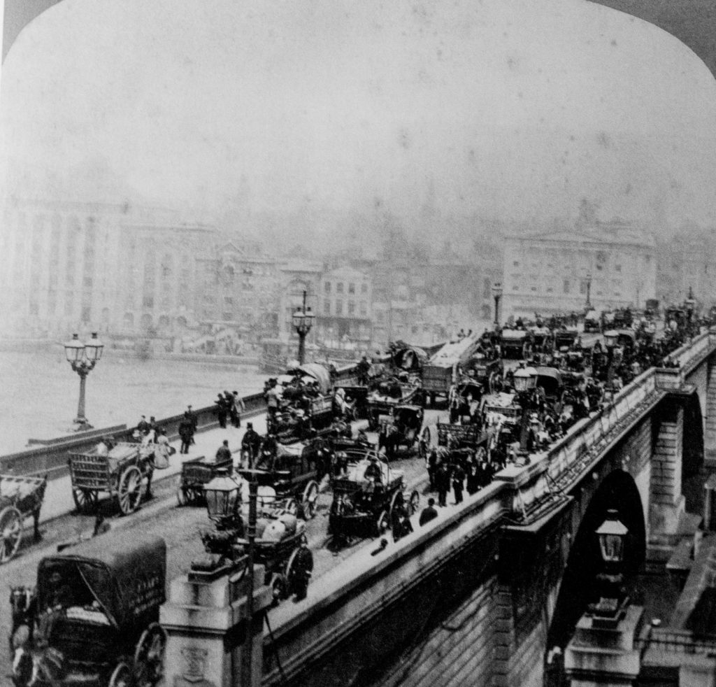
Once upon a time, access by foot to the River Thames was absolutely essential since it was London’s main highway. These ‘Watermen’s Stairs’ were also of great benefit if you were unfortunate enough to fall into the river. A Waterman would usually be nearby plying for hire and might be inclined to rescue you (and the stairs were often adjacent to a public house, where such accidents could be more likely to happen!).

Although wharves and later rudimentary docks began to be used to offload goods, most ships simply moored in lines in the middle of the river and their cargo was rowed to shore and carried up shoreline stairs.

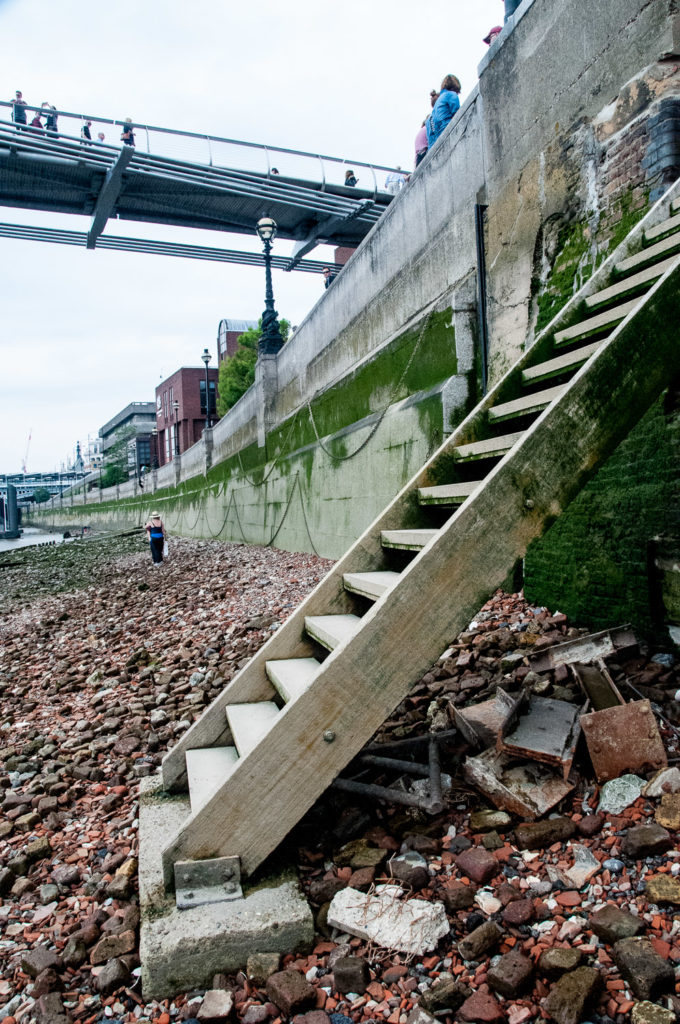
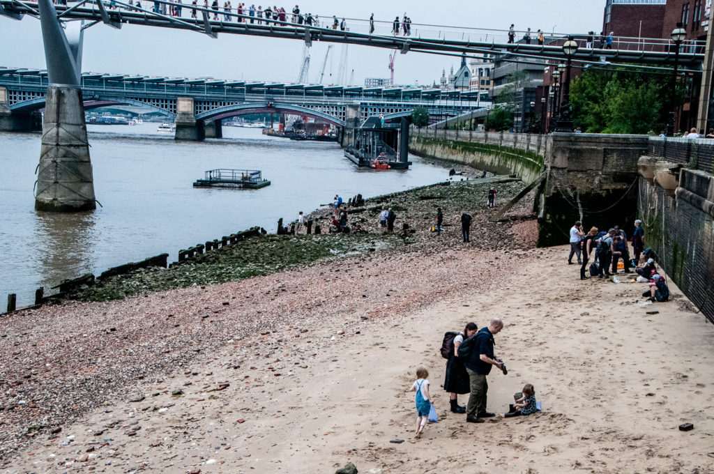
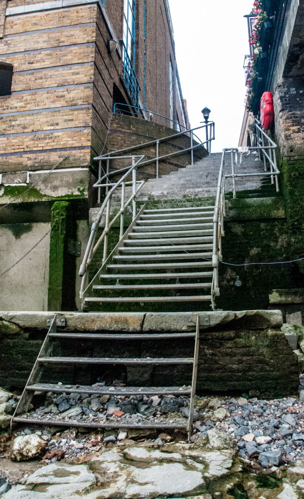
John Rocque’s London Map of 1756 showed literally dozens of such access points and last Sunday I decided to go in search of what was left of them, starting at the east side of the Millennium Bridge. These are the steps leading to the foreshore …

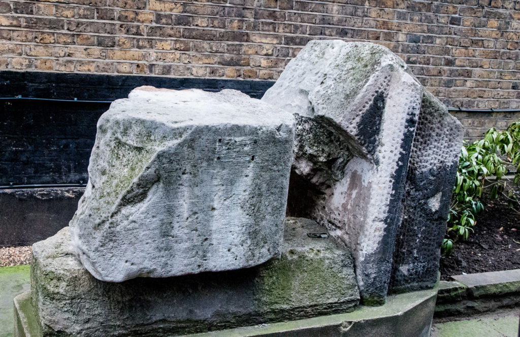
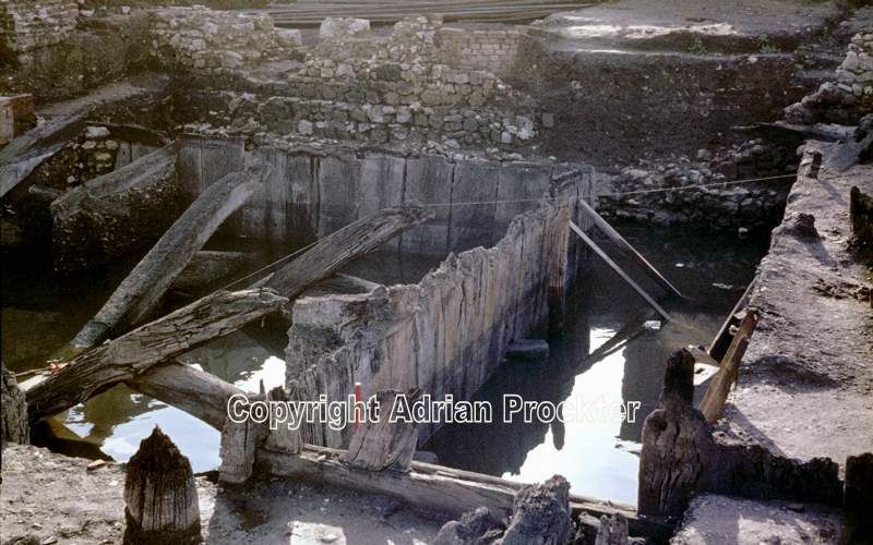
This is the exact spot where the ancient Trig Lane access to the River was located and back in the 1970s redevelopment work revealed a 14th century wharf. Here is a picture of some of the site taken in 1974, now totally covered by riverside office development …

Read more on Adrian Procter’s blog

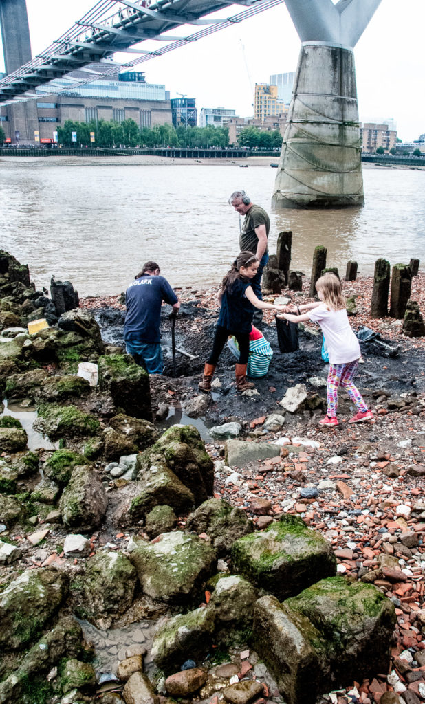
There was some amateur excavation taking place when I visited …

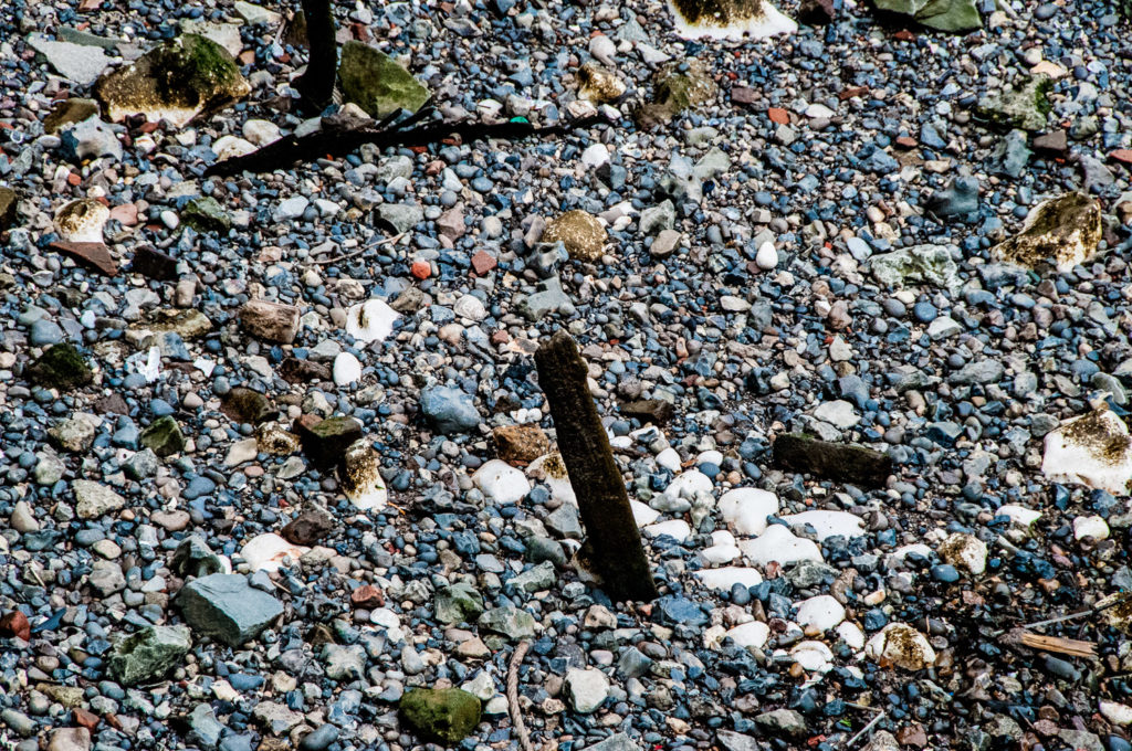
Looking all around you see lots of pieces of pottery, tiles and bricks along with lumps of chalk …

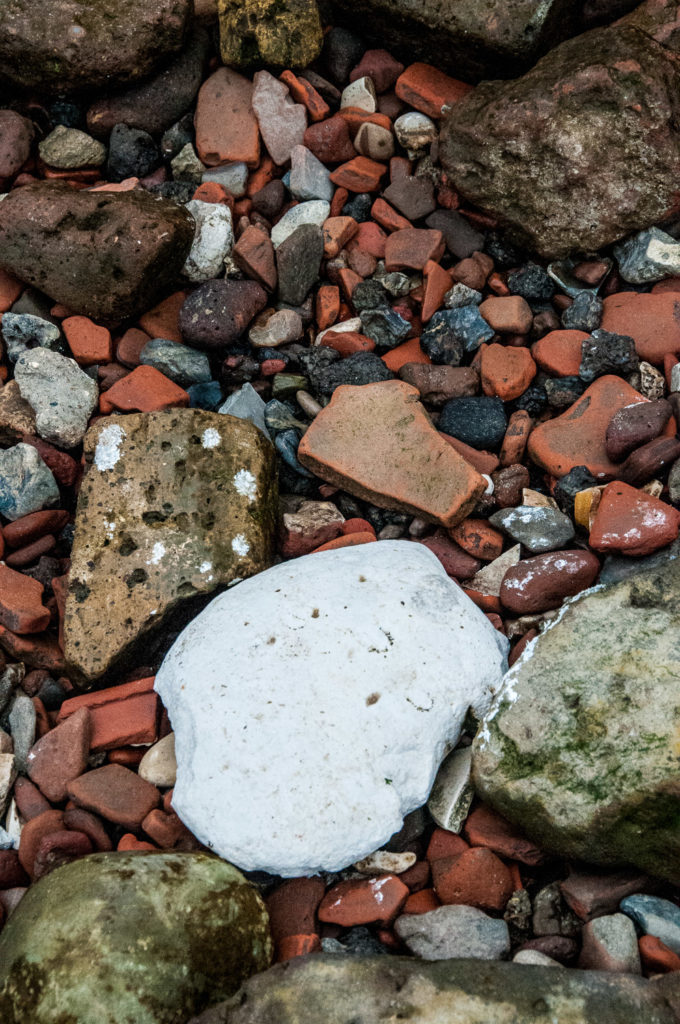
Large chalk beds were once laid down to provide a soft settling place for barges at low tide.

It’s rather a strange feeling standing on the river bed and gazing along the foreshore …

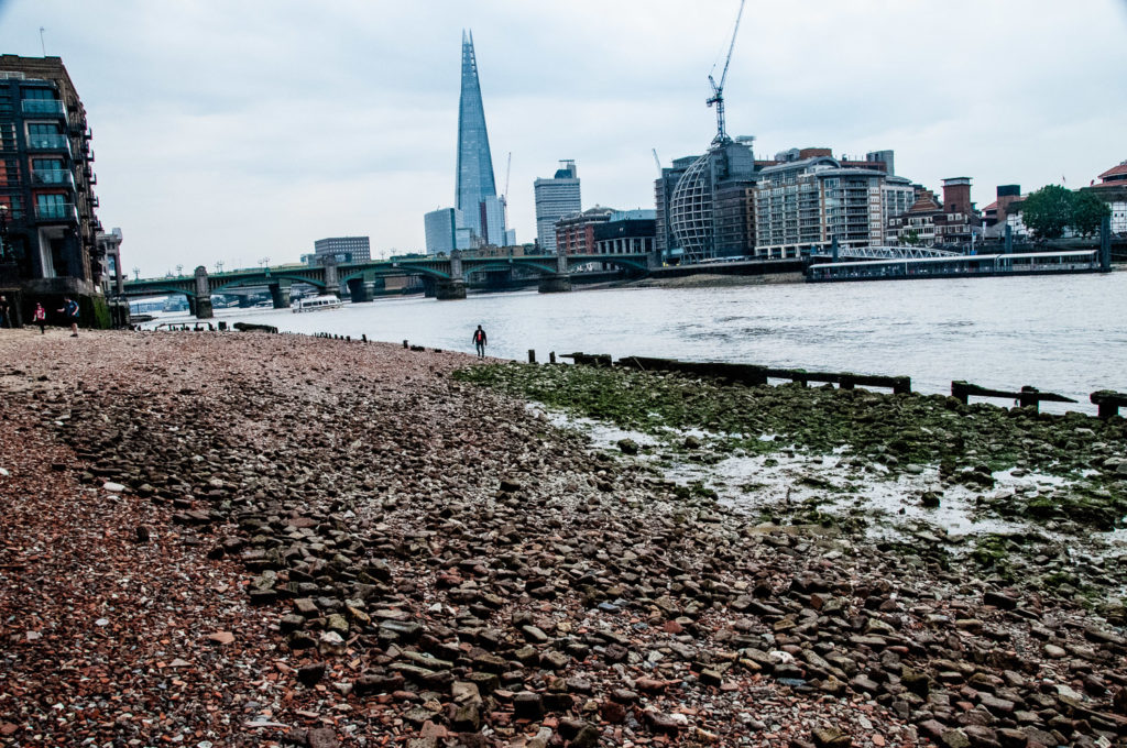
As I walked east I looked back and spotted a sandy beach. You can see the Trig Steps in the distance …

My next stop was the Cousin Lane steps next to Cannon Street railway station …

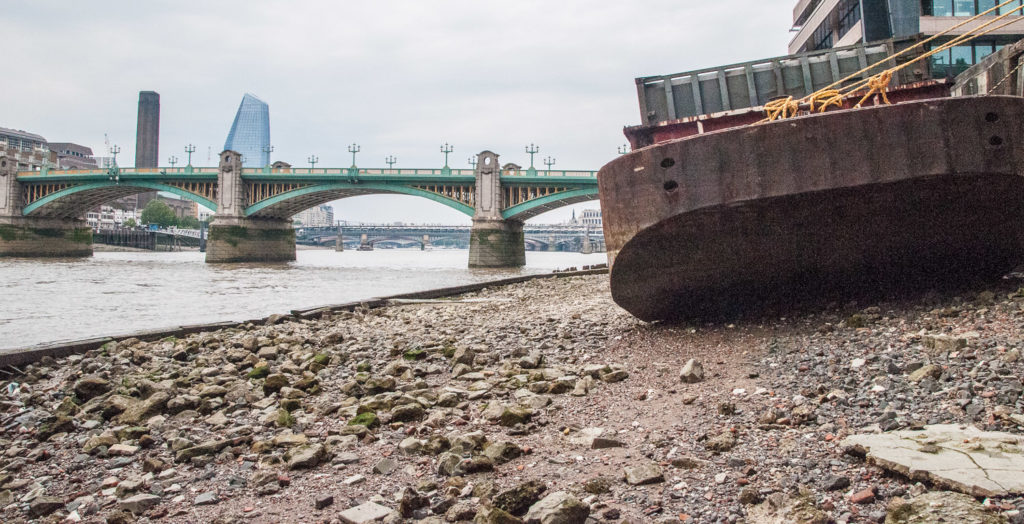
As is common along the River, you can see the remains of old wharves …

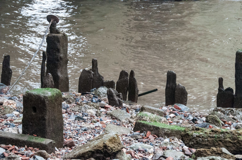
And a barge resting nearby …

I got a distinct feeling that I was trespassing.

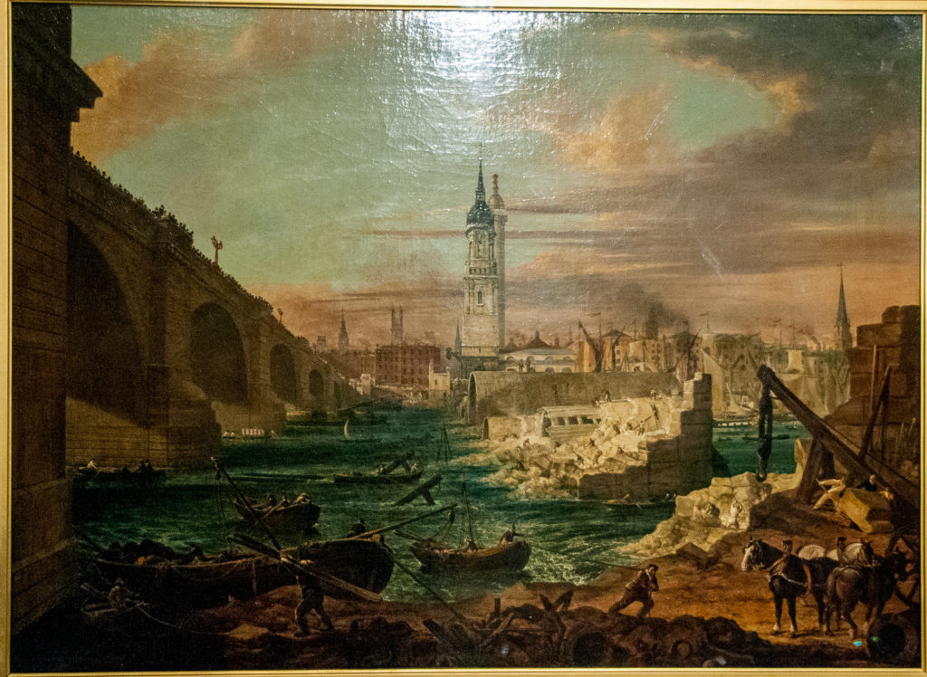
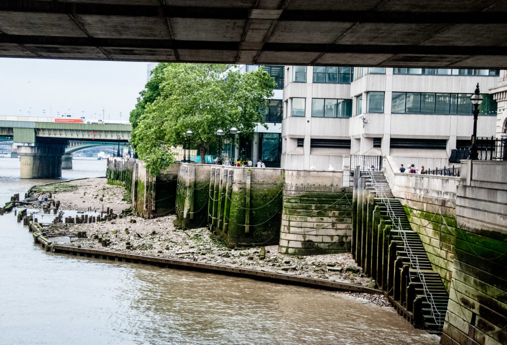
These steps at London Bridge are no longer open to the public. Again the remains of old wharves are visible at low tide …

Further along the Thames Walk a capstan reminds us of the days when this part of the river was a major commercial shipping hub …

Looking over the riverside wall, lots more lumps of chalk are clearly visible …

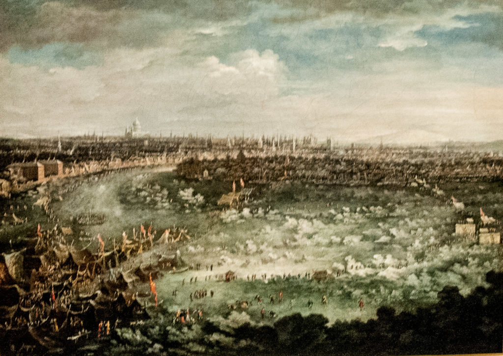
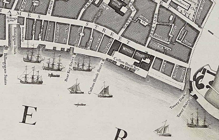
Next on my list was Custom House Stairs – here is how they appear in Roque’s Map of 1746 …

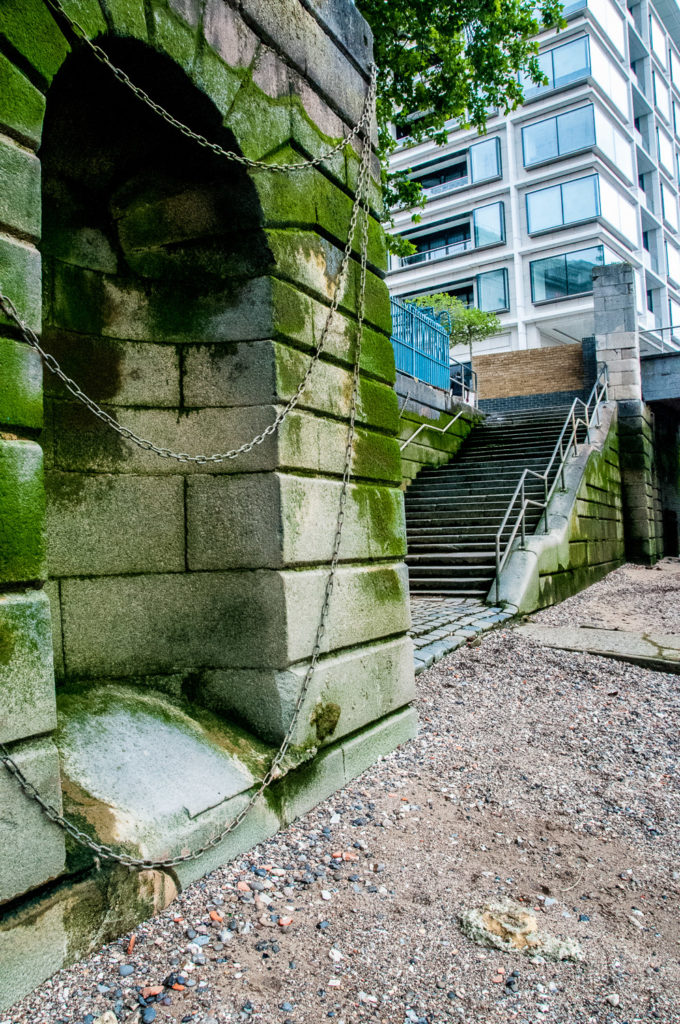
And here they are today …

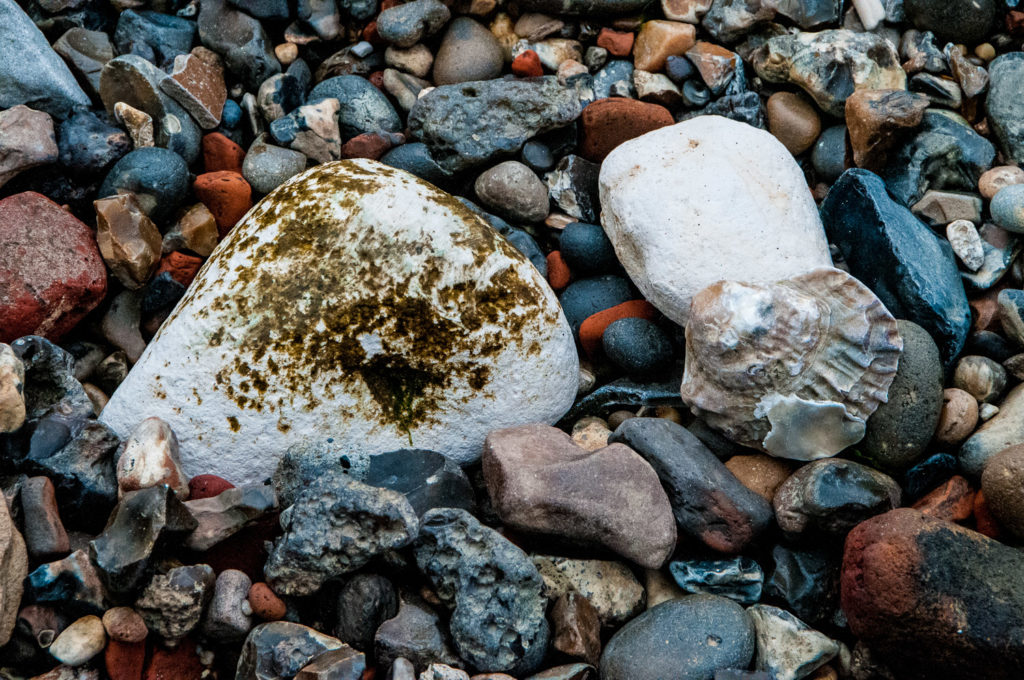
I encountered lots of oyster shells on my walk, once a very cheap source of food for Londoners …

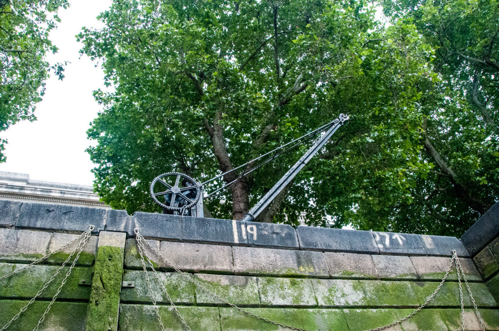
An old winch still decorates the pedestrian walkway …

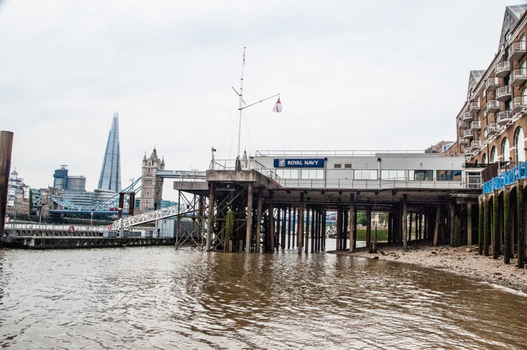
As I walked past the Tower I was reminded of pictures I had seen of the beach there that was opened up in July 1934 for the use of people who couldn’t afford to go to the seaside. Apparently 1,500 bargeloads of sand were used to create it …

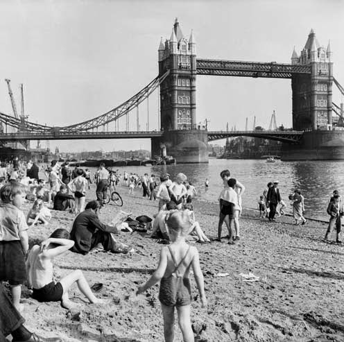
It was finally closed in 1971 due to river pollution. There is a nice blog about it here.

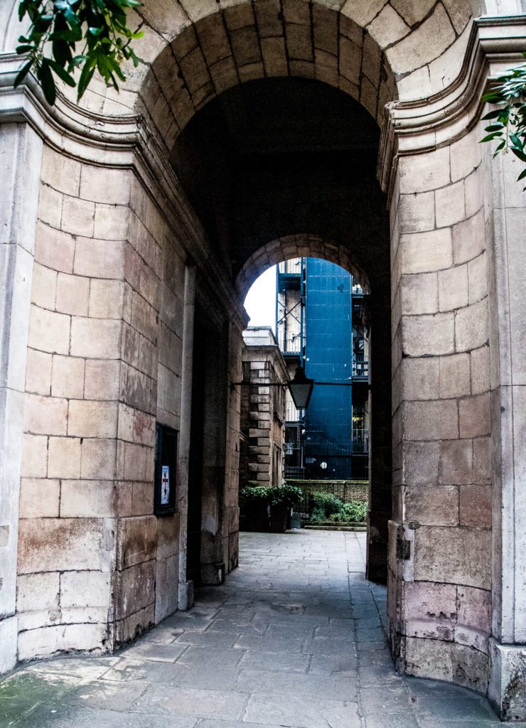
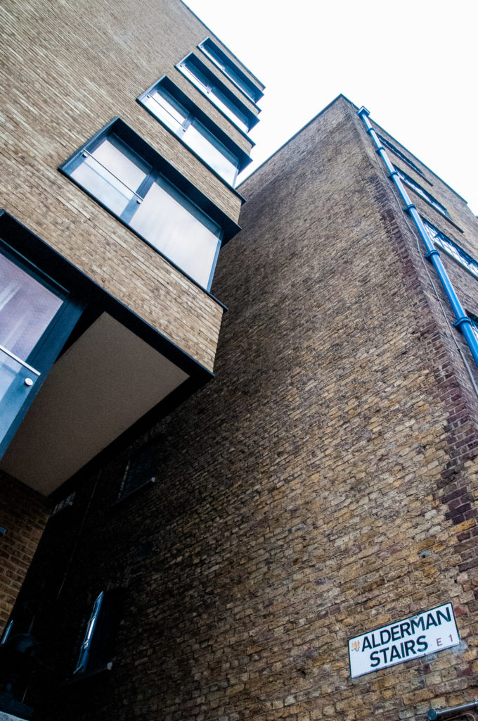
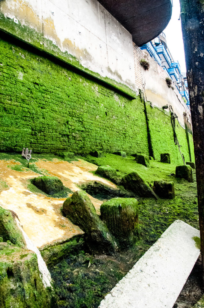
My final set of stairs were located just past St Katharine Dock along St Katharine’s Way. The entrance is easy to miss since the signage is quite high up …

Here I hesitated …

It’s all a bit slimy and slippery …

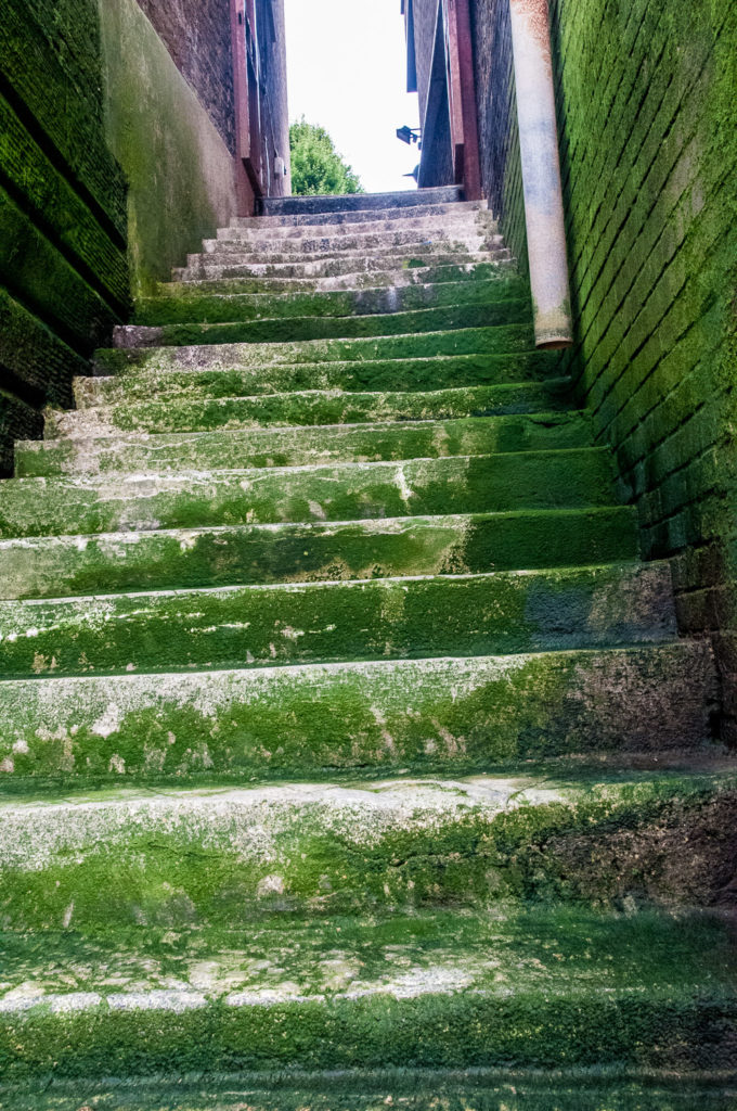
When you reach the bottom it’s clear you are definitely below the level of high tide …

The view looking west …

As I looked back up the steps I was reminded of a story in the London Inheritance blog.

On the 24th April 1847, the Illustrated London News reported on arrivals at Alderman’s Stairs …

IRISH IMMIGRATION INTO LONDON – The importation of Irish paupers, so much complained of in Liverpool and Glasgow, begins to wear a threatening aspect in London. On Sunday, the Prussian Eagle, from Cork, and the Limerick, from Dublin, landed 1200 Irish Paupers at Alderman’s Stairs, Lower East Smithfield. The new comers, who were in the most wretched state of distress, were forthwith distributed over the eastern part of the metropolis. The same vessels landed 1200 Irish paupers on Sunday week.

I hope these steps led to a better life for some of those poor souls, many surely victims of the Great Irish Famine of 1845 to 1849.

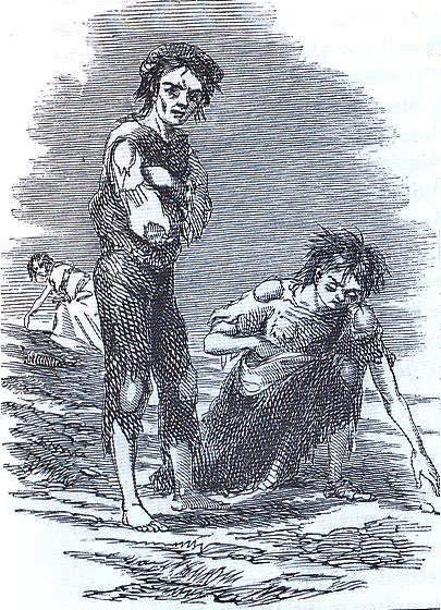
The scene at Skibbereen during the Great Famine, by Cork artist James Mahony (1810–1879), commissioned by The Illustrated London News.

The bridges of London Bridge – Part 1

When I discovered that, at one time, the London Bridge authorities employed a Keeper of the Heads I was inspired to write about the many reincarnations of London Bridge since the Romans built the first crossing about AD 50. The relationship between the bridges and London is fascinating and so I want to do it justice with two blogs.

There is an artist’s impression of Roman London, including the bridge, on display at the Guildhall Art Gallery …

The picture reflects the fact that the river was very much wider then (about five times what we see today) and consequently much shallower. The bridge was probably built of oak and, being the only fixed crossing below Staines, it became a major contributor to the prosperity of London which soon replaced Colchester as the Roman capital.

The earliest written reference to the bridge (Lundene brigce) appears in the Anglo-Saxon Chronicle of AD 984 when mention is made of a woman being taken there to be drowned for witchcraft. From 1176 a new stone bridge was constructed under the leadership of a cleric, Peter of Colechurch, and was to last for well over 600 years.

This painting by Samuel Scott (1702-1772) gives some idea of what the bridge looked like around the middle of the 18th century. People in the houses had a magnificent view and could fish from their windows as the buildings overhung the water by several feet. In the mid-1750s, the naturalist Thomas Pennant also observed that …

People living on the Bridge soon grew deaf to the noise of the falling waters, the clamours of the watermen, or the frequent shrieks of drowning wretches.

Copyright Corporation of London – Guildhall Art Gallery

Do pop into St Magnus-the-Martyr on Lower Thames Street (EC3R 6DN) and have a look at this splendid model of the Bridge (a photo really doesn’t do it justice) …

The bridge was supported by 18 boat-shaped ‘starlings’. These effectively blocked half the river and tidal surges and the build up of waste made the current notoriously uneven. The drop in water level could be as much as eight feet and navigating the arches was known as ‘shooting the bridge’. Wary passengers would alight on one side and be picked up by their boat on the other – assuming their waterman had not drowned, which many of them did, hence the 1670 saying …

London Bridge was made for wise men to pass over, and fools to pass under.

Such was the proliferation of buildings, people crossing the bridge for the first time (which could take an hour) often did not realise they were not in a normal street. At some points it was only twelve feet wide.

I have to mention the heads.

Beheading was a common form of execution at the time and reserved for higher-born individuals since it was swifter and less barbaric than hanging or burning at the stake. Heads also became available when individuals suffered the terrible death of being hanged, drawn and quartered (usually for high treason).

From ‘Visscher’s Panorama1616

Between 1305 when the first head was placed atop a pike over the Drawbridge Gate, and 1678 when the practice was stopped, there was a near-permanent display of decapitated heads grinning down from their spikes that pedestrians would have passed beneath. There was a plentiful supply, a visitor in 1592 counted 34 ‘heads of persons of distinction’.

The first head to be displayed in this way was the Scottish patriot and rebel William Wallace in 1305 after he had been hanged, drawn and quartered at Smithfield. The Bridge authorities employed a Keeper of the Heads who maintained security since relatives of the deceased were often desperate to reclaim the head in order that it could be reunited with the body (thereby restoring the immortal soul). When the flesh had rotted away the Keeper usually tossed the skull into the river.

I am indebted to the historian Heidi Nichols for her research – read her full article here.

The width of the river, its slow current, and the obstruction caused by London Bridge all contributed to the river frequently freezing over for two months at a time. This enabled the famous Thames Frost Fairs whose heyday was during the Little Ice Age between the 17th and early 19th Century (although the river had frozen before – Henry VIII travelled the river from Westminster to Greenwich by sleigh in 1536).

This picture, The Thames During the Great Frost of 1739, shows the Frost Fair in the foreground and figures inspecting the incomplete piers of Westminster Bridge on the right. In the distance is a view of the City of London including St Paul’s Cathedral and spires of the City churches …

Painting by Jan Griffier the Younger (1688-1750) at the Guildhall Art Gallery. It was reported that ‘The Thames floated with rocks and shoals of ice; rising everywhere in hillocks and huge rocks of ice and snow‘.

Between 1607 and 1814 there were a total of seven major fairs. There were football pitches, bowling matches, fruit-sellers, shoemakers, barbers… even a pub or two. To keep the shopkeepers warm, there were even fires within their tents. During the four days of the final 1814 Fair an elephant was led across the river below Blackfriars Bridge.

A Frost Fair in full swing (from the Londonist blog) …

The fairs ended as the weather became warmer and their possibility finally eliminated when the old London Bridge was demolished in 1831.

Demolition of Old London Bridge as seen from the Southwark side 1832 Guildhall Art Gallery

I will write about the bridges that subsequently replaced it next week.

In the meantime, if you visit St Magnus, pause outside for a few minutes. Firstly, you will be standing on the pedestrian approach to the old bridge …

And under the arch you will see this piece of wood …

Two remnants of the medieval bridge sit within the church gardens; originally part of the bridge’s northern archway, these stones now lie unmarked …

My next blog about the bridges will take us up to the present day.

City of London – Then and Now

In some respects, parts of the City of today look remarkably like they did decades ago whilst others are changed almost beyond recognition.

I shall start with the entrance to the Guildhall as painted in 1905 and attributed to William Luker Junior (1867-1947). I like the intimate family group with the little girl glancing back at the authentic flapping pigeons …

I felt I just had to write a few words about the painter.

The son of a famous artist who fell on hard times, young William (‘Willie’ to his doting mother) caused consternation when, in 1888 at the age of 21, he made a family servant pregnant. He did the honourable thing and married her, albeit secretly, which caused even more anguish to his poor mum. Records of the period show his new wife to be Margaret Stadowicka, a Polish immigrant eight years his senior. The greater responsibility seems to have prompted him to mature quickly as an artist and he became a very successful painter of animals.

This is the Guildhall entrance today …

The view from Fleet Street to St Paul’s Cathedral was slightly improved by the removal in 1990 of the London Chatham & Dover Railway bridge that used to span Ludgate Hill. Here is the view at the turn of the last century …

This view (from Gillian Tindall’s book A Tunnel Through Time) shows the railway bridge in more detail …

And here is a more recent image. The bridge may have gone but modern buildings do intrude …

This is a photograph of the Wren church of St Alban Wood Street circa 1875 …

Picture taken for the London & Middlesex Archaeological Society and now held at the Bishopsgate Institute.

And here is the view today. Only the church tower remains as the area was devastated by Second World War bombing …

The name Cheapside comes from the old English term for a market (ceapan – ‘to buy’) and the a street with this name was here long before the Great Fire of 1666. Here is a picture taken around 1890 looking east when there were about 11,000 hansom cabs and 500 horse-drawn buses in London. By 1910 they had all virtually disappeared to be replaced by taxis and motor buses …

Picture taken for the London & Middlesex Archaeological Society and now held at the Bishopsgate Institute.

And here is a view from about the same point taken in May 2019 …

Apart from the tower of St Mary-le-Bow, the south side of Cheapside has changed dramatically with the construction of the office and retail space One New Change. On the north side at the junction with Wood Street, however, stands a little treasure …

The shop on the corner in an anonymous drawing from the 1860s

The rebuilding of the City after the Great Fire took over forty years, but the little shop on Cheapside, along with its three neighbours to the west, were some of the earliest new structures to be built as the City recovered. The site is small and each of the shops in the row consists of a single storey above and a box front below.

The plaque in the churchyard attached to the Cheapside shop’s northern wall confirms the age of the building …

This is how the corner looks today …

Copyright Katie at ‘Look up London’

You can read lots more about the little shop and its fascinating immediate surroundings in my earlier blog: A Shop, a Tree and a Poem. And even more here: Hidden Gems.

Some of Fleet Street has hardly changed at all. Here is a view of St Dunstan-in -the-West around 1910 …

Picture taken for the London & Middlesex Archaeological Society and held at the Bishopsgate Institute

And here is a picture taken in May this year. Some of the Journals changed their names – the Dundee Advertiser becoming the Dundee Courier and the Sunday Hours becoming the Sunday Post. The Post has now become famous as the last newspaper to leave Fleet Street. They turned off the lights for the final time on 5th August 2016.

I came across this fascinating picture whilst doing my research. It was published in 1975 in the book The City at War by Ian Grant and Nicholas Maddren. Looking west along Fleet Street towards the Strand, it was taken in 1944 and shows the smoke arising in the distance from a recent hit by a V2 rocket …

The caption in the book reads: ‘Passengers getting off the bus hardly break their stride’.

And finally, I am publishing again this painting by Harold Workman now on display at the Guildhall Art Gallery and entitled Chaos on London Bridge. It was probably painted some time in the 1930s or 1940s …

And here is a picture I found of London Bridge circa 1870 …

Taken from a stereocard in the B E C Howarth-Loomes Collection [Ref BB83/05717B]

I think London Bridge and its history might be worth a blog on its own and I shall explore this idea.

You can find more great ‘Then and Now’ pictures (including some of the above) here on the Spitalfields Life blog.

Page 19 of 27

Powered by WordPress & Theme by Anders Norén

Symbols & Secrets
Privacy Overview

This website uses cookies so that we can provide you with the best user experience possible. Cookie information is stored in your browser and performs functions such as recognising you when you return to our website and helping our team to understand which sections of the website you find most interesting and useful.