Walking the City of London

Month: March 2018

The City Parishes and their boundaries

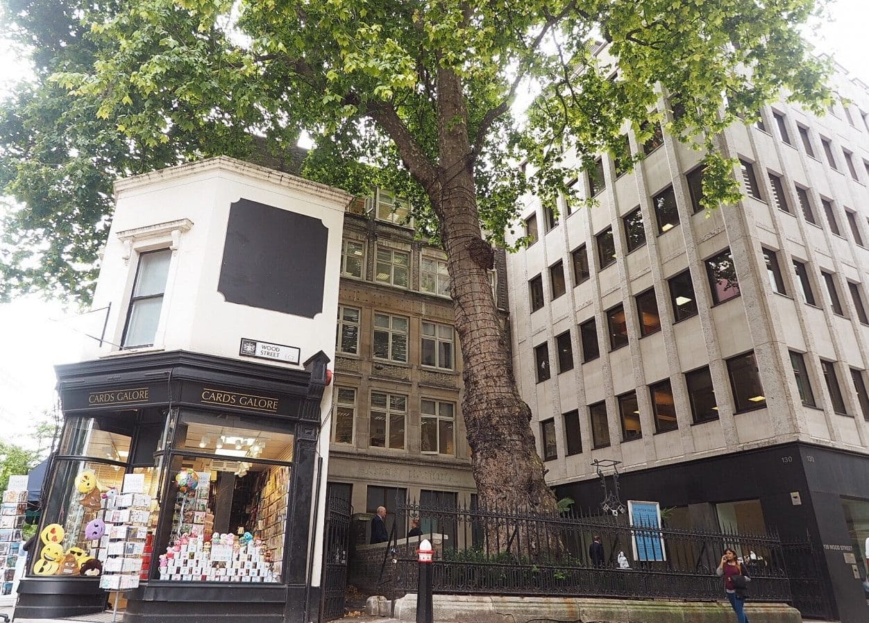
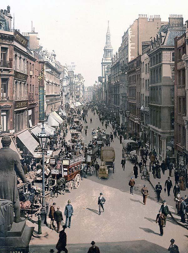
Since I wrote last week’s blog I became a bit obsessed with old boundary markers and started recording the ones I hoped my readers might find interesting. The City contains over 120 parishes, known primarily by the name of a church rather than a location, and although some may consist of only a few streets, up until the end of the 19th century they played an important part in the City’s governance. Although small, they were often densely populated, and most rectors and vicars would have known the majority of their brethren.

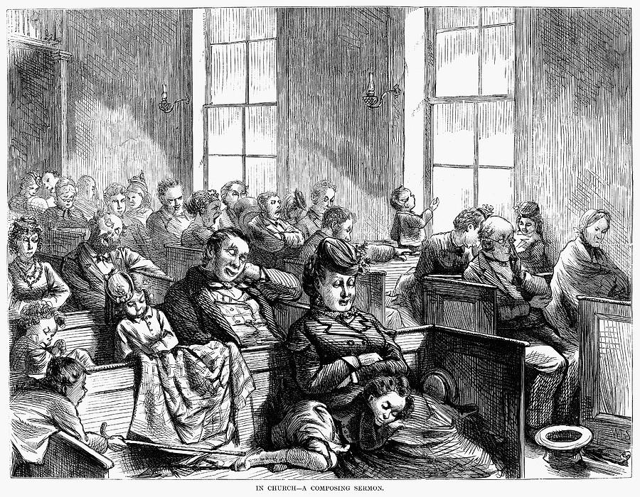
Church attendance was sometimes more of a duty than a pleasure.

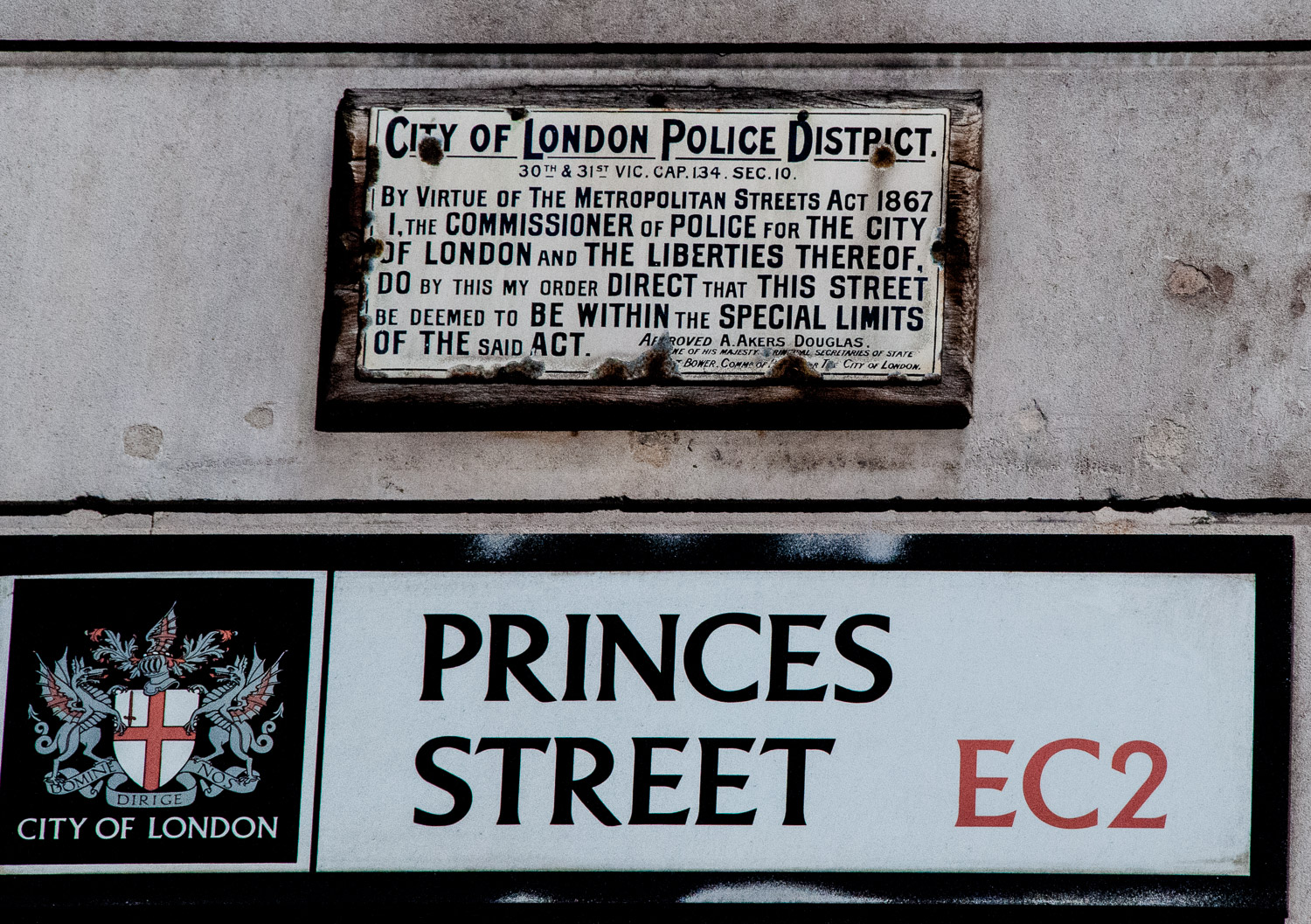
As historian Mike Horne has pointed out, the parish already had a version of ‘management’ in the form of its vestry and a mechanism for getting local people together, either in the church or in a nearby vestry hall. It was to the parish that local administrative responsibility was gradually given by Parliament. Even when new statutory bodies were set up to deal with lighting, policing, paving, sewerage and so on, the parish remained as the local unit capable of raising its local rate or tax. It was therefore important that people knew what parish they lived in and where the boundaries were. From this emerged the need for distinctive markers. Horne has attempted to survey and record them all and his incredibly detailed research findings can be found on the Metadyne website which I found invaluable when composing this blog.

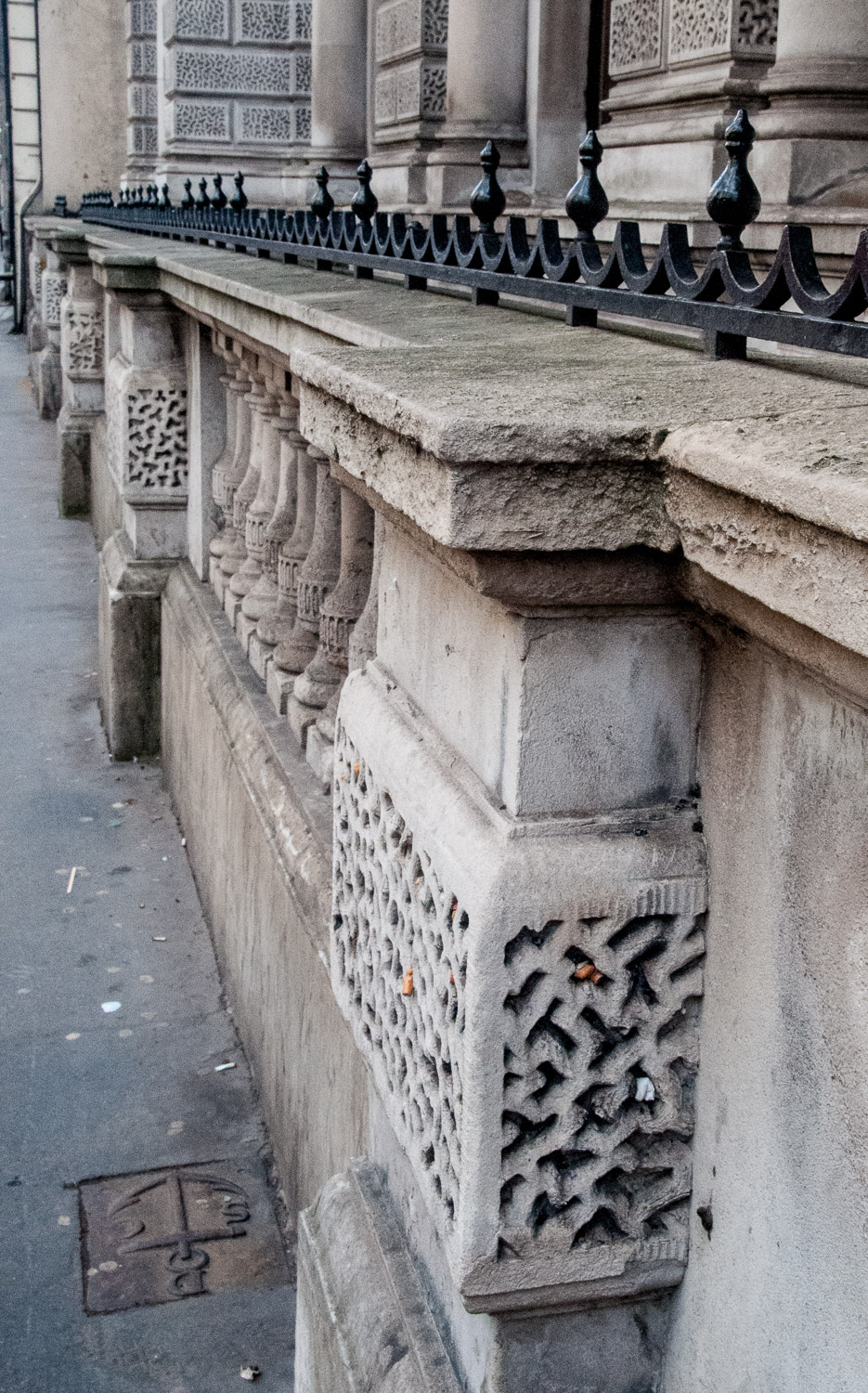
I like these old markers for two reasons. Firstly, they are a tangible link with the past, sometimes recording churches that have long since vanished and clerks, vergers and church wardens long since deceased. Secondly, they are remarkable survivors since most are not listed for conservation and their continued existence depends on rigorous planning enforcement and the compliance and support of developers.

Here are some of my favourites.

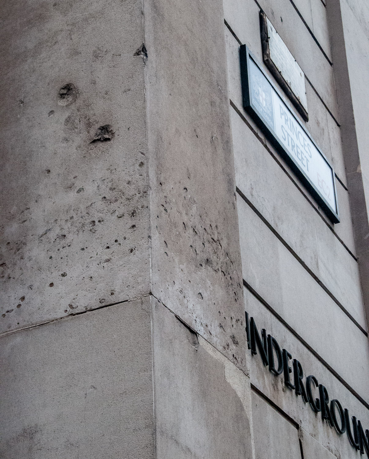
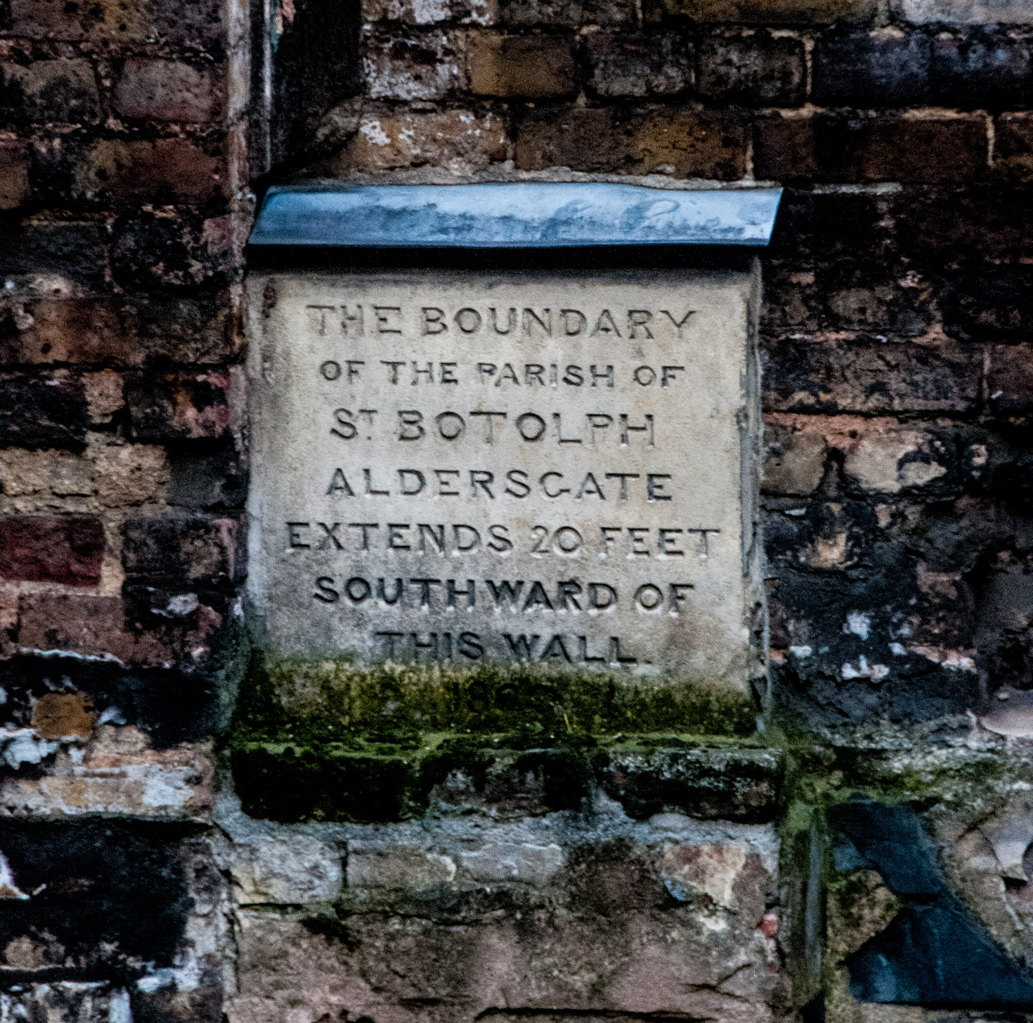
If you are travelling on the Underground and your train stops at Barbican station, look out of the window and you may see this stone marker on the station wall …

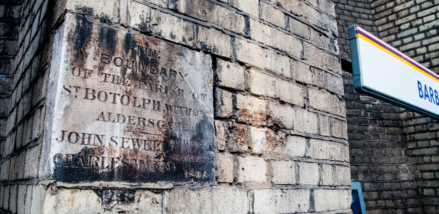
Barbican Station, Eastbound platform – Parish marker for St Botolph Without Aldersgate dated 1865.

The station, then called Aldersgate Street, opened on 23 December 1865 and was subsequently renamed several times before finally becoming Barbican in 1968. St Botolph’s church is still there in Aldersgate Street. ‘Without’ means it was located outside the City wall.

Parish markers are not always placed high up on walls, sometimes they can be found beneath your feet or just above street level. For example, as you walk down Fann Street EC1 you will come across this marker outside the Welsh Church …

St Luke Middlesex and the City of London (the boundary passes through the church).

And there is this very unusual metal pavement marker outside No1 Fleet Street, opposite the Law Courts and Temple Bar …

And in close up …

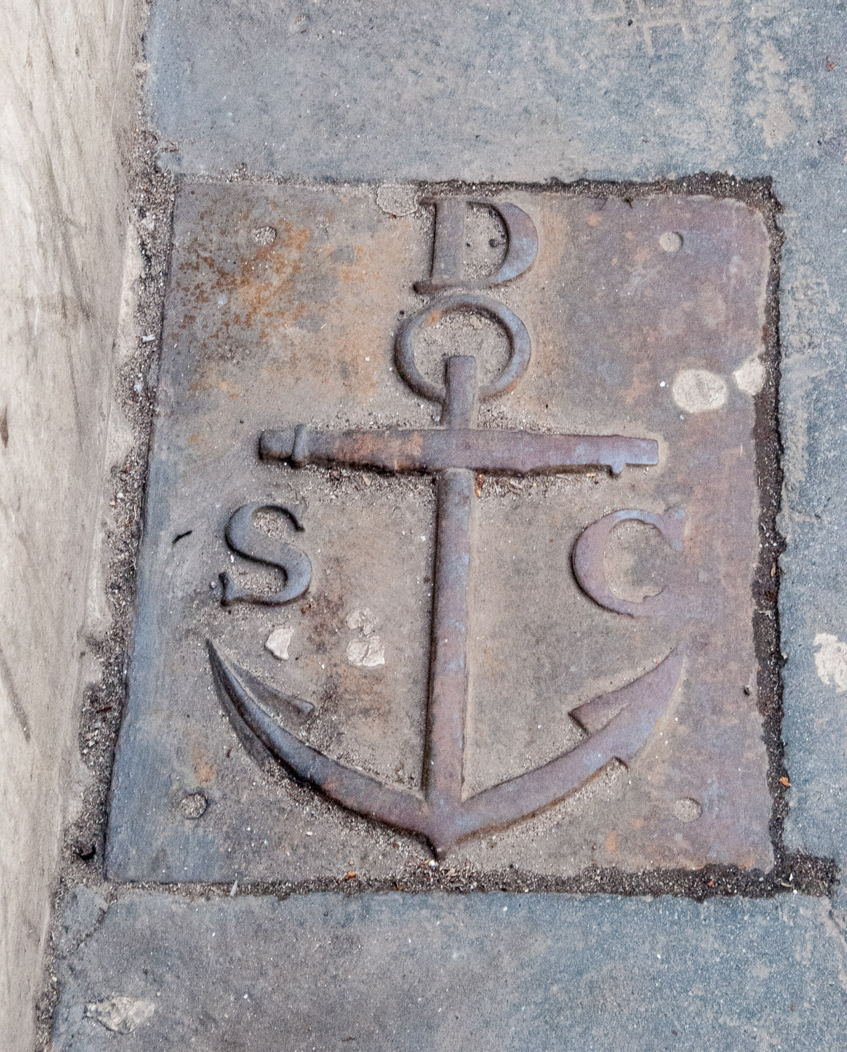
St Clement Danes with City of London (St Dunstan’s in the West).

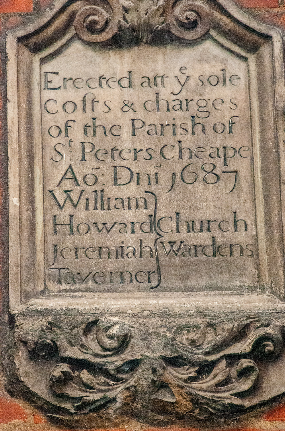
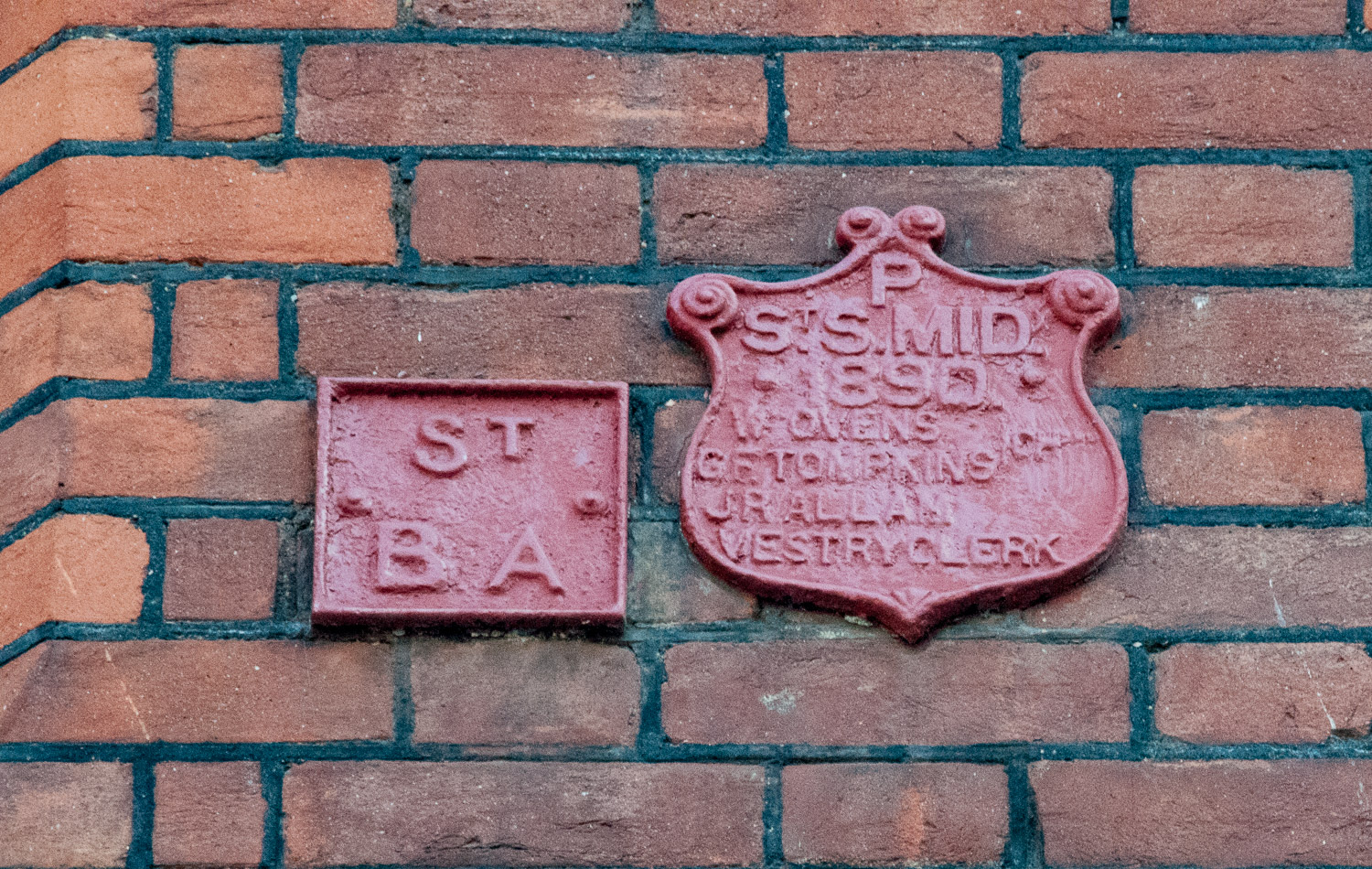
If you are walking near Smithfield Market do take a look at street level on the east side of the main building (to the south of the central doorway). This is what you will see …

On the left, the marker for St Sepulchre London (City of London) and on the right St Sepulchre Middlesex. There are two more marker stones – congratulations if you can find them.

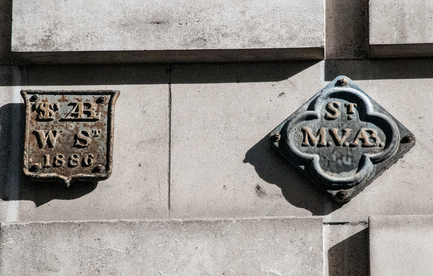
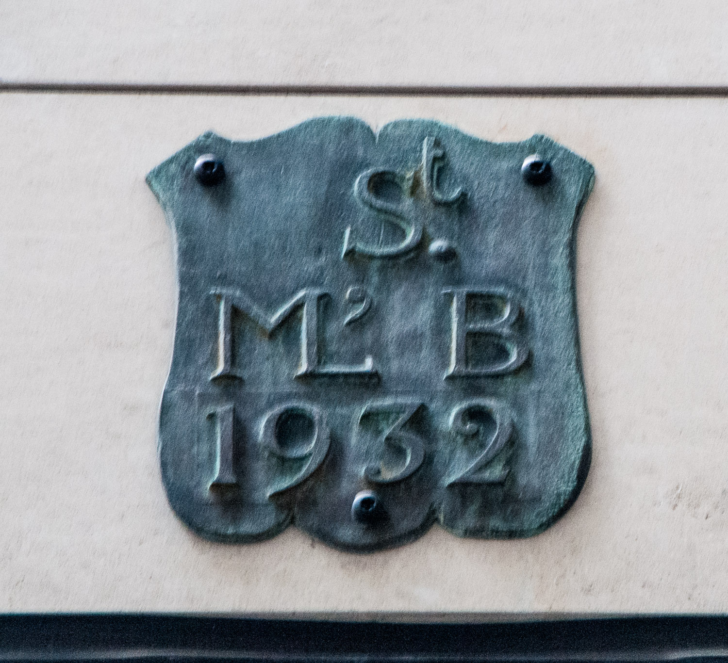
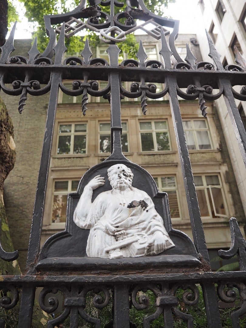
Many have been transferred to more modern buildings. For example, as commuters rush off to work from Cannon Street station there are two links with the distant past just above their heads …
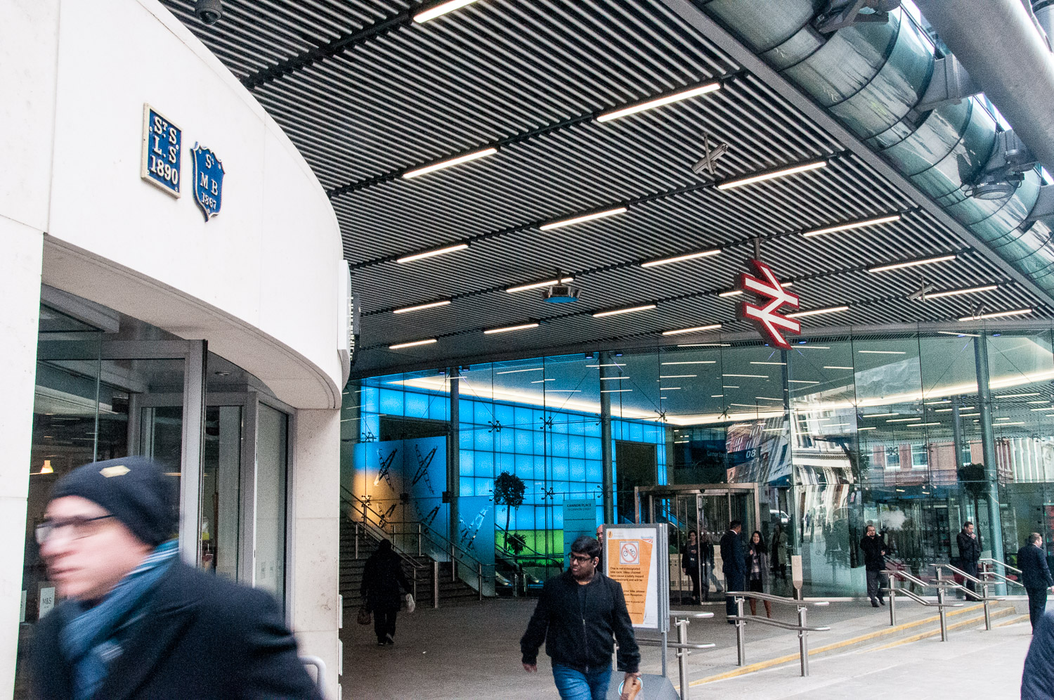
In close up …

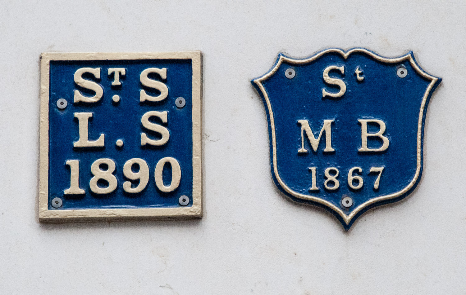
Markers for St Swithen London Stone and St Mary Bothaw.

St Swithen and St Mary Bothaw were both destroyed in the Great Fire of 1666 but only St Swithen was rebuilt (by Christopher Wren) in 1678 and the two parishes merged. Badly damaged in the Blitz, St Swithen was finally totally demolished in 1962.

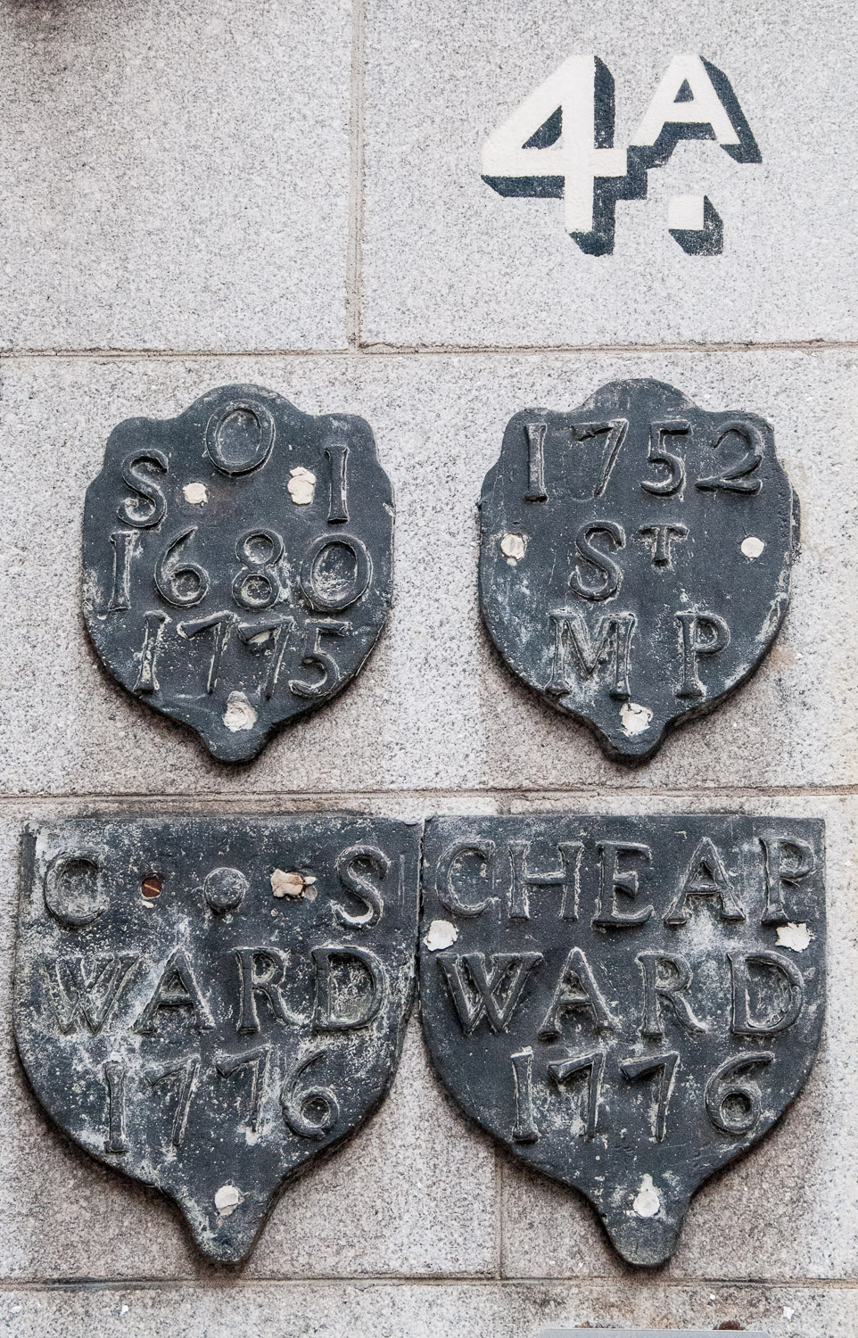
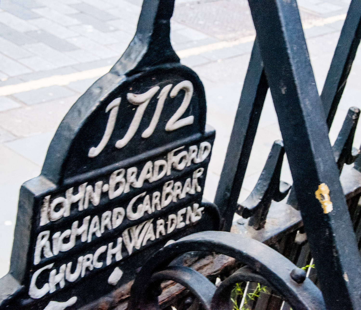
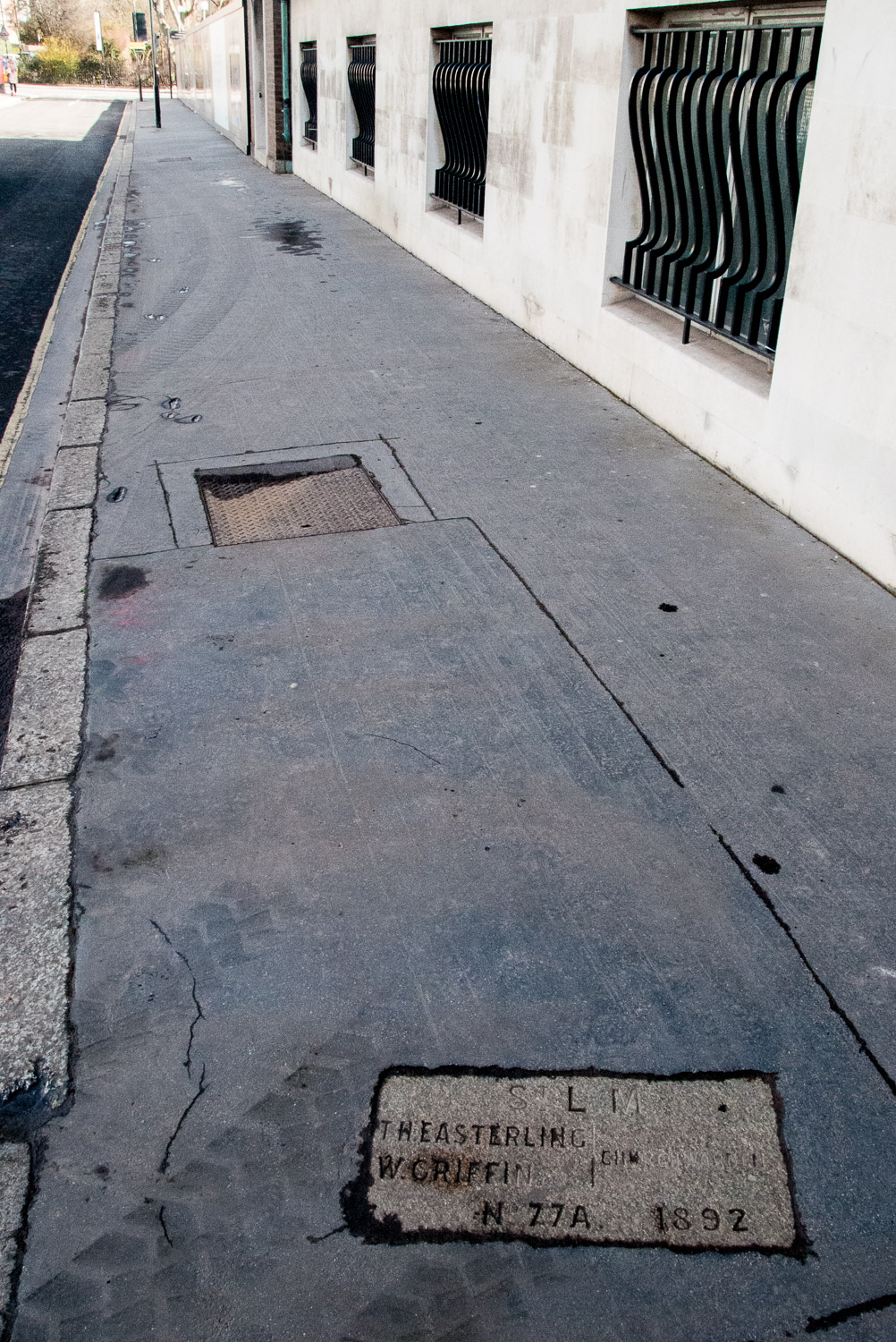
And finally a few more markers that also record the names of Churchwardens and Vestry Clerks, stressing the importance of these gentlemen.

On 41 Carthusian Street, EC1, opposite Charterhouse Square …

St Sepulchre (Middlesex) with the City Parish of St Botolph Without Aldersgate.

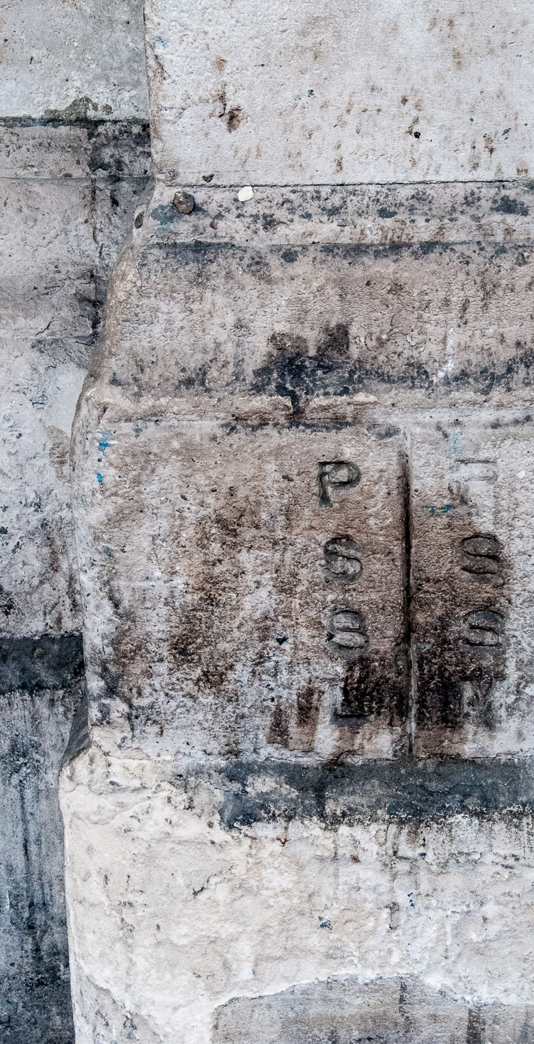
In Charterhouse Street, EC1 …

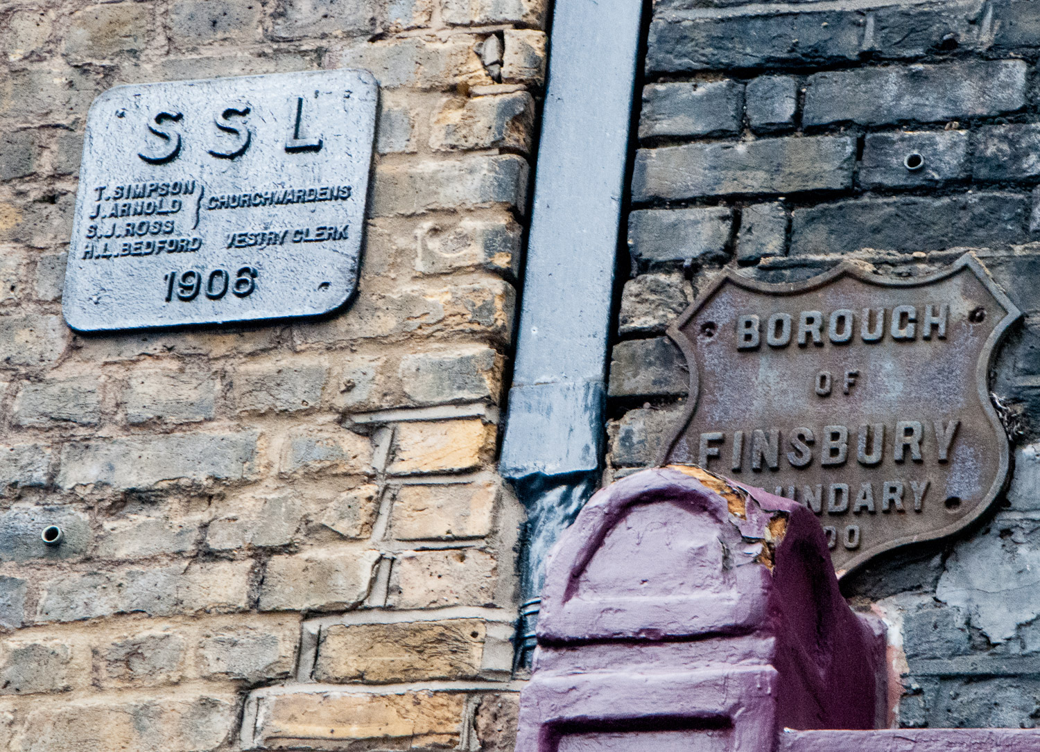
St Sepulchre (London) with the Metropolitan Borough of Finsbury.

There are many, many more examples of markers that I have come across but I will leave the subject for now and maybe return at a later date when I have done some more research. I hope very much you have enjoyed the journey so far.


Bombs and Boundaries

In today’s blog I have pulled together two subjects that I have found really interesting in my City wanderings. They are not linked thematically at all, but I hope you will still enjoy reading about them.

When we think of ‘London at War’ we tend to think of the Blitz, but Londoners were also at considerable risk during the First World War.

The first Zeppelin raid on London took place on 30 May 1915. At 10:50 that night Zeppelin LZ38 looped around London and, from a high altitude and barely heard, it dropped eighty-nine incendiary bombs and thirty ‘man killing’ grenades. The historian Jerry White tells us, in his splendid book Zeppelin Nights, that there were seven fatalities that night, including four children. Two of the children and two of the adults were burnt to death as a result of fires started by the incendiaries. He goes on to say …

Londoners met the raids with that unpredictable mixture of sangfroid and blind terror that characterised their response to aerial warfare throughout the First World War.

The last attack on Britain did not take place until 5 August 1918, when four Zeppelins bombed targets in the Midlands and the North of England.

There is still some evidence to be seen of the destruction, and the terrible danger you were exposed to if you were on the street during a bombing raid …

Damage at St Bartholomew’s Hospital from Zeppelin raids on 8th September 1915 and on 7th July 1917. Photo courtesy of Spitalfields Life.

Another picture of the St Bartholomew’s Hospital outer wall. Photo courtesy of Spitalfields Life.

And damage from the Second World War …

Shrapnel scars at the junction of Mansell St & Chambers St. Photo courtesy of Spitalfields Life.

Once I saw the pictures in Spitalfields Life I kept an eye open for other evidence and, sure enough, on the wall of the Bank of England in Princes Street …

Wall of the Bank of England.

And more of the same …

Beside the entrance to Bank Underground.

Above the Princes Street sign is a notice that will allow me to segue into ‘Boundaries’ …

The signatory, Aretas Akers-Douglas was First Commissioner of Works from 1895-1902, so the notice is a remarkable survivor.

Parish boundary markers will probably be a familiar sight to anyone who has worked in the City.

Long before the advent of the London borough, the parish already existed for spiritual purposes and had a form of management.  This was the ‘vestry’ and so a mechanism was in place for getting local people together, either in the church or in a nearby vestry hall. It was to the parish that local administrative responsibility was gradually given by Parliament. Even when new statutory bodies were set up to deal with lighting, policing, paving, sewerage and so on, the parish remained as the local unit capable of raising its local rate or tax. It was therefore important that people knew what parish they lived in and where the boundaries were. From this emerged the need for distinctive markers.

Here are some example I have found …

Love Lane EC2V : On the left, St Alban, Wood Street, on the right the marker for St Mary Aldermanbury.


A St Martin-in-the Fields parish marker, on a lamp post in Fleet Street

At Frederick’s Place EC2R, clockwise from top left are markers for: St Olave Old Jewry, St Martin Pomeroy and Cheap Ward. I am still researching the last one.

St Botolph Without Aldersgate – a stone marker on a wall in a bomb site in Noble Street EC2V

Honey Lane EC2V : a marker for the parish of St Mary-le-Bow

And finally …

The most famous boundary marker of all – the City of London Dragon. See my earlier blog from October last year: ‘Dragons and Maidens’.

I will be returning to the subject of Parish Markers later in the year – lots more research still to do.


A shop, a tree and a poem

Although it doesn’t look it at first glance, the corner of Wood Street and Cheapside is a little historical treasure trove. Here it is today, a card shop, a tree and a bit of open space – and all offer a fascinating sense of continuity with the City’s past.

Copyright Katie at ‘Look up London’

Cheapside had originally been known as West Chepe to distinguish it from East Chepe at the other end of the City and the name comes from the Saxon Ceap, meaning market. For centuries it was a scene of medieval pageantry, being wide enough for horse racing and jousts. It was also a place of grisly executions and the punishment of the likes of errant tradesmen and apprentices, usually utilising the permanent pillory and stocks. Facing Wood Street was the Eleanor Cross, one of a dozen lavish monuments erected by Edward I between 1291 and 1294, in memory of where the coffin of his wife Eleanor of Castile rested overnight as her body was transported to London.

The Cheapside Cross, with the Great Conduit to the right of it. Illustration: Guildhall Library & Art Gallery/Heritage Images/Getty

Before its demolition in 1643, the Cross was adjacent to a conduit, one of three providing fresh water piped from the River Tyburn, giving the citizens of London an alternative to the foul water from the wells and the Thames. It was the custom, on days of celebration, for the conduits to run with claret. The historian Bernard Ash observed that it was …

‘Claret undoubtedly as coarse and bloody as the mob which drank it’.

By the beginning of 1666 the street was dominated by traders: mercers, drapers, haberdashers, furriers and also Cheapside’s ‘greatest treasure’, the goldsmiths. Most of the messy, smelly trades had migrated to London’s rim.

As the Great Fire fire spread, people dug desperately into the earth to puncture the conduit’s water supply, hoping the water might quench the flames – in vain – and the Great Conduit itself was razed to the ground along with Cheapside on Tuesday 4 September 1666. A post-fire visitor declared in amazement …

‘You may stand in Cheapside and see the Thames!’

I would like to start my story with the little shop on the corner, which I have been tracking through time …

An anonymous drawing from the 1860s.

The 1920s – From ‘Spitalfields Life’ – pictures selected from the three volumes of ‘Wonderful London’ edited by St John Adcock and produced by The Fleetway House in the nineteen-twenties.

As I remember it in the 1970s through to the late 1990s. Sadly the lovely glass door engraved with the words ‘L R Woderson under the Tree’ has disappeared and been replaced with plain glass and a security grille.

The rebuilding of the City after the Great Fire took over forty years, but the little shop on Cheapside, along with its three neighbours to the west, were some of the earliest new structures to be built as the City recovered. The site is small and each of the shops in the row consists of a single storey above and a box front below. According to Peter Ackroyd, in his London, the Biography, many trades have operated there since the stores were built in 1687. These included silver-sellers, wig-makers, law stationers, pickle- and sauce-sellers, fruiterers, florists and, as can be seen above, shirt-makers. The shop now sells greetings cards.

The little garden at the back of the shop used to be the churchyard of St Peter Westcheap (also known as St Peter Cheap) which was destroyed in the Great Fire and not rebuilt. Three gravestones survive as do the railings which date from 1712.

The railings and the names of the Churchwardens who probably raised the money for them.

The railings incorporate an image of St Peter. In his lap and above his head are the Keys to the Kingdom of Heaven.

The plaque in the churchyard attached to the Cheapside shop’s northern wall confirms the age of the building …

And finally to the magnificent London Plane tree that you can see in most of the pictures. It stands 70 feet high and is protected by a City ordinance which also limits the height of the shops.

No one knows precisely how old it is but what we do know is that it was there in 1797 when its presence inspired the poet Wordsworth to compose a poem ‘where the natural world breaks through Cheapside in visionary splendour’. The poem, The Reverie of Poor Susan, records the awakened childhood memories of a country girl now working in London, possibly as a servant. I think it is rather sad. An excerpt is displayed in the churchyard, but here is the complete version:

At the corner of Wood-Street, when day-light appears,
There’s a Thrush that sings loud, it has sung for three years.
Poor Susan has pass’d by the spot and has heard
In the silence of morning the song of the bird.

‘Tis a note of enchantment; what ails her? She sees
A mountain ascending, a vision of trees;
Bright volumes of vapour through Lothbury glide,
And a river flows on through the vale of Cheapside.

Green pastures she views in the midst of the dale,
Down which she so often has tripp’d with her pail,
And a single small cottage, a nest like a dove’s,
The only one dwelling on earth that she loves.

She looks, and her heart is in Heaven, but they fade,
The mist and the river, the hill and the shade;
The stream will not flow, and the hill will not rise,
And the colours have all pass’d away from her eyes.

As Ackroyd declares, in his unique, poetic style …

Everything about this corner of Wood Street suggests continuity … on every level, human, social, natural and communal.

I thought this picture was worth including. Sir Robert Peel looks east down Cheapside around the turn of the 20th century (and a uniformed ‘Peeler’ stands beneath the lamp post). The shops gradually disappeared for a while as commerce took over but now they are back in abundance, especially with the new development at New Change.

Sir Robert was moved in 1933 to reduce traffic congestion. He is now outside the Peel Centre in Barnet (more familiarly known as Hendon Police College).


The Mysterious Panyer Boy – and other curiosities

Here he sits in Panyer Alley, just beside an entrance to St Paul’s Underground Station, a naked little boy astride what looks like a basket, and a strange inscription precisely dated ‘August the 27 1688’. What is going on?

Sadly the little chap has become very eroded and damaged over the years, and it is pretty surprising that he has survived at all. After a bit of searching I have found a drawing of him, possibly from the 18th or 19th century, which may give us a better idea of what he used to look like …

The pedestal and scrollwork have now disappeared.

I have also found this old photograph, probably early 20th century …

For this picture and other really interesting photos, visit the ‘Spitalfields Life’ website and search for ‘Signs of Old London’.

As with all mysteries, there are many theories, but all are agreed that the sign really does date from the 17th century since this is acknowledged in trusted sources such as Thomas Pennant’s Of London (1790). What the boy is doing and what he represents are the areas where there is much dispute, for example:

‘Is he: sitting on a pannier (basket), or a coil of rope, or a woolsack, or a barrel?’

‘Is he holding: a bunch of grapes, or a loaf of bread, or his foot (perhaps pulling out a thorn – apparently the carving was once known locally as ‘pick my toe’)?’

‘Does he represent: the bread market that was here in medieval times, and at nearby St Martin’s Le Grand, or the sign of a brewhouse (brewery)? There was a Panyer brewhouse recorded nearby as long ago as 1426.’

‘Does he have any connection whatsoever to the claim to the highest ground?’.

I don’t know the answer to these questions, but one thing that is certain is that this is not the ‘highest ground’ in the City, that description nowadays belongs to Cornhill.

Nearby on the north west corner of Warwick Lane is a small bas-relief of Guy, Earl of Warwick. It is believed that the lane was so named since it was the location of the Warwick Inn owned, not surprisingly, by the Earls of Warwick.

The knight represented is the 10th Earl (c.1272-1315) and the British Museum archives hold a picture of the carving as it was illustrated in Antiquities of London (1791) …

Copyright : British Museum

And here is how it looks now …

You can see that the top and bottom sections of the present-day relief were added later, most likely at the time of a restoration in 1817 by John Deykes (an architect and surveyor). Pennants London is a book published in 1805 and its 5th edition (1815) gets a mention on the relief, right down to the page number where  the carving is discussed (492). Maybe the publisher paid for the restoration in return for this smart piece of advertising?

Incidentally, whilst researching the Warwicks I came across this reference to the Warwick Inn. Neville, the 16th Earl …

At a meeting of the great estates of the realm in 1547 … lodged himself  (there) with 600 men where, says Stowe, ‘there were oftentimes six oxen eaten at … breakfast, and every tavern was full of his meat; for he that had any acquaintance in that house, might have there so much of sodden [boiled] and roast meat, as he could prick and carry upon a long dagger.’

Now that’s what I call a buffet.

On the north west side of nearby Ludgate Circus is this memorial plaque. Wallace sold newspapers on this corner when he was eleven years old …

The memorial is by F.W. Doyle-Jones (1934)

Born out of wedlock in Greenwich in 1875, and with both of his parents itinerant actors, he was adopted by a kindly Billingsgate fish porter and his wife. Asked by a journalist years later to contribute to a celebrity feature entitled ‘What I Owe My Parents’, Wallace replied on a postcard:

‘Sorry, cock, I’m a bastard’.

Despite such a challenging start to life (or perhaps because of it) his story is extraordinary. As well as journalism, Wallace wrote screen plays, poetry, historical non-fiction, 18 stage plays, 957 short stories, and over 170 novels, By 1926, he was knocking out 18 novels a year and by 1929, he was up to 34, and it was claimed that a quarter of all books read in English were by him.

When he turned to writing fiction in 1905 he told his wife he would give his readers :

 ‘Crime and blood and three murders to the chapter; such is the insanity of the age that I do not doubt for one moment the success of my venture.’

More than 160 films have been made of Wallace’s work and he sold over 50 million copies of his combined works in various editions, The Economist describing him as ‘one of the most prolific thriller writers of [the 20th] century’.

So why is he hardly known at all now compared to his overlapping contemporaries Arthur Conan Doyle and Agatha Christie? His biographer, Neil Clark, sees him as a victim of literary snobbery, being one of the first crime writer to come from a working-class background. Another factor may be that the characters of his investigators, JG Reeder and the gloomy Inspector Elk, were not as seductive as Holmes, Poirot or Maigret. For example, Elk was introduced in The Fellowship of the Frog as ‘tall and thin, a slight stoop accentuated his weediness.’

Wallace’s last piece of work was on one of the most famous movies of all time …

In 1931 RKO invited him to Hollywood to work on an idea that Wallace would generously credit to the director, Merian C. Cooper. However, as Neil Clark makes clear in his biography, the Bodleian’s existing script shows that Wallace conceived the ‘beauty and the beast’ motif himself, the climb up the Empire State building and the aeroplane attack.

He also created the final scene …


‘Kong opens his eyes, picks the girl up, holds her to his breast like a doll, closes his eyes and drops his head,’

Wallace died in Hollywood on 10th February 1932 after falling into a diabetic coma, compounded by double pneumonia, from which he never recovered.

And finally, would you like a close look at a piece of work by the pioneering modern sculptor Jacob Epstein?

Once again, as in previous blogs, I invite you to pass through the blue doors in Foster Lane to the lovely tranquil garden of St Vedast-alias-Foster  …

In the corner you will find Epstein’s Head and Shoulders of Canon Mortlock (1936)…

Mortlock was a personal friend of Epstein’s and also of Max Mallowan (Agatha Christie’s husband) who gave him the cuneiform marked tablet also displayed in the churchyard – see my blog City Churches and Churchyards – more Tales of the Unexpected.


Powered by WordPress & Theme by Anders Norén