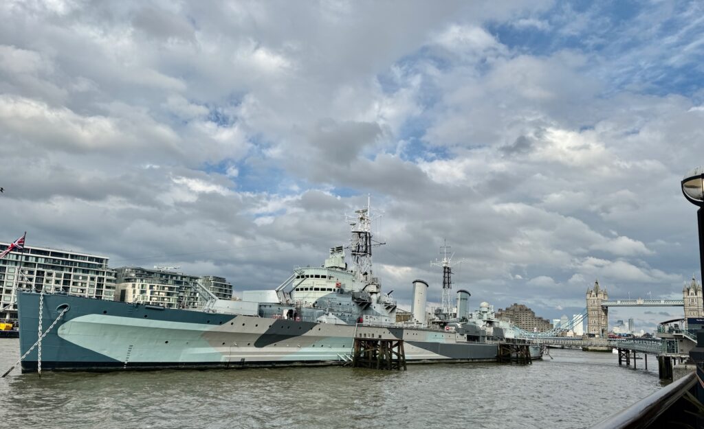
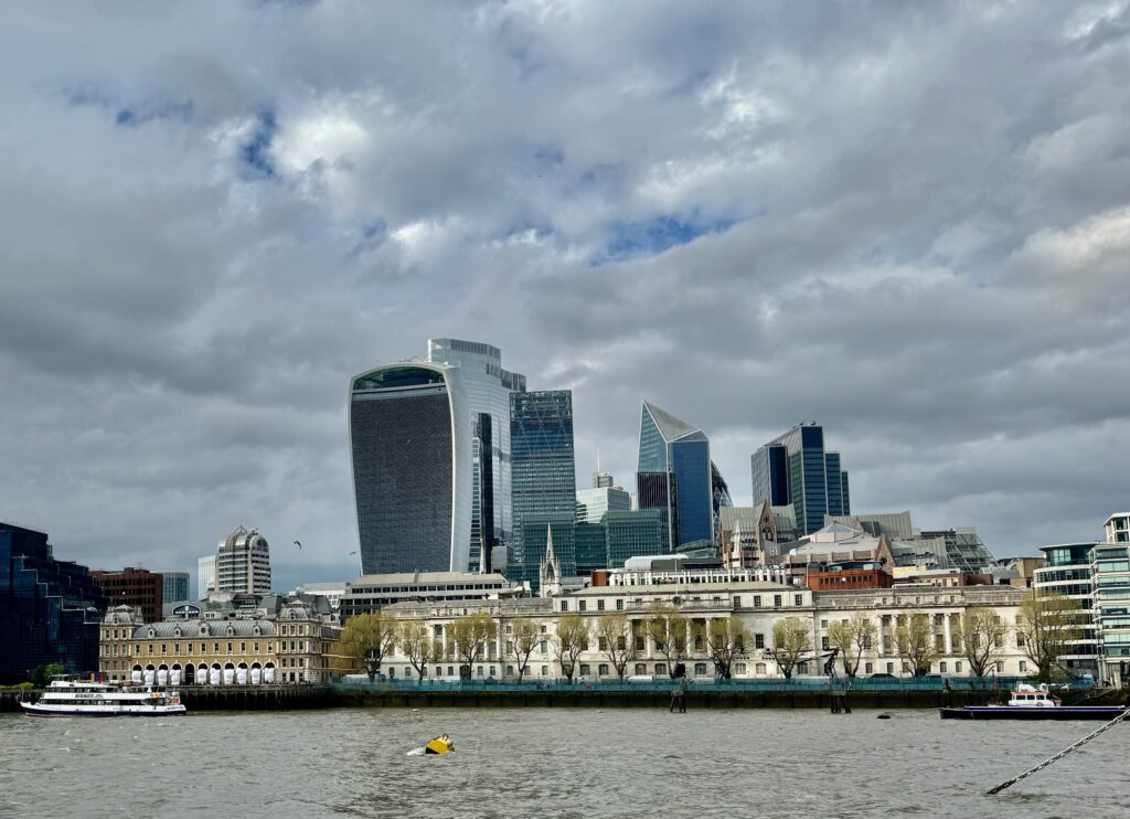
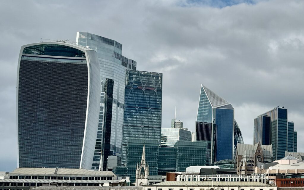
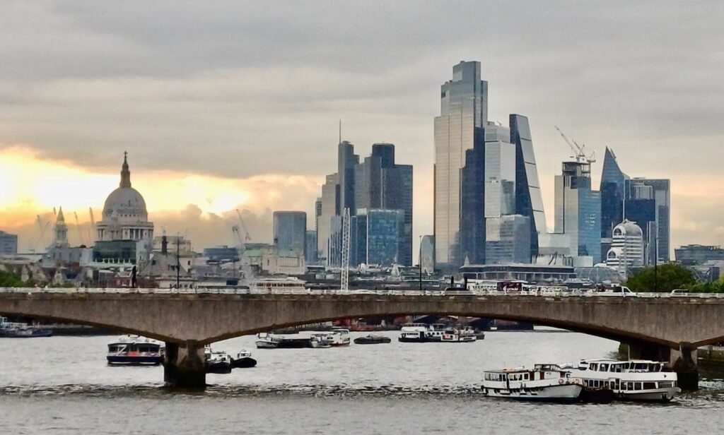
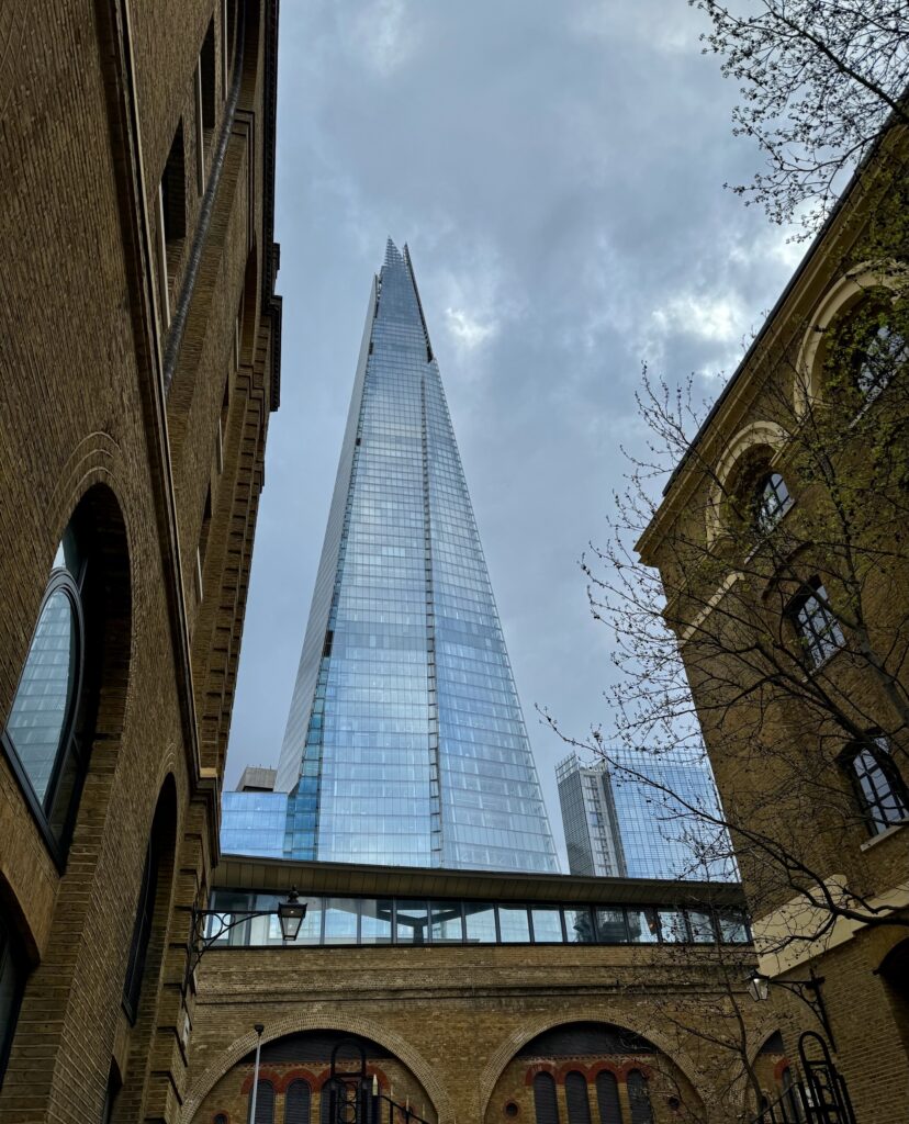
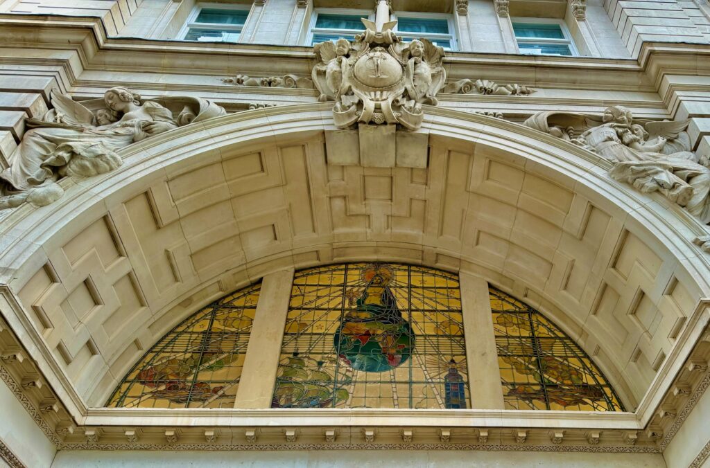
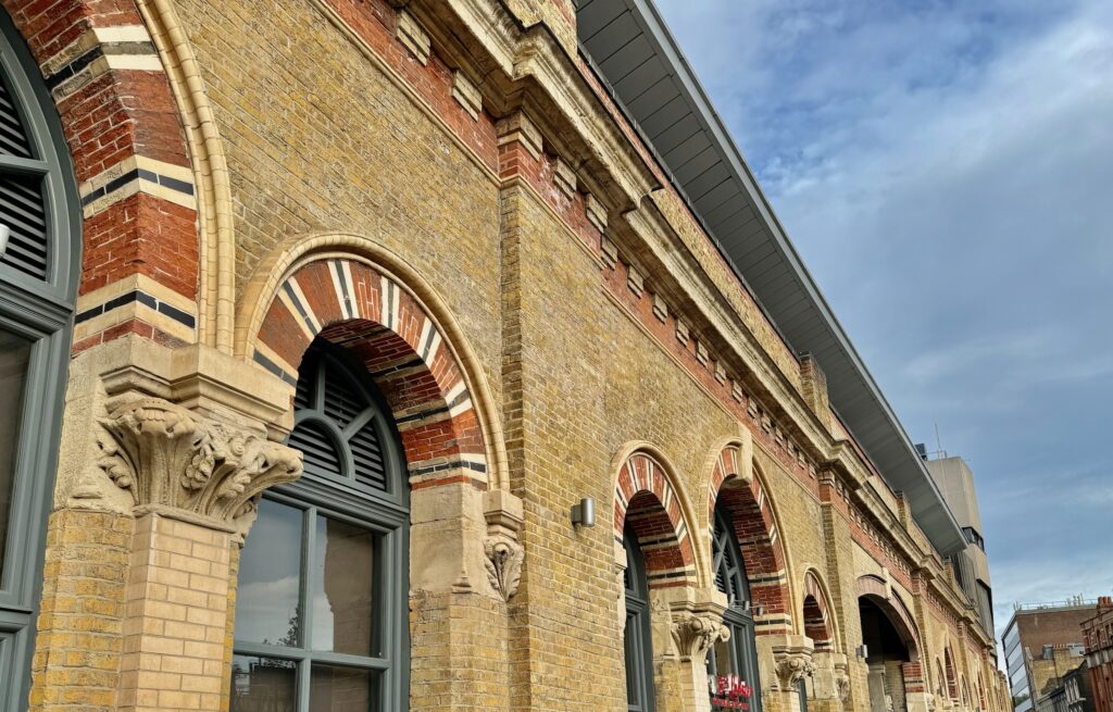
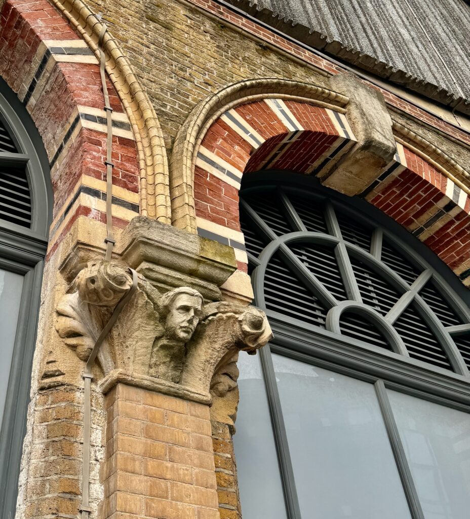
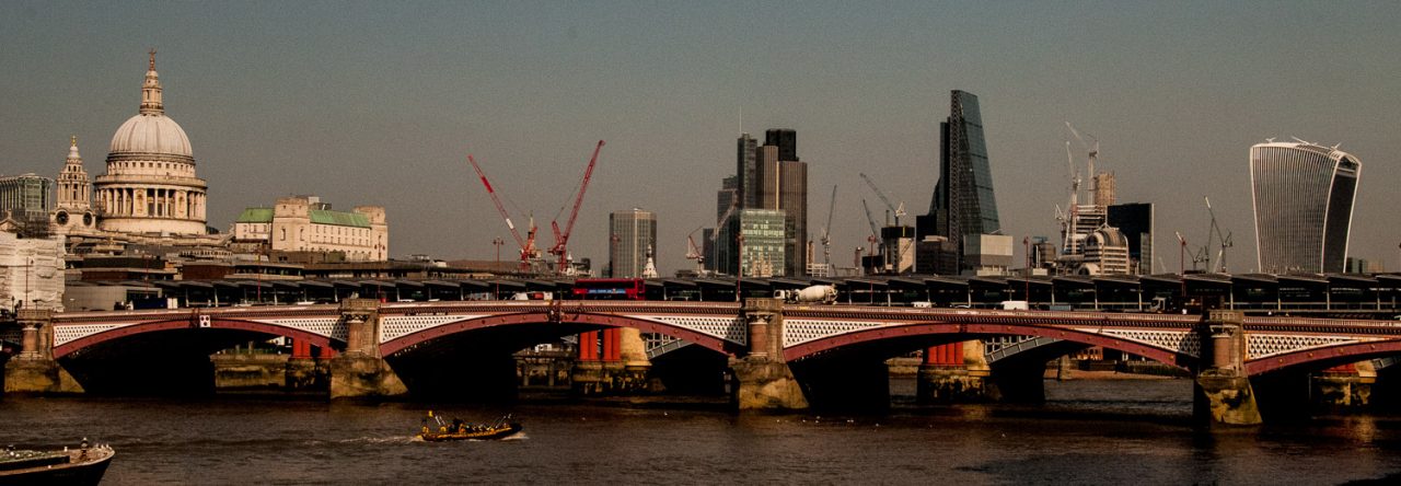
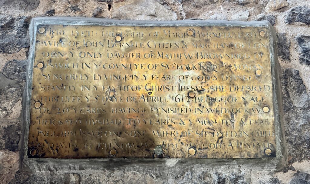
I was thrilled when I finally got around to visiting The Garden at 120 on the roof of 120 Fenchurch Street (EC3M 5BA). The entrance is in Fen Court and before you even get to the lift you can look up and see the digital art installation by Vong Phaophanit and Claire Oboussier on the ceiling. There is also a haunting soundscape as well. It’s a fabulous piece of work (entitled The Call of Things) and you can read more about it here.
You don’t have to book a time to visit, just turn up. Visiting times are set out on their website. After airport style bag checks a lift whisks you to the 15th floor where you have a 360 degree view. Here are a few of the images I took on a nice sunny day last week.
You can see the Gherkin in all its glory. A treat now that it is becoming more and more hemmed in by, frankly not very attractive, new buildings …
The Scalpel can be observed just alongside it …
The Walkie Talkie dominates part of the view …
In the distance, Canary Wharf …
and Tower Bridge …
The Shard is framed by the Witch’s Hat (the London Underwriting Centre) and the Walkie Talkie …
Down below a massive development takes place behind some preserved facades …
The roof is, of course, a garden as well as an observation point and the plants will eventually grow to form a pergola …
Many congratulations to insurer Generali and their architects Eric Parry for this stunning development and for making it so accessible.
Let’s not forget, however, the other great free view that can be enjoyed on the roof at One New Change (EC4M 9AF). Interesting views of St Paul’s start in the lift …
And continue on the roof …
The panorama includes the new apartments at Blackfriars, the Oxo Tower, the London Eye, the Unilever Building and the spire of St Augustine with St Faith (now part of St Paul’s Cathedral School) …
Both roofs are usually nowhere near as busy as you might expect.
High up on a tiled pillar in Barbican Underground Station is this poignant memorial …
For many years Pebbles was a favourite of staff and passengers, often sleeping soundly on top of the exit barriers despite the rush hour pandemonium going on around him. Here is a picture from the wonderfully named Purr’n’Fur website, a great source for moggie-related stories …
Clearly he was greatly missed when he died, as the plaque faithfully records, on 26th May 1997. This was doubly sad because he was due to be given a Lifetime Achievement Award. This was sponsored by Spillers Pet Foods and named after Arthur, a cat they used in their advertising who, I seem to remember, ate with his paws. The Certificate that came with the award is also displayed (the co-winner, the aptly named Barbie, was Pebbles’ companion) …
As I walked down the stairs to see the plaque I noticed that everything looks sadly tatty. However, just imagine these tiles when they were newly fitted before the War, with their geometric patterns leading you down to the Ticket Office …
And how wonderful, the Office window is still there, although instead of a helpful Ticket Clerk there is a poster. I reckon those lovely brass fittings and the counter date from the early 1930s. The pattern on the tiles continues down here as well – such thoughtful design …
The station, originally called Aldersgate Street, was opened on 23 December 1865 and had a large glazed roof which allowed light down to the platform. Here it is in 1936 …
The roof was removed in 1955 but you can still see the supporting brackets …
John Betjeman wrote about the roof’s dismantling, calling the work Monody on the death of Aldersgate Street Station …
Snow falls in the buffet of Aldersgate station, Soot hangs in the tunnel in clouds of steam. City of London! before the next desecration Let your steepled forest of churches be my theme.
Barbican station holds the unenviable distinction as the scene of the tube network’s first ever passenger disaster. On 16 December 1866 three passengers were killed and a guard was seriously injured when a girder collapsed onto a passenger train in the station. The newspapers reported that service on the line was running again only 30 minutes after the accident.
Look out for the old parish boundary marker dated 1868 on the eastbound platform …
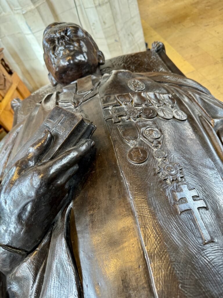
I have written in more detail about boundary markers in an earlier blog which you can find here. If you want to read more about the railways in the area, there is a great blog on the subject called Reconnections with useful maps and interesting pictures.
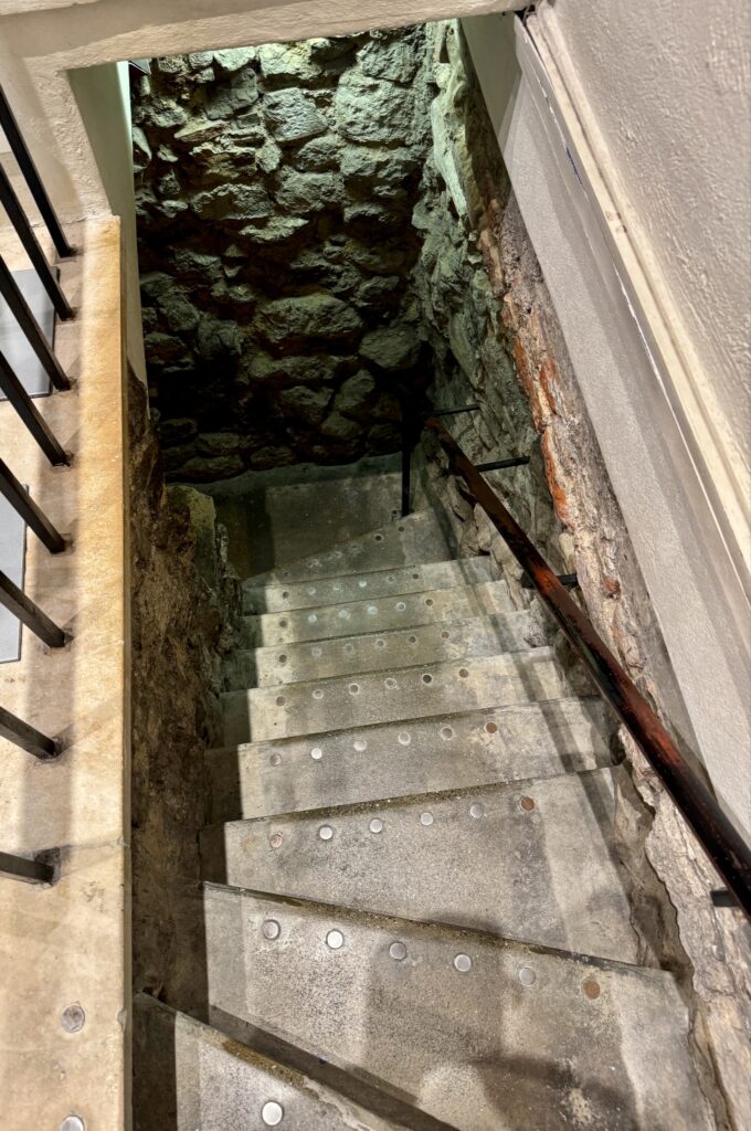
Onward now to the refurbished Farringdon Station. On climbing the stairs from the platform you can admire the original 19th century roof supports …
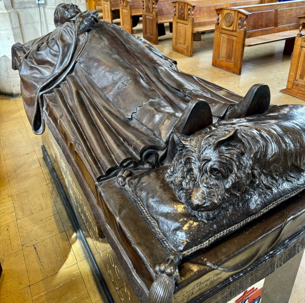
Just before exiting through the barriers I spotted some nice old stained glass windows. I had never noticed them before, it just shows what you can come across if you have time to dawdle …
I had as my guide a book by the brilliant Underground historian Antony Badsey-Ellis – Underground Heritage. He tells us that many Metropolitan Railway stations were modernised between 1914 and 1931 and the house style employed at what is now Farringdon Station was by Charles W Clarke …
The only decoration on the friezes was the diamond motif used by the railway …
It’s been reproduced as a heritage sign at Moorgate ..
And here it is again at Aldgate …
In the lobby is a beautifully maintained memorial to the seven people killed at Aldgate in the terrorist attacks on 7 July 2005 …
There is also a plaque commemorating the Queen’s visit in 2010 …
The tiles at Aldgate are very pretty and often include the Metropolitan Railway diamond …
And it’s nice to see some original platform signage from the 1930s (with original roof supports in the background) …
And finally, a ghost station …
You can still see the old entrance to Mark Lane tube station next to the All Bar One, just as Byward Street becomes Tower Hill. It closed on 4 February 1967 and was replaced by the nearby Tower Hill station. The entrance (through the arch on the left of the steps) now leads to a pedestrian subway …
I’m always intrigued by Londoners’ capacity to ignore odd behaviour. For example, I spent a good ten minutes bending over this grating, some of it virtually on my knees, and no one showed the slightest curiosity …
I was, of course, trying to hear the sound of running water since, directly underneath, runs probably the most famous of London’s ‘lost’ subterranean rivers, the Fleet. Its headwaters are two streams on Hampstead Heath, each of which was dammed into a series of ponds in the 18th century. At the southern edge of the Heath these descend underground as sewers which join in Camden Town. The waters flow four miles from the ponds to the River Thames, just underneath Blackfriars Bridge. Incidentally, it didn’t run down Fleet Street, it merely ran past its eastern, lower end.
This map, showing the route of the Fleet and various other waterways, is on display at the excellent Secret Rivers exhibition at the Museum of London Docklands …
Because of its later reputation, I always had a view that the Fleet where it joined the Thames would be a deeply unpleasant place, so this picture rather surprised me …
This painting (by a follower of Samuel Scott) was obviously influenced by Canaletto, who was based in England until 1755. Looking north across the Thames, it shows the entrance to the Fleet circa 1750 with Bridewell Foot Bridge, the City Wharf and Dock, and Blackfriars Stairs. The Fleet was developed into a canal up to Holborn, lending this view a Venetian appearance. This grand aspect, however, did not last long as the wharves proved unprofitable and Londoners continued to dump their rubbish in the river.
Originally a green river valley, the Fleet River had been gradually transformed into the Fleet Ditch, infamous for being a source of filth, corruption and disease. Observing a flood during a storm in 1710 Jonathan Swift penned the following lines …
Sweepings from Butchers Stalls, Dung, Guts and Blood, Drown’d Puppies, stinking Sprats, all drench’d in Mud, Dead Cats and Turnip-Tops come tumbling down the Flood.
Pope made this small literary contribution in 1728 …
To where Fleet Ditch, with disemboguing streams, rolls the large tribute of dead dogs to the Thames.
On display at the exhibition is sad little exhibit. Found during excavations of the old river bed, it’s a dog’s collar with the inscription ‘Tom at Ye Greyhound Bucklersbury’. Poor Tom.
There is a reminder in the exhibition of how muddy and dirty the City’s streets were. This pair of wooden pattens date from the 15th century and were used to protect shoes and raise the wearer above the mud. They have a leather hinge to aid walking …
London’s population grew rapidly through the seventeenth century from about 200,000 to about half a million which resulted in a significant rise in the need for coal. This was brought from the north east of the country in barges which offloaded at wharves in the tidal Fleet. Street names that survive today remind us of this …
And the thoroughfare that ended at the canal, so you couldn’t go any further …
The Fleet Valley from Clerkenwell to the Thames housed many of London’s prisons and all manner of vice was practised in the dingy, stinking claustrophobic rookeries (slums). Nor was there much privacy if you had to go to the loo. This medieval oak three-seater toilet seat was found over cesspit in a yard behind buildings that faced on to modern day Ludgate Hill …
This picture tells a story. It’s an 1841 drawing by Antony Crosby of the Fleet River at Holborn Bridge – note the wooden latrine projecting over the ditch on the left …
Holborn Viaduct was built between 1863 and 1869 in order to span the Fleet and provide level access from east to west – a great improvement in an era of horse-drawn traffic. You can see it reaches over a deep valley …
When I climbed the stairs to take a picture from above a curious City dragon popped his head up to see what I was doing …
Gradually the entire river was enclosed in Victorian sewer tunnels and it now flows into the Thames under Blackfriars Bridge (just below where the banker Roberto Calvi was found hanged in 1982) …
Rivers, such as the Thames and the Walbrook, influenced where the Romans founded Londinium and the Museum of London exhibition also illustrates the fact that our connection to water goes beyond the practical, reaching into the spiritual. While most objects found in London’s rivers are lost items, rubbish or remnants of river-related activities, some cannot be explained so easily. These bear witness to the spiritual importance of rivers.
On display, for example, is this first or second century AD small representation of a river god, possible Neptune, apparently cast or placed into the Walbrook …
And this piece of a marble offering is particularly fascinating …
The inscription has been translated thus:
To the Divinities of the Emperors (and) to the god Mars Camulus. Tiberinius Celerianus, a citizen of the Bellovaci, moritix, of Londoners the first …
It is the first example from the capital to use the word Londiniensi or ‘Londoners’. The language suggests a man who hailed from northern France and probably traded or travelled regularly within that region but whose home seems to have become London.
Old Street really is old – recorded as Ealdestrate in about 1200, and leOldestrete in 1373. I started my walk heading west from Old Street Roundabout (or Silicon Roundabout as it was nicknamed some years ago, due to the nearby cluster of hi-tech businesses).
The Underground Station is now buried beneath the roundabout but was once much more visible …
As you leave the present day station you catch a glimpse of the spectacular Leysian Mission building – something for a future blog …
I crossed the road and started my Old Street journey on the south side of the street.
The first building of interest is on the left, what was previously St Luke’s Parochial School …
The foundation stone is now protected behind a perspex sheet (the school moved to new premises in 1972) …
A generous benefactor paid for this extension in 1887 …
Around the door there is some lovely gothic-style woodwork …
Across the road is this striking piece of street art …
It was commissioned by The Flavasum Trust to commemorate the life of a young man, Tom Easton, who died nearby in 2006 as a result of a knife attack. The painter was Ben Eine.
If you are feeling peckish, grab a tasty Turkish Kebab from my pal at number 94 …
Look up for the old Salvation Army Hostel ghost sign …
There is a 19th century pub building on the corner with Whitecross Street. It was once the site of the Jack-a-Newberry Tavern, a notorious brothel …
A plaque on the side commemorates a former resident …
Whitecross Street Market is one of London’s oldest markets, dating back to the 17th century. By the 19th century it was known as the Squalors’ Market, due to associations with poverty and alcohol, but investment in 2008 has made it a thriving daytime street-food market.
I have written about Priss (‘the second best whore in the city’) and Whitecross Street in an earlier blog which you can find here.
On the other side of the road is the now de-consecrated St Luke’s church. It was designed by John James, though the obelisk spire, a most unusual feature for an Anglican church, the west tower and the flanking staircase wings were by Nicholas Hawksmoor …
The weathervane is actually a red-eyed dragon but for some reason locals thought it resembled a louse and nicknamed the church Lousy St Luke’s …
The church was closed in 1964 due to subsidence, but the previously derelict building has now been restored by the London Symphony Orchestra as a beautiful space for performances, rehearsals, recording and educational purposes.
William Caslon the Elder is buried in the churchyard. …
A typefounder, the distinction and legibility of his type secured him the patronage of the leading printers of the day in England and on the continent. His typefaces transformed English type design and first established an English national typographic style. Here is a specimen sheet of his typefaces from 1728. In it’s own way I think it is beautiful …
Caslon’s first workshop was in Helmet Row, next to the church. It has some early 19th century terraced houses, a few of which later had their ground floors converted into shops …
There are more 19th century buildings further to the west but I think the property on the right is more recent …
There is what looks like a livery company crest on one of them but I can’t identify which company …
Number 116 used to be the Margolin Gramophone Company factory …
They manufactured the Dansette record player – a name very familiar to us baby-boomers …
Dansette production ended in December 1969, following the introduction of relatively cheap and efficient Japanese and other Far Eastern imported Hi-Fi equipment. Margolin went into liquidation.
At 12 Old Street is the building that once housed The Old Rodney’s Head public house …
The building is for sale at the moment – offers in excess of £6.5 million if you’re interested – EC1V 9BE.
George Brydges Rodney, 1st Baron Rodney (1718-1792) was a famous
Admiral best known for his victory over the French at the Battle of the
Saintes in 1782 which ended the French threat to Jamaica. The building
dates from 1876 and Rodney still gazes down on Old Street …
Sadly the Hat and Feathers across the road has not reopened after a short time operating as a restaurant …
2 Clerkenwell Road EC1M 5PQ.
British History Online tells us that the building dates from 1860 and the facade – ‘gay without being crude’ – is decorated with classical statues, urns and richly ornate capitals and consoles. There are quite a few ghost pubs in the City and you can read more about them here.
I love this old photograph of tram lines being laid at the same junction …
There are some interesting things to see just off Old Street.
There is the seven storey, eleven foot wide, award-winning narrow house at 125 Golden Lane (it does come with a lift) …
Further down Golden Lane, turn left into Garrett Street and admire the old Whitbread Brewery stables. I have written about them in an earlier blog which you can find here …
The Gentle Author has also taken a walk down Old Street and some of the pictures here of St Luke’s church are his. He also covers the east end on the other side of the roundabout which I did not. Here is a link.
Take a stroll down Garrett Street (EC1Y 0TY) and you’ll soon be walking past a building that still survives to remind us of the end of two great eras – the age of horse-drawn transport and the once-thriving brewing industry in London. These were the stables custom-built for the dray horses that pulled the Whitbread Brewery wagons. When the brewery’s stables in Chiswell Street became full, Garrett Street was built to take the overflow – 13 horses on the ground floor, 36 on the first floor and over 50 on the top. The building had to be well constructed – a shire horse can weigh up to a ton.
I think these are the original gates, now painted a rather dramatic yellow …
At the rear you can see the individual stables on the ground floor …
The internal stairs reflect the gentle slope underneath that made it easy for the horses to be led to the upper floors …
The first floor stables in 1991 …
Some of the original features are still visible today …
In 1897, when the Garrett Street stables were built, there were over 50,000 horses transporting people around the city every day – several thousand horse buses (which needed 12 horses per day) and 11,000 Hansom cabs. In addition there were thousands of horse drawn carts and drays, like Whitbread’s, delivering goods around what was then the largest city in the world.
In this 19th century image you are looking east down Cheapside with the statue of Sir Robert Peel in the foreground (along with one of his uniformed ‘Bobbies’) …
The presence of so many horses in the already congested city had major implications for the health of the population. On average each horse would produce between 15 and 35 pounds of manure every day plus several pints of urine and this attracted huge numbers of disease-carrying flies. Also, working horses only had a working life of about three years and many collapsed and died in the street. These carcasses had to be disposed of but often the bodies were left to putrefy so the corpses could be more easily sawn into pieces for removal.
Some working animals led terrible, short, brutal lives, but clearly the Whitbread horses were far better cared for. We should spare a thought, though, for the 118 of their best horses that were commissioned by the Government for service in the battlefields of the First World War – none ever returned.
In happier times, Whitbread Shires were delivering ale well into the 20th century …
The brewing business was formed in 1742 when Samuel Whitbread formed a partnership with Godfrey and Thomas Shewell and acquired a small brewery at the junction of Old Street and Upper Whitecross Street and another brewhouse for pale and amber beers in Brick Lane. The entire operation was moved to Chiswell Street in 1750 and was spectacular enough to attract a visit from King George III and Queen Charlotte which this plaque commemorates …
The size of the premises is still impressive today, although the building is now a hotel (EC1A 4SA) …
As you walk through the arched entrance you see an impressive mahogany door on the right …
Then you enter the main yard itself with its overhanging gantries …
The old clock is still there …
And there is a weathervane incorporating the old Whitbread hind’s head logo over the 1912 extension, now dwarfed by the Barbican’s Cromwell Tower …
The yard is still cobbled …
Just visible across the road is the appropriately named Sundial Court. Also once part of the Brewery site, the sundial itself is now behind locked security gates but is still visible from the road. It is made of wood, with its motto ‘Such is Life’, dating back to 1771. Around the sides it has the interesting inscription Built 1758, burnt 1773, rebuilt 1774. I have written about it and other City sundials in an earlier blog, We are but shadows.
Adjacent to Sundial Court are the houses used by the Brewery partners …
A plaque on the wall also references the fire of 1773 …
Brewing at Chiswell Street stopped in 1976 and Whitbread stopped brewing beer altogether in 2001, selling all its operations to the Belgian group Interbrew.
A mere ten years after the stables were built, horse traffic was rapidly vanishing from the streets of London to be replaced by motorised vehicles such as this …
The last horses left the Garrett Street stables on Monday 16th September 1991, heading for their new home on the Whitbread hop farm in Paddock Wood, Kent.
If you want to know more about the fascinating history of the Whitbread Shire horses and their stables there is no better place to look than the website run by John Sparks : http://whitbreadshires.moonfruit.com/#
By the way, whilst doing my research I came across an interesting example of the danger of forecasting. In 1894 The Times newspaper predicted …
In 50 years, every street in London will be buried under nine feet of manure.
I now always think of this when reading forecasts in today’s press and there was an interesting article on this very subject in the Financial Times which you can read here.
Did you realise that, just off Cannon Street, is the final resting place of Catrin Glyndwr, daughter of Welsh hero Owain Glyndwr? She was captured in 1409 and taken with her children and mother to the Tower of London during her father’s failed fight for the freedom of Wales. A memorial to her, and the suffering of all women and children in war, was erected in the former churchyard of St Swithen where she was buried. It survives as a raised public garden and here is the pretty entrance gate on Oxford Court (EC4N 8AL) …
And this is the memorial …
With its inscription …
The garden is a cosy, secluded space with seating where you can enjoy a break from the City hustle and bustle …
The Church itself was demolished as a result of World War II bombing.
St Clement’s Eastcheap isn’t on Eastcheap, for reasons I will go into in a future blog. It’s in the appropriately named St Clement’s Lane (EC4N 7AE). As you look down the Lane from King William Street it’s tucked away on the right …
Just past the church is St Clement’s Court, the narrow alley leading to the churchyard. There is an intriguing plaque on the wall of the adjacent building …
Obradović was a Serbian writer, philosopher, dramatist, librettist, translator, linguist, traveler, polyglot and as the plaque says, the first minister of education of Serbia. Here is a link to his Wikipedia entry. He was honoured in 2007 by a special Serbian stamp …
You enter the churchyard via three steps. City churchyards are frequently higher than street level, evidence of how may bodies were crammed in until graveyards were closed to new burials in the middle of the 19th century …
The churchyard was reduced in size in the 19th century by an extension that was added to the church and all that remains now are a couple of gravestones and two chest tombs …
The inscription on one is just about legible, it reads …
In memory of Mr JOHN POYNDER late of this Parish who departed this life on 11th April 1800 aged 48 years. Also four of his children who died in their infancy.
The narrow alleyway can be traced back to 1520 and St Clement’s Lane is also an old thoroughfare. Here it is on Roques map of 1746 leading then, as it does now, to Lombard Street directly opposite the Church of St Edmund King and Martyr …
Here’s another view from King William Street, you can see St Edmund’s in the distance …
The church dates from 1674 having been rebuilt by Wren after the Great Fire (although the design was probably by his able assistant Robert Hooke). In 2001 it became the London Centre for Spirituality …
To find the churchyard, now a private garden, head down George Yard adjacent to the church (EC4V 9EA). It closed for burials in 1853 …
One tomb is visible from the street …
It has a fascinating inscription …
Sir HENRY TULSE was a benefactor of the Church of St Dionis Backchurch (formerly adjoining). He was also Grocer, Alderman & Lord Mayor of the City. In his memory this tombstone was restored in 1937 by THE ANCIENT SOCIETY OF COLLEGE YOUTHS during the 300th year of the Society’s foundation. He was also Master of the Society during his Mayoralty 1684.
St Dionis Backchurch was demolished in 1878 and the proceeds of the land sale used to resurrect it as a new church of the same name in Parsons Green. The Ancient Society of College Youths is the premier change ringing society in the City of London, with a national and international membership that promotes excellence in ringing around the world. Sir Henry owned significant estates in South London – you’ll be remembering him as your train trundles through Tulse Hill Station.
St Gabriel Fenchurch was destroyed in the Great Fire and not rebuilt but its churchyard remains – now called Fen Court (EC3M 6BA) it’s just off Fenchurch Street. If you are feeling stressed, or just need to take time out, you can use the labyrinth there to walk, meditate and practise mindfulness. It was the idea of The London Centre for Spiritual Direction and you can read more about it here.
Three chest tombs are evidence of it’s earlier burial ground function …
This vault was built in the year 1762 by MRS ANNE COTTESWORTH for a burying place for Herself she being born in this Parish And her nearest relations being buryed in the next Vault
Also there is the striking Gilt of Cain monument, unveiled by Archbishop Desmond Tutu in 2008, which commemorates the abolition of the transatlantic slave trade in 1807. Fen Court is now in the Parish of St Edmund the King and St Mary Woolnoth, Lombard St, the latter having a strong historical connection with the abolitionist movement of the 18th and 19th centuries. The Rev John Newton, a slave-trader turned preacher and abolitionist, was rector of St Mary Woolnoth from 1780 to 1807 and I have written about him in an earlier blog St Mary Woolnoth – a lucky survivor.
The granite sculpture is composed of a group of columns surrounding a podium. The podium calls to mind an ecclesiastical pulpit or slave auctioneer’s stance, whilst the columns evoke stems of sugar cane and are positioned to suggest an anonymous crowd. This could be a congregation gathered to listen to a speaker or slaves waiting to be auctioned.
The artwork is the result of a collaboration between sculptor Michael Visocchi and poet Lemn Sissay. Extracts from Lemn Sissay’s poem, Gilt of Cain, are engraved into the granite. The poem skilfully weaves the coded language of the City’s stock exchange trading floor with biblical Old Testament references.
And finally here is another meditation labyrinth …
It’s in one of my favourite places, St Olave Hart Street churchyard in Seething Lane (EC3R 7NB) …
You walk in through the gateway topped with gruesome skulls, two of which are impaled on spikes …
It leads to the secluded, tranquil garden …
This was Samuel Pepys’s local church. He is a hero of mine and I have devoted an earlier blog to him and this church : Samuel Pepys and his ‘own church‘.
In 1655 when he was 22 he had married Elizabeth Michel shortly before
her fifteenth birthday. Although he had many affairs (scrupulously
recorded in his coded diary) he was left distraught by her death from
typhoid fever at the age of 29 in November 1669.
Do go into the church and find the lovely marble monument Pepys commissioned in her memory. High up on the North wall, she gazes directly at Pepys’ memorial portrait bust, their eyes meeting eternally across the nave where they are both buried. When he died in 1703, despite other long-term relationships, his express wish was to be buried next to her.
Take a close look at her sculpture – I am sure it is intended to look like she is animatedly in the middle of a conversation …
As you leave the church, notice how much higher the churchyard ground level is …
It’s a reminder that it is still bloated with the bodies of plague victims, and gardeners still turn up bone fragments. Three hundred and sixty five were buried there including Mary Ramsay, who was widely blamed for bringing the disease to London. We know the number because their names were marked with a ‘p’ in the parish register.
Sorry not to end on a more cheerful note! I have written before about City churchyards and you can find the blog here.
For the first half of the 18th century the river remained London’s main thoroughfare. The watermen’s cry of ‘Oars! Oars!’ as they looked for customers constantly rang out in riverside streets. One Frenchman, who hadn’t quite mastered the language but had heard of London’s immoral reputation, thought this an invitation to try a quite different service.
But things were about to change.
By the mid-1750s the bridge was clearly failing in its purpose to provide an adequate river crossing, but the building of a new bridge nearby was constantly blocked by the strong waterman lobby and riverside businesses. Bridge residents showed their objection to a nearby temporary wooden bridge by persistently trying to burn it down.
But something had to be done, the bridge being …
Narrow, darksome, and dangerous … from the multitude of carriages … with frequent arches of strong timber crossing the street from the tops of houses to keep them together and stop them falling into the river.
Thomas Pennant writing in 1750.
A compromise was reached in 1757 by pulling down all the houses on the bridge as well as the chapel of St Thomas the Martyr. The bones of the cleric who oversaw the earliest building of the bridge in the 12th century, Peter de Colechurch, were interred there and some accounts say that, when they were uncovered, the workmen unceremoniously tossed them into the Thames.
St Thomas’s chapel is commemorated with a stained glass window in St Magnus-the -Martyr church. I like the sleepy monk on the right …
But the bridge continued to be congested and, for a growing port, increasingly seen as an obstacle to trade. The momentum for change was unstoppable and the old bridge was doomed …
Few tears were shed over its destruction. As Bernard Ash writes in his fascinating book The Golden City : ‘This was not a sentimental generation. It looked forward not backward. It saw no picturesqueness in the narrow, inconvenient ways of its forebears or in the narrow, inconvenient and often makeshift things they had built’.
But the river was no longer the highway of London – private carriages and hackney coaches were taking over. As Ash eloquently points out, all the watermen’s traffic had ‘run away on wheels’.
A new bridge designed by the Scottish engineer John Rennie (1761-1821) was decided upon. The work went ahead in 1824 under the supervision of his sons, John Rennie the Younger and George. In order to keep the old bridge open for traffic during construction it was decided that the new one should be on a different alignment, about one hundred feet upstream.
Construction took seven and a half years at a cost of two and a half million pounds and the lives of forty workmen, many perishing in the fast flowing water caused by the continued existence of the old bridge.
The opening (depicted below) was described in The Times as …
the most splendid spectacle that has been witnessed on the Thames for many years.
The King arrived at about 4pm and the red carpeted stairs where he landed can be seen leading up to the bridge on the far side of the river. A huge pavilion where a sumptuous banquet was held had been erected on the bridge. The royal standard can be seen flying from the pavilion at the north end. The King was accompanied by his wife Adelaide – hence the name of the 1925 Art Deco office block on the north east side of the bridge that you can see today.
Here’s a view of Adelaide House from the Thames path …
London’s growing prosperity led to increased traffic and more congestion problems for the bridge …
By 1896 the bridge was the busiest point in London, and one of its most congested – on average 8,000 pedestrians and 900 vehicles crossed every hour. Subsequent surveys showed that the bridge was sinking an inch every eight years, and by 1924 the east side had sunk some three to four inches lower than the west side. Clearly the bridge would eventually have to be removed and replaced.
In 1967, to many people’s astonishment, Rennie’s bridge was put up for sale and, to more astonishment, was bought on 18th April 1968 by the Missourian entrepreneur and oilman Robert P McCulloch for $2,460,000. Under no illusion that he had bought Tower Bridge (as some papers mischievously reported) he moved it piece by piece to Lake Havasu City Arizona – all 10,276 granite blocks individually numbered.
I think it looks great …
You can read more about Lake Havasu here along with the 50th anniversary last year of the bridge’s purchase.
The London Bridge we see today was constructed between 1967 and 1972 and opened by Queen Elizabeth on 17th March 1973. I like this nighttime picture …
Now there are security blocks in place as a result of the terrorist attack in June 2017…
I hope you have enjoyed these short histories of the bridges that have been known as ‘London Bridge’. Incidentally, if you do a Google search for ‘London Bridge images’ you will see that, on most American sites, you’ll be shown pictures of Tower Bridge!
When I discovered that, at one time, the London Bridge authorities employed a Keeper of the Heads I was inspired to write about the many reincarnations of London Bridge since the Romans built the first crossing about AD 50. The relationship between the bridges and London is fascinating and so I want to do it justice with two blogs.
There is an artist’s impression of Roman London, including the bridge, on display at the Guildhall Art Gallery …
The picture reflects the fact that the river was very much wider then (about five times what we see today) and consequently much shallower. The bridge was probably built of oak and, being the only fixed crossing below Staines, it became a major contributor to the prosperity of London which soon replaced Colchester as the Roman capital.
The earliest written reference to the bridge (Lundene brigce) appears in the Anglo-Saxon Chronicle of AD 984 when mention is made of a woman being taken there to be drowned for witchcraft. From 1176 a new stone bridge was constructed under the leadership of a cleric, Peter of Colechurch, and was to last for well over 600 years.
This painting by Samuel Scott (1702-1772) gives some idea of what the bridge looked like around the middle of the 18th century. People in the houses had a magnificent view and could fish from their windows as the buildings overhung the water by several feet. In the mid-1750s, the naturalist Thomas Pennant also observed that …
People living on the Bridge soon grew deaf to the noise of the falling waters, the clamours of the watermen, or the frequent shrieks of drowning wretches.
Do pop into St Magnus-the-Martyr on Lower Thames Street (EC3R 6DN) and have a look at this splendid model of the Bridge (a photo really doesn’t do it justice) …
The bridge was supported by 18 boat-shaped ‘starlings’. These effectively blocked half the river and tidal surges and the build up of waste made the current notoriously uneven. The drop in water level could be as much as eight feet and navigating the arches was known as ‘shooting the bridge’. Wary passengers would alight on one side and be picked up by their boat on the other – assuming their waterman had not drowned, which many of them did, hence the 1670 saying …
London Bridge was made for wise men to pass over, and fools to pass under.
Such was the proliferation of buildings, people crossing the bridge for the first time (which could take an hour) often did not realise they were not in a normal street. At some points it was only twelve feet wide.
I have to mention the heads.
Beheading was a common form of execution at the time and reserved for higher-born individuals since it was swifter and less barbaric than hanging or burning at the stake. Heads also became available when individuals suffered the terrible death of being hanged, drawn and quartered (usually for high treason).
Between 1305 when the first head was placed atop a pike over the Drawbridge Gate, and 1678 when the practice was stopped, there was a near-permanent display of decapitated heads grinning down from their spikes that pedestrians would have passed beneath. There was a plentiful supply, a visitor in 1592 counted 34 ‘heads of persons of distinction’.
The first head to be displayed in this way was the Scottish patriot and rebel William Wallace in 1305 after he had been hanged, drawn and quartered at Smithfield. The Bridge authorities employed a Keeper of the Heads who maintained security since relatives of the deceased were often desperate to reclaim the head in order that it could be reunited with the body (thereby restoring the immortal soul). When the flesh had rotted away the Keeper usually tossed the skull into the river.
I am indebted to the historian Heidi Nichols for her research – read her full article here.
The width of the river, its slow current, and the obstruction caused by London Bridge all contributed to the river frequently freezing over for two months at a time. This enabled the famous Thames Frost Fairs whose heyday was during the Little Ice Age between the 17th and early 19th Century (although the river had frozen before – Henry VIII travelled the river from Westminster to Greenwich by sleigh in 1536).
This picture, The Thames During the Great Frost of 1739, shows the Frost Fair in the foreground and figures inspecting the incomplete piers of Westminster Bridge on the right. In the distance is a view of the City of London including St Paul’s Cathedral and spires of the City churches …
Between 1607 and 1814 there were a total of seven major fairs. There were football pitches, bowling matches, fruit-sellers, shoemakers, barbers… even a pub or two. To keep the shopkeepers warm, there were even fires within their tents. During the four days of the final 1814 Fair an elephant was led across the river below Blackfriars Bridge.
A Frost Fair in full swing (from the Londonistblog) …
The fairs ended as the weather became warmer and their possibility finally eliminated when the old London Bridge was demolished in 1831.
I will write about the bridges that subsequently replaced it next week.
In the meantime, if you visit St Magnus, pause outside for a few minutes. Firstly, you will be standing on the pedestrian approach to the old bridge …
And under the arch you will see this piece of wood …
Two remnants of the medieval bridge sit within the church gardens; originally part of the bridge’s northern archway, these stones now lie unmarked …
My next blog about the bridges will take us up to the present day.
In some respects, parts of the City of today look remarkably like they did decades ago whilst others are changed almost beyond recognition.
I shall start with the entrance to the Guildhall as painted in 1905 and attributed to William Luker Junior (1867-1947). I like the intimate family group with the little girl glancing back at the authentic flapping pigeons …
I felt I just had to write a few words about the painter.
The son of a famous artist who fell on hard times, young William (‘Willie’ to his doting mother) caused consternation when, in 1888 at the age of 21, he made a family servant pregnant. He did the honourable thing and married her, albeit secretly, which caused even more anguish to his poor mum. Records of the period show his new wife to be Margaret Stadowicka, a Polish immigrant eight years his senior. The greater responsibility seems to have prompted him to mature quickly as an artist and he became a very successful painter of animals.
This is the Guildhall entrance today …
The view from Fleet Street to St Paul’s Cathedral was slightly improved by the removal in 1990 of the London Chatham & Dover Railway bridge that used to span Ludgate Hill. Here is the view at the turn of the last century …
This view (from Gillian Tindall’s book A Tunnel Through Time) shows the railway bridge in more detail …
And here is a more recent image. The bridge may have gone but modern buildings do intrude …
This is a photograph of the Wren church of St Alban Wood Street circa 1875 …
And here is the view today. Only the church tower remains as the area was devastated by Second World War bombing …
The name Cheapside comes from the old English term for a market (ceapan – ‘to buy’) and the a street with this name was here long before the Great Fire of 1666. Here is a picture taken around 1890 looking east when there were about 11,000 hansom cabs and 500 horse-drawn buses in London. By 1910 they had all virtually disappeared to be replaced by taxis and motor buses …
And here is a view from about the same point taken in May 2019 …
Apart from the tower of St Mary-le-Bow, the south side of Cheapside has changed dramatically with the construction of the office and retail space One New Change. On the north side at the junction with Wood Street, however, stands a little treasure …
The rebuilding of the City after the Great Fire took over forty years, but the little shop on Cheapside, along with its three neighbours to the west, were some of the earliest new structures to be built as the City recovered. The site is small and each of the shops in the row consists of a single storey above and a box front below.
The plaque in the churchyard attached to the Cheapside shop’s northern wall confirms the age of the building …
This is how the corner looks today …
You can read lots more about the little shop and its fascinating immediate surroundings in my earlier blog: A Shop, a Tree and a Poem. And even more here: Hidden Gems.
Some of Fleet Street has hardly changed at all. Here is a view of St Dunstan-in -the-West around 1910 …
And here is a picture taken in May this year. Some of the Journals changed their names – the Dundee Advertiser becoming the Dundee Courier and the Sunday Hours becoming the Sunday Post. The Post has now become famous as the last newspaper to leave Fleet Street. They turned off the lights for the final time on 5th August 2016.
I came across this fascinating picture whilst doing my research. It was published in 1975 in the book The City at War by Ian Grant and Nicholas Maddren. Looking west along Fleet Street towards the Strand, it was taken in 1944 and shows the smoke arising in the distance from a recent hit by a V2 rocket …
And finally, I am publishing again this painting by Harold Workman now on display at the Guildhall Art Gallery and entitled Chaos on London Bridge. It was probably painted some time in the 1930s or 1940s …
And here is a picture I found of London Bridge circa 1870 …
I think London Bridge and its history might be worth a blog on its own and I shall explore this idea.
You can find more great ‘Then and Now’ pictures (including some of the above) here on the Spitalfields Life blog.
The west end of Fleet Street belongs to the lawyers. You can leave the noise and bustle of the main roads and enjoy the tranquility of the Inns of Court, where you can still glimpse through the windows book-stuffed rooms and ribbon-bound briefs. I am going to write about The Temple, the area in the vicinity of Temple Church which consists of two of the four Inns of Court – the Inner Temple and Middle Temple. There is map at the end of the blog to help you navigate.
I entered the Middle Temple from Fleet Street through the archway beneath Prince Henry’s Room at number 17, one of the few buildings still around today that survived the Great Fire of 1666 …
Once called the Fountain Tavern, Samuel Pepys visited it on 28 November 1661 and wrote in his diary …
To the Fountain tavern and there stayed till 12 at night, drinking and singing, Mr. Symons and one Mr. Agar singing very well. Then Mr. Gauden, being almost drunk, had the wit to be gone; and so I took leave too.
Sadly you can’t drink or sing there now since it is not open to the public.
As you walk down Middle Temple Lane, look back and you can see the posts that support the 17th century buildings above. I read somewhere that Dr Johnson used to enjoy swinging around these when in an exuberant mood …
On your right as you walk down the Lane is Fountain Court where there is a Mulberry tree planted in 1887 to celebrate Queen Victoria’s Jubilee …
Nearby is the 16th Century Middle Temple Hall where Shakespeare’s company first performed Twelfth Night in February 1602.
Go down the steps to the left of the fountain and you can walk alongside Middle Temple Gardens. The giant Triffid-like plant on the right is an Echium …
The Middle Temple has kept a garden, in various forms, for centuries – indeed Shakespeare’s Henry VI, Part I, refers to the ‘Temple Garden’ as the location for an argument between York and Lancaster, complete with the plucking of red and white roses, which led to the War of the Roses. There doesn’t seem to be any contemporary evidence for this, however.
Retrace your steps and walk through Pump Court to Church Court pausing in Essex Court to admire this old gas lamp …
Not surprisingly, in Church Court you will find the Temple Church after which the area is named. Originally built by the Knights Templar as their English headquarters, it was consecrated on 10th February 1185 by Heraclius, the Patriarch of Jerusalem. It was built in the round to remind worshippers of the Jerusalem Church of the Holy Sepulchre …
Outside the door of each Chambers is a list of the barristers who practise there or are ‘door tenants’ who do not but who have a connection with the Chambers …
Some have accommodation in Chambers – the author John Mortimer practised as a barrister and had rooms here in Dr Johnson’s Buildings.
You will see frequent representations of the symbol of Middle Temple, the Lamb and Flag or Agnus Dei. These two are in different styles, an older one on Plowden Buildings in the distance and a post war 1954 version in the foreground …
Pegasus, the winged horse, is the emblem of the Middle Temple …
If you leave by the Tudor Street Gate and look back you can admire the gate design and see another winged horse …
The longbow was a crucial English weapon of war and King Edward III’s second Archery law of 1363 made it obligatory for Englishmen to practise their archery skills every Sunday. Stray arrows proved to be extremely dangerous and the wind played a part in diverting arrows away from their intended targets. The answer they came up with was the weather vane, the word vane coming from the Old English word fana meaning flag. They were originally fabric pennants and lots of high buildings were fitted with them, not just churches. Compass points were added later.
The vanes developed into the more permanent metal structures we still see today, and I used one of the recent lovely sunny days to venture into the City and photograph a selection of them.
My first stop was the beautifully restored St Lawrence Jewry which took its name from a Jewish community that lived nearby during the early medieval period (EC2V 5AA). The Jews came to London at the time of the Norman Conquest and were expelled from England by Edward I in 1290. In the medieval period there were several churches dedicated to St Lawrence in London, and this one was named St Lawrence Jewry to distinguish it from other churches dedicated to the same saint. The nearby street called Old Jewry recalls the medieval Jewish presence here.
St Lawrence was martyred in San Lorenzo on 10 August 258 AD in a particularly gruesome fashion, being roasted to death on a gridiron. At one point, the legend tells us, he remarked ‘you can turn me over now, this side is done’. Appropriately, he is the patron saint of cooks, chefs and comedians and the church weathervane consists of a gridiron …
If you were born within the sound of Bow Bells you were considered a true Cockney and the Wren church on Cheapside has a weathervane that consists of a copper dragon (symbol of the City) nearly nine feet long (EC2V 6AU). You can see the cross of St George under its wing (the cross was originally painted red but the weather has worn this away) …
The dragon is very old and dates back to the rebuilding of St. Mary-le-Bow in 1679 after the Great Fire. Records show that a sum of £4 was paid to Edward Pearce, Mason, for carving the wooden model on which the dragon was based; and that a further £38 was paid to Robert Bird, the coppersmith who made the dragon itself. It is said that when the dragon was raised to its pinnacle it was accompanied by the famous Jacob Hall, a noted trapeze artist of the time, who performed a high wire act to the astonishment of the watching crowd.
When the dragon was repaired and restored after the Second World War it was lowered into place by helicopter!
There is a fascinating story about the consequences of allowing the dragon to meet the grasshopper from the Royal Exchange and you can read it, and much more, here in the splendid History London blog.
The Royal Exchange grasshopper may be even older, dating back to the original Exchange built in 1567. You can read a fascinating story about its restoration here.
The grasshopper is the symbol of Thomas Gresham, the founder of the original Royal Exchange. The story goes that one of Thomas’s ancestors, Roger de Gresham, was abandoned as an infant in the marshlands of Norfolk and would have perished had not a passing woman been attracted to the child by a chirruping grasshopper. Heraldic spoilsports assert that it is more likely a ‘canting heraldic crest’ playing on the sound ‘grassh’ and ‘gresh’.
I have written an entire blog about Gresham and you can view it here and my blog about the Royal Exchange can be accessed through this link.
The beaver above 64 Bishopsgate (EC2N 4AW) is a reminder of the Hudson’s Bay Company, which was founded by a Royal Charter in 1670 and had its headquarters nearby. The Charter granted a group of investors a monopoly on trade in the Hudson Bay region of North America, known as Rubert’s Land, and for centuries was dominant in the fur trade. Beaver fur was much sought after, particularly in the making of hats …
We are so lucky to still be able to admire the pre-Great Fire church of St Helen’s Bishopsgate (EC3A 6AT) …
And I just managed to get a picture of its pennant weathervane with the beaver in the background …
Pennants are common on weathervanes, flat metal equivalents of the original fabric versions. This one is on the tower of St Giles’ Cripplegate and dates from 1682 (EC2Y 8DA) …
It is difficult to imagine churches built by Sir Christopher Wren being demolished, but that was what was happening in the 19th century as congregations declined and City land could be sold for substantial sums. One of the victims was St Michael Queenhithe, but its charming elaborate weathervane found a home atop St Nicholas Cole Abbey on Queen Victoria Street (EC4V 4BJ). Very appropriate as St Nicholas (aka Santa Claus) is the patron saint of sailors …
This close-up picture, along with many others, appears in Hornak’s book After the Fire and more details are available here on the Spitalfield’s Life blog.
The old Billingsgate Market building dates from 1876 and was designed by Sir Horace Jones, an architect perhaps best known for creating Tower Bridge but who also designed Leadenhall and Smithfield markets. Business boomed until 1982, when the fish market moved to the Isle of Dogs.
The south side of the old market today.
I love the original weathervanes at each end…
The weathervane at the west end of the market.
Similar weathervanes adorn the new market buildings in Docklands but they are fibreglass copies.
This Bawley fishing boat is situated across the road from the old market (EC3R 6DX) and commemorates Gordon V. Young, a well-known Billingsgate trader …
A plaque gives more information …
And finally, a weathercock.
The Church of St Katherine Cree in Leadenhall Street, one of the few to almost totally survive the Great Fire and the Blitz, has a rooster on its weathervane.
The St Katherine Cree weathercock with The Gherkin in the background
The Bible tells the story of St Peter denying Christ three times ‘before the cock crowed’. In the late 6th Century Pope Gregory I declared the rooster to be the emblem of St Peter and also of Christianity generally. Later, in the 9th Century, Pope Nicholas decreed that all churches should display it and, although the practice gradually faded away, the tradition of rooster weathervanes survived in many places.
If you can avoid colliding with someone intent on reading their smartphone, looking up as you walk through the City can be very rewarding.
One day in the 1660s a young apprentice lad was due to meet his Master on London Bridge. Unfortunately, because he had no way of telling the time, he was late and severely castigated for his tardiness. Some fifty years later the young man, Charles Duncombe, had become immensely wealthy and, along with being knighted, had been elected Lord Mayor of London. The story goes that, the day he got into trouble, he promised himself that one day he would erect a public clock, so that all in the vicinity would know the time.
And we can still see today the clock he paid for and donated …
It’s at the side of the tower of St Magnus-the-Martyr, which once stood alongside the entrance to London Bridge until 1832, and so was highly visible both to people crossing the bridge and many in the City. Nowadays it is very hemmed in by office development …
But its situation was quite different in the early 19th century …
You can see the clock and its proximity to the bridge in this etching by Edward William Cooke entitled Part of Old London-Bridge, St Magnus and the Monument, taken at Low-water, August 15th, 1831.
Now I have to say that, although Duncombe definitely donated the clock, there are some doubts about whether it was linked to a ‘promise’ he made as an apprentice. Nonetheless, it’s a nice story and so I thought it was appropriate to include it here.
I have always liked this clock at the corner of Fleet Street and Ludgate Circus …
I read somewhere that, during the Blitz, an incendiary device became entangled in the ball at the top and dangled there for hours until it was deactivated. I often have this image in my head of gently swaying ordnance when I walk up Fleet Street.
And Fleet Street has a lot to offer when it comes to clock spotting.
How about this masterpiece …
Installed just after the Great Fire of London in 1671, it was the first clock in London to have a minute hand, with two figures (perhaps representing Gog and Magog) striking the hours and quarters with clubs, turning their heads whilst doing so.
The present version of the clock was installed in 1738 before, in 1828, being moved to the 3rd Marquess of Hertford’s house in Regent’s Park. The Great War saw the Regent’s Park residence housing soldiers blinded from combat. The charity which undertook this went on to name itself after where the clock in the house came from: St Dunstan’s. It was returned to the Church in 1935 by Lord Rothermere to mark the Silver Jubilee of King George V.
If you like the occasional burst of colour, look up at this Art Deco beauty outside the old Fleet Street offices of the Daily Telegraph (EC4A 2BB) …
Do any of you remember the original Number 1 Poultry, the 1870 Mappin & Webb building which, despite being listed, was demolished in 1994? Here is a picture taken a few years before demolition …
I was very familiar with the clock that faced the junction since, when I started work nearby and got off the Tube, it would indicate whether I was going to be late or not.
This is the new building that replaced it. I don’t dislike it, I’m just sad they felt they had to destroy the old one …
A small plus, I suppose, is that the old Mappin & Webb clock has been preserved in the public atrium …
And a wonderful frieze from the old building illustrating royal processions has also been preserved and relocated facing Poultry. Here is a small section …
I am really pleased to report that the refurbishment of Bracken House is now complete and we can see again the extraordinary Zodiacal clock on the side of the building that faces Cannon Street (EC3M 9JA).
Here it is in all its glory …
If you look more closely at the centre this is what you will see …
On the gilt bronze sunburst at the centre you can clearly see the features of Winston Churchill. The building used to be the headquarters of the Financial Times and is named after Brendan Bracken, its chief editor after the war.
During the War Bracken served in Churchill’s wartime cabinet as Minister of Information. George Orwell worked under Bracken on the BBC’s Indian Service and deeply resented wartime censorship and the need to manipulate information. If you like slightly wacky theories, there is one that the sinister ‘Leader’ in Orwell’s novel 1984, Big Brother, was inspired by Bracken, who was customarily referred to as ‘BB’ by his Ministry employees.
The oddly-shaped Blackfriar pub on Queen Victoria Street sports a pretty clock just above the jolly friar’s head …
Unfortunately it hasn’t worked for long time.
The Royal Courts of Justice have a magnificent clock (WC2A 2LL). It was ‘set in motion’ when ‘the surveyor severed the cord holding the pendulum’. Here’s the event as recorded in the Illustrated London News of December 1883 …
Designed by George Edmund Street, it has been described as ‘exuberant’ …
When doing research for this blog I discovered a tragic event relating to the clock. On 5th November 1954 a clock mechanic, Thomas Manners, was killed when his clothes were caught up in the machinery as he wound up the mechanism. He had been carrying out this task every week since 1937, as well as looking after the 800 or so other clocks in the law court buildings. You can read the press cutting I came across here.
The Royal Exchange has two ‘twin’ clocks, both exactly the same, one facing Threadneedle Street and one facing Cornhill …
Britannia and Neptune hold a shield that contains an image of Gresham’s original Royal Exchange whilst above Atlas lifts a globe. I have seen it described as a Valentine’s Day clock because of the two red hearts. Ahhhh, sweet!
Clocks have featured regularly in my blogs and you can read more about some of them here and here.
Next time you are walking across the Millennium Bridge (aka the Wobbly Bridge) slow your pace and look down whilst trying to avoid being trampled by the crowds. You will soon be rewarded by seeing some tiny pictures …
There are literally hundreds of them, painted on discarded chewing gum by the artist Ben Wilson …
‘When a person throws chewing gum, it’s a thoughtless action. I’m turning that around. People think they don’t have an effect. But all the people that chew gum and throw it on the street, they created that. Once painted, it suddenly takes on new meaning and has been given the kind of worth that would otherwise be unthinkable’
Ben Wilson talking to Human Nature magazine
You can read the interview here and see many more pictures here. He’s never been arrested because he’s painting chewing gum not the Bridge. Smart!
Whilst on the subject of quirky bridge features, have a look at this picture I took as I walked across Tower Bridge last weekend …
Is that a lamp post without a lamp? Here’s a view from the other side …
It’s a cast iron chimney that used to be connected to a coal fire in the Royal Fusiliers room under the Bridge, helping them to keep warm whilst on guard duty.
The room has now been enveloped by a restaurant, appropriately named The Sergeant’s Mess …
Now to one of my favourite churches, St Magnus-the-Martyr on Lower Thames Street (EC3R 6DN).
It’s believed that the Roman’s first built a crossing over the Thames around here in AD 50. Eventually there were wharves nearby and the churchyard holds a piece of one …
This is not, however, the best feature of the yard.
Take a look at this picture of the ‘old’ Medieval London Bridge where St Magnus can be seen in the top left hand corner …
A plaque as you enter from the street explains why this area is so unique …
For a treat go inside the church where there is a model of the Bridge on display …
It’s enhanced by dozens of little figures going about their business as well as what looks like a visit by the King on horseback …
From 1763 until the old bridge was demolished in 1831, this archway was the main pedestrian entrance onto the bridge. As I walk through it I can’t help thinking about the thousands and thousands who preceded me. Were they heading into the City to make their fortune perhaps? Or maybe leaving in bitter disappointment …
As a further surprise, some of the stones from the old Medieval bridge’s northernmost arch remain in the courtyard …
And finally, here are a few things to look out for as you cross Blackfriars Bridge.
There are these columns rising out of the river …
In 1862-64 a bridge was built to accommodate four trains at one time. John Wolfe-Barry and H M Brunel built a second bridge to increase the number of trains coming into St Paul’s. The columns are the remains of the original bridge, which was removed in 1985 as it was deemed too weak for modern trains.
Note the pulpit-shaped tops of the bridge pillars. They reference the original monastery of the Black Friars or Dominican monks, evicted by Henry VIII during the dissolution of the monasteries in 1538. I have written about the Medieval monasteries in an earlier blog which you can find here.
On the south side is the beautifully painted coat of arms of the London Chatham & Dover Railway …
And now some features not everyone notices. Peer over the parapet and on either side you will see some birds on the capitals of the bridge supports, meticulously carved in Portland stone by J.B.Philip.
The birds on the west side are fresh water birds and plants to be found on the upper reaches of the river …
And on the east side, sea birds and seaweeds to be found at the mouth of the Thames …
On the north side of the bridge you will see one of my favourite water fountains, recently liberated from behind hoardings and nicely restored …
The pretty lady represents ‘Temperance’ and she originally stood outside the Royal Exchange.
The fountain was inaugurated by Samuel Gurney, MP, the Chairman of the Metropolitan Free Drinking Fountains Association, on 27 July 1861 and you can read more about him, and the Association, in my earlier blog Philanthropic Fountains.
I love old photographs, and there is a selection of them on display alongside the platforms at Mooorgate Station. For those of you who don’t board or alight there I have reproduced them here. For those of you that do, I have added a little more history.
First up is this distinguished looking gentleman …
Ashfield was then Chairman of the Underground Electric Railways Company of London. He had joined the organisation as General Manager in 1907 when it was in such poor financial shape that he reserved the right to leave after a year and return to America where he was running the New Jersey transport system. A charming but tough character, on arrival he demanded and got resignation letters from all the UERL senior management, post-dated by six months.
An extraordinarily competent businessman, he turned the operation into a success and went on to hold numerous senior positions with the Underground railway as well as becoming President of the Board of Trade in 1916.
Here is a copy of the first Underground Map of 1908 showing the UERL’s lines and those of the other Tube lines including the Metropolitan Railway …
I still find it quite amazing that the Metropolitan opened for business over 150 years ago in 1863 as a possible solution to London’s desperately overcrowded streets. It was a great success, carrying over 30,000 passengers on its first day, despite the foul and disgusting atmosphere created by the steam trains that pulled the carriages. The Metropolitan’s owners claimed the ‘invigorating’ atmosphere ‘provided a sort of health resort for people who suffered from asthma’, but they also allowed drivers to grow beards in a futile bid to filter out the worst of the fumes. An attempt to ban smoking was thwarted by Parliament and a total ban didn’t take place until 1987 as a result of the King’s Cross fire.
This drawing of circa 1865 shows early morning commuters arriving having taken advantage of cheap fares on ‘workmen’s trains’ …
Available if you travelled before 6:00 am, the cheap workmen’s tickets were incredibly popular. Interviewed by the journalist Henry Mayhew, the labourers he spoke to all voiced their enthusiasm for a service that allowed poorer Londoners to live further out, sparing them a six-mile walk to work and allowing their families to live in two rooms rather than one.
Commuting from the suburbs was portrayed in this poster as a very civilised experience …
Isn’t this poster from 1911 by Alfred France splendid, look at the silhouettes …
There was also a horse-drawn omnibus available at Moorgate for onward journeys. In fact, the very last journey of this nature in London was between Moorgate and London Bridge on October 25th 1911 …
The station was busy enough to require a signal box …
By 1955 a signaller controlled Moorgate’s section of track from a new push-button signalling cabin …
I think this is a great picture from 1965 of Underground workers stopping for a tea break during a shift realigning the Metropolitan line tracks …
An entrance to the station survived the Second World War bombing that destroyed other parts of the building …
I found these pictures during my research and hope you find them interesting …
There is a Greathead tunneling shield which was left in place below the station in 1904 when the Lothbury extension to the Great Northern & City Line was abandoned …
You can find this picture and read more fascinating facts on the Subterranea Britannica website. I have also written about Greathead and where you can actually walk through one of his shields in an earlier blog. You can find a link here.
Lovat Lane, which runs between Eastcheap and Lower Thames Street, reminds one of the old City with its cobbled surface and narrow winding shape …
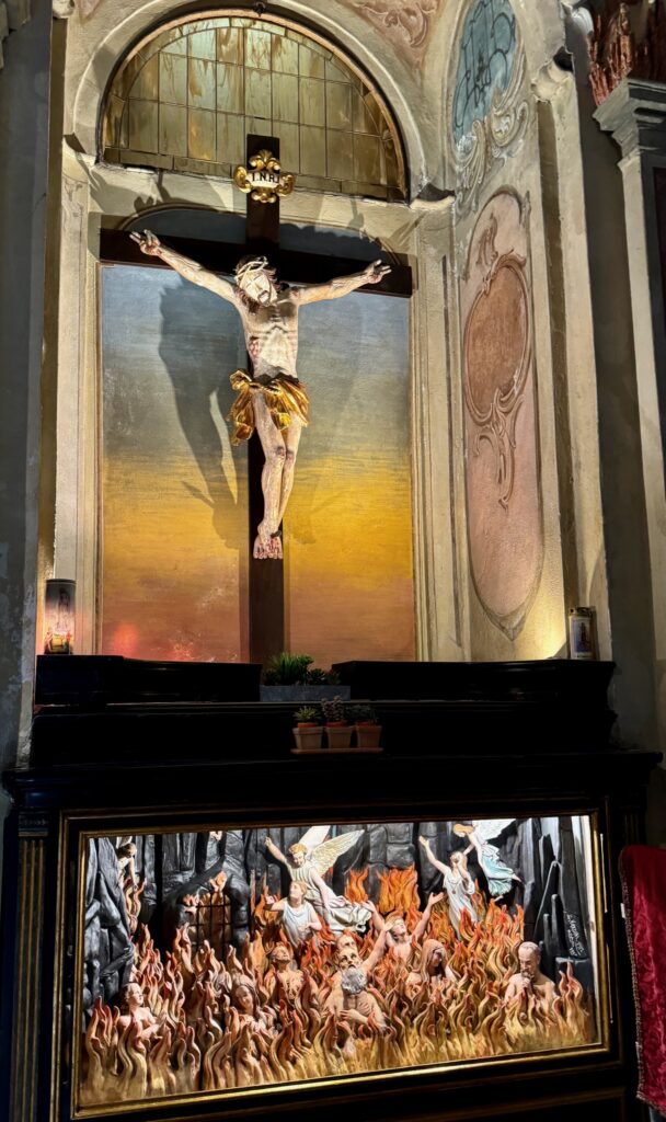
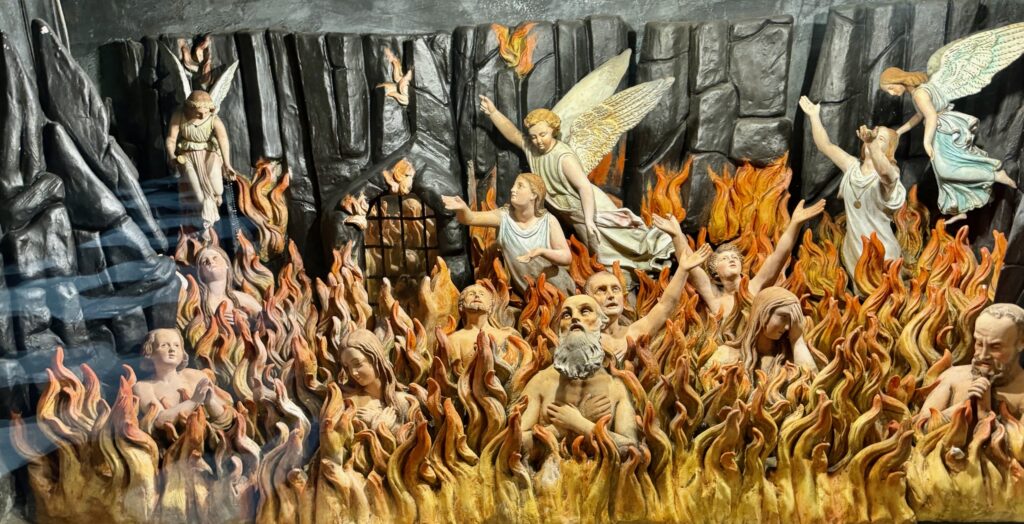
If you pop into St Mary-At-Hill church you will immediately encounter on your left this extraordinary representation of Resurrection on the Day of Judgment …
It’s a very unusual example of late 17th century English religious carving and most likely dates from the 1670s. Its carver is unknown, but it is known that the prominent City mason Joshua Marshall was responsible for the rebuilding of the church in 1670-74 and his workshop may have produced the relief. Exactly where it was originally positioned is uncertain; most likely it stood over the entrance to the parish burial ground and was brought inside in more recent times.
If you visit the little churchyard you will see evidence of another form of resurrection …
A plaque on the wall informs us that ‘the burial ground of the parish church of St. Mary-At-Hill has been closed by order of the respective vestries of the united parishes of St. Mary-At-Hill and Saint Andrew Hubbard with the consent of the rector and that no further interments are allowed therein – Dated this 21st day of June 1846’. Following closure, all human remains from the churchyard, vaults and crypts were removed and reburied in West Norwood cemetery. You can read more on the excellent London Inheritanceblog.
I spotted this splendid winged lion outside number 31 – placed their by the owners of the Salotti 31restaurant …
And there are some nice ghost signs …
Walking along Old Jewry last week I noticed this little courtyard …
Tucked away behind locked gates is what was once the City of London Police Headquarters (the Old Jewry address gave the force its former radio call sign of ‘OJ’). They originally moved there in 1842 but this building, in neo-Georgian style, was constructed between 1926 and 1930. The police moved out, to Wood Street, in 2001.
There are two alleys off Bishopsgate that are quite easy to miss but reward investigation. The first I explored was Swedeland Court (EC2M 4NR) …
I can’t find out why it’s called Swedeland Court (or why it’s a ‘court’ and not an ‘alley’). At the end is the interesting Boisdale Restaurant. It’s worth walking to the end and looking back towards the street as there are some charming old lamps and it’s very atmospheric …
Nearby is the rather uninviting looking Catherine Wheel Alley which will eventually lead you to Middlesex Street …
Looking back you get the true canyon effect …
The Catherine Wheel pub stood here for 300 years until it burned down in 1895. It’s said that the name was changed at one point to the Cat and Wheel in order to placate the Puritans who objected to its association with the 9th century saint. It’s also claimed that the highwayman Dick Turpin drank here, but if he drank in every pub that has since claimed a connection he would never have been sober enough to ride a horse.
When I worked near here in the 1970s it was always a pleasure to walk through this covered passage since the enclosed area was redolent with the aroma of spices, once stored here in the heyday of London Docks. It had the nickname ‘Spice Alley’ …
The pathway from Fenchurch Street (just beside the East India Arms EC3M 4BR) leads to Crutched Friars and by the time of Rocque’s map of 1746 it had acquired the name French Ordinary Court …
The lane itself dates from the 15th century and perhaps even earlier. It was further enclosed in the 19th century as Fenchurch Street railway station was constructed above, transforming it into a cavernous passage.
When you emerge, cross the road and look back …
The Court was named for the fact that, in the 17th century, Huguenots were allowed by the French Ambassador, who had his residence at number 42 next door, to sell coffee and pastries there. They also served fixed price meals and in those days such a meal was called an ‘ordinary’.
Star Alley (EC3M 4AJ) links Mark Lane with Fenchurch Street and you can also find it on Rocque’s map …
On the left is the tower of All Hallows Staining …
First mentioned in the late 12th century, ‘staining’ meant it was made of stone unlike other City churches which were made of wood. It was rebuilt in 1674 after collapsing four years earlier (possibly because of too many burials near the building). You can read more about it here in the London Inheritanceblog.
I found a few odd things here. These mysterious tiles, which look quite modern, have what I think are construction workers in the foreground and a tower crane in the background …
And this spooky little alien character …
There is one grave left in the graveyard …
Unfortunately I have not been able to find out more about the family.
As you look towards Fenchurch Street, you can see the date of the post-war building inscribed above the entrance …
Finally, there is also an edition of Spitalfields Life dealing with City Alleys – you can access it here. This is my favourite picture from it …
The church of St Mary Woolnoth has been lucky twice.
A masterpiece by Wren’s brilliant protégé Nicholas Hawksmoor, it was built between 1716 and 1727 in the English Baroque style. Amazingly, it was scheduled for demolition in 1898 in order to facilitate the construction of Bank Underground Station. A public outcry put a stop to that and a compromise was reached. The crypt was cleared and the extended area under the church became the Underground ticket office – the church authorities collected a whopping £170,000 in compensation.
It was lucky a second time around during the Second World War which it survived unscathed …
First recorded in 1191, it has an unusual name. The founder may have been a Saxon noble, Wulfnoth, or alternatively, the name may be connected with the wool trade. Certainly this was true of the nearby church of St Mary Woolchurch Haw, destroyed in the Great Fire of 1666 (its parish then united with that of St Mary Woolnoth).
The most celebrated priest associated with the church was John Newton (1725-1807)…
Born the son of a master mariner in Wapping, he spent the early part of his career as a slave trader. From 1745-1754 he worked on slave ships, serving as captain on three voyages. He was involved in every aspect of the slaver’s trade, and his log books record the torture of rebellious slaves. Following his conversion to devout Christianity in 1748 he eventually became rector here in 1780. In the church is his memorial tablet, which he wrote himself beginning …
John Newton, Clerk, once an infidel and libertine, a servant of slaves in Africa …
In 1785, he became a friend and counsellor to William Wilberforce and was very influential himself in the abolition of slavery. He lived just long enough to see the Abolition Act passed into law. Think of him also when you hear the hymn Amazing Grace, which he co-wrote with the poet William Cowper in 1773.
The outside of the church is very unusual and it has a fine position on the corner of King William Street and Lombard Street, just off the major Bank road junction (EC3V 9AN). The clock is mentioned in a famous poem which I shall refer to later …
The gate to the church bears the coat of arms of the Diocese of London …
These cherubs once used to gaze at me as, when I worked nearby, I went down the steps to the station on my way home …
The small, square, tranquil interior was regarded by Simon Jenkins as the ‘most remarkable in the City, the majesty it conjures from a limited space’ ..
At each corner are a group of three great Corinthian columns …
Monuments other than the one to Newton include this one to William Kentish …
The plaque, in the shape of the end of a chest tomb, incorporates a bright coat of arms with the motto ‘Survive and thrive’. William’s grandson was buried in Highgate Cemetery and the plaque describes where to find his resting place. Beneath is a note of the will of Thomas Kentish of St Albans (died 1712) which arranges for the education etc. of four boys, ideally named Kentish.
This panel was erected in memory of Thomas Lloyd, the man who started the famous coffee house, which eventually led to the Corporation of Lloyd’s …
The miniature coat of arms at the top is held by two tiny lions and, although it was placed here only in 1931, to me it does look appropriately 18th century.
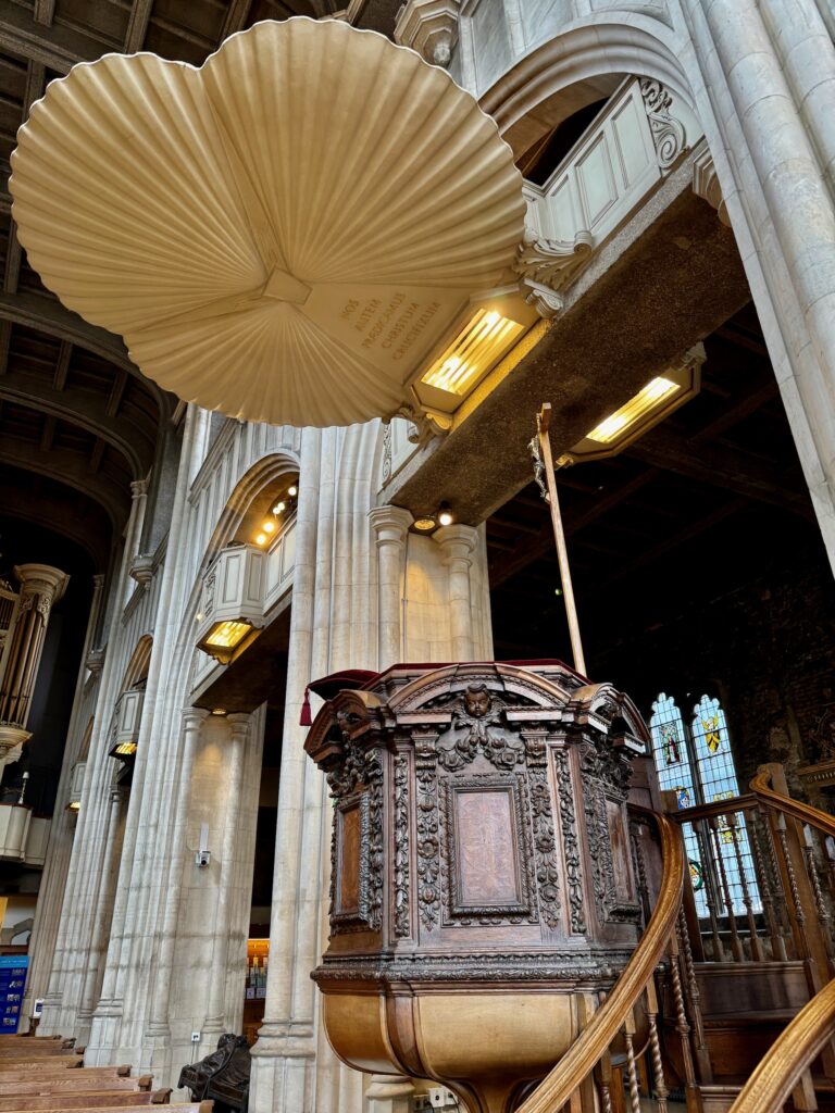
The stunning, bulging pulpit dates from Hawksmoor’s time and Newton delivered his sermons from it. It was made by Thomas Darby and Gervaise Smith …
The inlaid sunburst marquetry by Appleby is sublime …
In the corner sits this clock mechanism surrounded by a cover on which is etched an extract from T.S. Elliott’s poem The Wasteland …
Elliott worked nearby and, having watched the commuters trudge over London Bridge, wrote …
A crowd flowed over London Bridge, so many, I had not thought death had undone so many. Sighs, short and infrequent, were exhaled, And each man fixed his eyes before his feet. Flowed up the hill and down King William Street, To where Saint Mary Woolnoth kept the hours With a dead sound on the final stroke of nine.
No doubt if you were not at the office by the ‘final stroke of nine’ you were going to be late.
And finally, have you noticed these figures around the corner from the church in King William Street?
I used to think they were connected to the church but I was mistaken. They were, in fact, created in 1899 to enhance the entrance to the Underground Station. Bank was the terminus of the City and South London Railway – the first deep level ‘tube’ in London and, indeed, the world and the first to use electric locomotives.
Appropriately, the lady on the left represents electricity …
She wears a spiked crown, is surrounded by thunder clouds and shoots lightning bolts from her extended finger.
Mercury reclines on the right …
He represents Speed. He is wearing his winged hat and sandals and holding a caduceus. The architect was Sydney Smith who designed the Tate Gallery at Millbank and the sculptor Oliver Wheatley.
By the way, if you travel to the church by Underground, as you climb the stairs to the street take a moment to admire these fearsome dragons by Gerald Laing …
… and if you think the Tube is claustrophobic now, the original City & South London railway carriages had no windows because ‘there was nothing to see’. Here is a drawing from an 1890 edition of the Illustrated London News …
Just suppose you could go back in time and were approaching London from the north in Tudor times. If you were coming from modern day Lincoln or York, you would be following the old Roman Road, Ermine Street, which would lead you to Bishopsgate, one of the principal gates into the City. Stow’s 1598 Survey of London describes this area as part of the ‘suburbs without walls,’ and throughout the 16th century wealthy citizens were beginning to build properties for themselves in that vicinity. One of them was Sir Paul Pindar (1565?-1650), and when the Venetian Ambassador, Pietro Contarini, lodged with him in the early 17th century he described Bishopsgate Without as ‘… an airy and fashionable area … a little too much in the country‘.
It’s wonderful to know that you can today, in the 21st century, get some idea of the house’s scale and beauty since its facade is preserved and on display at the Victoria & Albert Museum …
Contarini’s chaplain described it as ‘a very commodious mansion which had heretofore served as the residence of several former ambassadors’.
Having unfortunately lent generously to Charles I, poor Pindar died leaving considerable debts and by 1660 the mansion had already been subdivided into smaller dwellings. It survived the Great Fire of 1666, but was soon given over to the London workhouse, with wards for ‘poor children’ and ‘vagabonds, beggars, pilferers, lewd, idle, and disorderly persons’. The street-level rooms on the front were used as a tavern, known as Sir Paul Pindar’s Head.
The house was demolished in 1890 to make room for the expansion of Liverpool Street Station, but we do have an idea as to what it looked like in 1812. There are more pictures and commentary on the Spitalfields Life blog which you can access here.
What would you see going on elsewhere in this area north of the City walls? We are extremely fortunate to have this map that gives us some idea …
This is one of the earliest maps we have of London and you can take an imaginary walk thanks to its fascinating detail. Approaching from Shoredich in the north, the already dissolved hospital of St Mary Spital would be on your left. On your right is the lunatic hospital of Bedlam before its destruction in the 1666 Great Fire. As you approached the Bishop’s Gate itself, the illustration appears to show some spikes exhibiting the gruesome remains of traitors who had been hanged, drawn and quartered. Moor Gate to the left seems to have a similar display and leads directly on to Moor Field, an area drained and ‘laid out in pleasant walks’ in 1527. There is a lot going on there.
Washing is being laid out to dry, goods are being carried to market, a lady carries a pot on her head, archery is being practised, people have stopped to chat and there is a rather elegant Dogge Hous. See if you can find the man with the horse and cart driving what looks like a sow and piglets in front of him.
To the right you can see that the wealthy and the religious orders have enclosed their land within private walls, windmills can be seen on hilly ground.
Now take a look at this map …
At a quick glance it looks the same but there are differences and this map is nowhere near as detailed. For example, fewer figures are shown in the fields and they are not so well drawn (the Dogge Hous is still there though!). Known as Civitas Londinum, it was first printed from woodblocks in about 1561 and obviously drew on the Copperplate map for much of its information. Widely, but erroneously, attributed to the surveyor Ralph Agas, no early copies survive and the small section above is from a modified version printed in 1633.
One of the things that fascinated me was how many of the streets exist to this day and have the same name. Here is another section of the map …
With some serious concentration I found Old Street, Chiswell Street, Beech Street, Cheapside, Aldersgate, Whitecross Street, Aldermanbury, Milk Street and a few others – all pretty much located exactly where they are today.
If you want to study an enlarged version of the map in more detail, pop into the Guildhall Art Gallery. Here it is displayed in all its glory …
The architect Simon Foxell, in his outstanding book Mapping London – Making Sense of the City, (ISBN 13: 9781906155070) states …
Civitas Londinum is the essential view into the teeming streets of Tudor London. It shows us the interrelationship between churches and streets and houses and how, outside the walls, London rapidly transforms into fields and villages. It shows the windmills that must have dominated the horizon and the regular lime kilns that must have filled the sky with smoke. A recognisable view into a past beyond living memory.
The Great Fire of 1666 devastated the City and, luckily for us, the etcher Wenceslaus Hollar was there to produce this ‘groundplot’ of the damage. His drawing of 1666 is a bird’s eye view of the City and gives us some perspective as to the vast extent of the catastrophe. The non-shaded area shows the extent of the destruction …
What else can we see today that pre-dates the Fire apart from the street names?
St Paul’s Cathedral was lost in the inferno but there was a remarkable survivor …
The effigy of John Donne, 17th century poet and Dean of the Cathedral, survived the Fire but you can still make out the scorch marks on the urn (you have to go into the Cathedral to see it). I have written about Donne in an earlier blog which you can access here.
And finally, there is the oldest house in the City …
Built in 1615, it survived the Great Fire due to its being enclosed and protected by the priory walls of St Bartholomew. Incidentally, you’ll notice the building has no window sills. The post-Fire Building Acts required window sills at least four inches deep or more to be installed in homes in order to reduce the risk of fire spreading upwards. I have written about this and other City dwellings in an earlier blog City Living.
I hope you enjoyed this trip back in time. I love old maps, so will probably be exploring the history of the City in a similar way in the future.
I have been back prowling around the alleys and courtyards just off Cornhill and again experiencing the atmosphere and surprises to be found here. Take, for example, Corbet Court (EC4V 0AT). The entrance doesn’t look very promising …
But once you have entered look around and you will come face to face with this lovely serene lady who has gazed out at London and Londoners since 1669 …
Regular readers will recognise her as a Mercer Maiden, the symbol and coat of arms of the Mercer Company. She first appeared on a seal in 1425 but her precise origins are unknown, and there is no written evidence as to why she was chosen as the Company’s emblem. She can be found all over London marking Mercer property and I have written about her in an earlier blog which can be found here.
Nearby is St Peter’s Alley (EC3V 3PD) with its atmospheric entrance on Cornhill …
Here stands the church of St Peter’s, Cornhill which is now used as a Christian Aid study centre and is currently not open to the public. The Saint stands atop the entrance gate holding the keys to the Kingdom of Heaven …
The church tower with some of its more recent neighbours such as the Cheesegrater …
A few memorial stones are beginning to wear away …
The churchyard was in use as the main place of burial for the parish until 1850 and following closure it was laid out as a garden for public use that you see now.
If you retrace your footsteps to Corbet Court, you can then walk down St Michael’s Alley (EC4V 9DS) which winds its way to back to Cornhill …
Your eye is immediately drawn to the gigantic lamp advertising the Jamaica Wine House, a Victorian stone fronted building which now stands on the site of the City’s first coffee house …
A plaque commemorates the coffee house and I wrote about this last week …
Pasqua Rosée (Easter Rose) the proprietor was the servant of a Levant merchant named Daniel Edwards, a trader in Turkish goods, who imported the coffee and assisted Rosée in setting up the establishment.
Look out for the entrance to Castle Court …
You’ll see the back of the George & Vulture … …
… and this splendid narrow alleyway.
Squeeze through and enjoy the feeling that you are back in the 17th century …
It was common at the turn of the 20th century for offices to have mirrors installed and hung outside to reflect light. I have come across this picture which is captioned Bengal Court 1910 …
Make your way back to the front entrance of the George & Vulture …
You will find a fascinating history of this great pub here.
Of course, I couldn’t resist taking a picture of these old tiles …
Simpson’s Tavern in Ball Court retains its character …
As does the Ball court entrance …
And finally, as I walked back down this alley towards Cheapside, I came across this old bank entrance …
… and, around the corner, these extra large iron-framed windows designed to catch the maximum amount of light for the benefit of the clerks beavering away inside …
I am taking a break from alleys and courtyards now!
One evening in April 1718 a comedian named Bowen (described as a ‘hotheaded Irishman’) was drinking copiously in the Pope’s Head Tavern. Having worked himself into a ‘transport of envy and rage’ he sent for an actor, a comedian and competitor called Quin. As soon as Quin entered, Bowen planted his back against the door, drew his sword, and bade Quin draw his. Quin remonstrated in vain and at last drew in his own defence, trying to disarm his antagonist. Bowen eventually received a mortal wound, of which he died in three days, ‘confessing at last his folly and madness’. Quin was tried, and honourably acquitted. This story, from British History Online*, sent me searching for the scene of the affray – logic telling me that it must be in Pope’s Head Alley (EC3V 9AY).
Sadly the Tavern no longer exists and the alley has been shifted a little to the east from its original location.
It looks a bit sterile from its Cornhill entrance (it leads to Lombard Street) and I wasn’t going to bother to walk down it …
I am glad I did though, because first of all, looking up, I noticed this line of bees and bee hives …
Here is a close-up of one of them …
And then came across the Pope himself …
The bee symbol was traditionally associated with the Barberini family and, in particular, the 17th century Pope Urban VIII Barberini. I honestly don’t know if this is the reason for the bees but that’s my hypothesis.
Below the Pope’s head there is metal fence incorporating the galloping Lloyd’s Bank horse …
So the moral of this tale is – don’t judge an alley by its entrance.
I went on enthusiastically to explore more. I know it’s a cliche, but the phrase ‘stepping back in time’ really does come to mind with some of them.
For example, here is a picture I took of Ball Court and a side entrance to Simpsons’s Tavern …
The Tavern’s full address is Ball Court, 38 1/2 Cornhill (EC3V 9DR). It still looks authentically 18th century …
On Cornhill you will find the entrance to Sun Court (EC3V 3NB) …
At the end of the alley the scene opens out considerably …
You are looking at the rear of the Merchant Taylors’ Hall with its lovely curved glass windows. There is a nicely carved rendition of the Merchant Taylors’ coat of arms …
Here is the full colour version …
The motto is a quotation from Gaius Sallustius Crispus: ‘Concordia parvae res crescunt, discordia maxumae dilabuntur‘ : with harmony small things grow, while with discord the mightiest are ruined.
Further along Cornhill another nice surprise awaits you in White Lion Court (EC4V 3NP) …
Once inside you find yourself facing this stunning four-storey house, said to date from 1767 …
Probably originally the home of a wealthy merchant, it was once the offices of Lloyd’s Register of Shipping.
On the wall is another emblem of the Merchant Taylors’ crest …
And a nice example of the Parish Boundary mark for St Peter Cornhill …
I hope you have enjoyed this short tour through some of the City’s courts and alleys. There are many more to visit and I shall cover them in a future blog.
*Incidentally, there are a number of versions of the fight between Quin and Bowen and not all of them coincide with the British History Online account. The fullest I have found appears in the book The Life of Mr James Quin, Comedian, from his commencing Actor to his retreat to Bath. It was published in London in 1766, includes an account of Quin’s trial, and can be found online here.
My subjects are often inspired by what other bloggers have published and one of my blogging heroes is the author of the blog A London Inheritance. The author inherited a photographic archive from his father showing London scenes before, during and after the war. In the blog he follows up what those locations look like now along with beautifully illustrated stories of London’s history.
Recently he wrote about this Report published on behalf of the Corporation of London in 1951. It deals in detail with plans conceived by consultants in 1947 for the reconstruction of the City …
I have taken some extracts from it that I found particularly fascinating but if you want to read the entire blog (and I recommend it highly) here is a link.
The first illustration that interested me was this Inventory of Accommodation within the City. The present day Barbican Estate falls firmly into section 9 …
The report then goes on to illustrate in this table the total floor space in 1939 along with the percentage destroyed during the War …
As you can see, the map highlights the considerable amount of damage caused by the early raids of 1940 / 41 when incendiaries caused significant fire damage in the areas around and to the north of St. Paul’s Cathedral as shown by the high percentage figures for blocks 2,7 and 9.
New roads and high and low level separation of pedestrians and vehicles was seen as the way forward for the City. The Barbican Highwalk is a present day example of what the new ‘pedways’ above the traffic might have looked like and there is an interesting article on the subject here.
The following drawing shows the proposed high level road in Lower Thames Street with the ground level occupied by a service road and a pedestrian area …
This drawing is of the proposed low level concourse at London Bridgehead, just to the west of the Monument …
This is a clever piece of anticipation if you just swop the Sherry, Port and Madeira bar for a Wine bar and the Tea Rooms for a Cafe Nero. And nowadays men seem to be wearing hats again.
The following impression, also of the proposed London Bridgehead, is again (apart from the clothes) rather modern …
The report notes that the City is ‘chronically short of places to eat’ so no doubt the authors would be pleased to see how that situation has drastically improved.
The high level separation of traffic can be seen here as part of the large circulatory road system on the northern end of London Bridge …
To the right is a glass sided entrance to the Monument Underground Station with the London Transport roundel on the side. This would have replaced the entrance on Fish Street Hill which today is an entrance directly on the ground floor of an office building rather than this rather nice, glass sided descent by escalator. I have to keep reminding myself that these ideas were being put forward over 70 years ago.
I really had to do a double-take when I saw this drawing entitled ‘An impression of a possible treatment of the proposed new approach to St. Paul’s from the river.’
And now we have a similar view after we cross the Millennium Bridge (however we are unlikely to spot a man in a top hat).
Just to show that not all the recommendations were attractive, a picture entitled ‘An impression of the suggested Cheapside Underpass, a proposal which has been postponed on grounds of cost.’
I think we had a lucky escape there.
And finally, a reminder of the utter destruction the War brought to some parts of the City. A photograph taken by the blogger’s father showing a very large pile of rubble following the demolition of bombed buildings in Aldersgate …
I hope you enjoyed today’s blog – apologies to those of you who already subscribe to the London Inheritance blog and have therefore seen these images before. If you don’t subscribe and are interested in London’s history I can’t recommend it more highly.
This website uses cookies so that we can provide you with the best user experience possible. Cookie information is stored in your browser and performs functions such as recognising you when you return to our website and helping our team to understand which sections of the website you find most interesting and useful.
Strictly Necessary Cookies
Strictly Necessary Cookie should be enabled at all times so that we can save your preferences for cookie settings.
If you disable this cookie, we will not be able to save your preferences. This means that every time you visit this website you will need to enable or disable cookies again.