Symbols & Secrets

Walking the City of London

Horses and Ale – the end of two eras

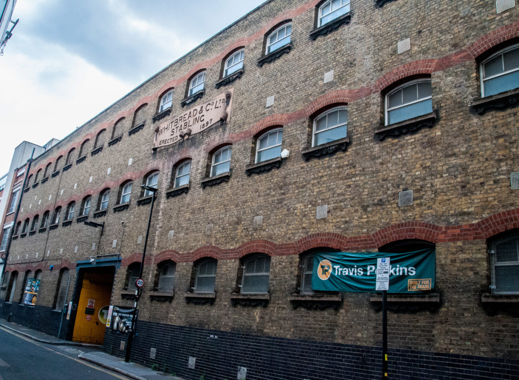
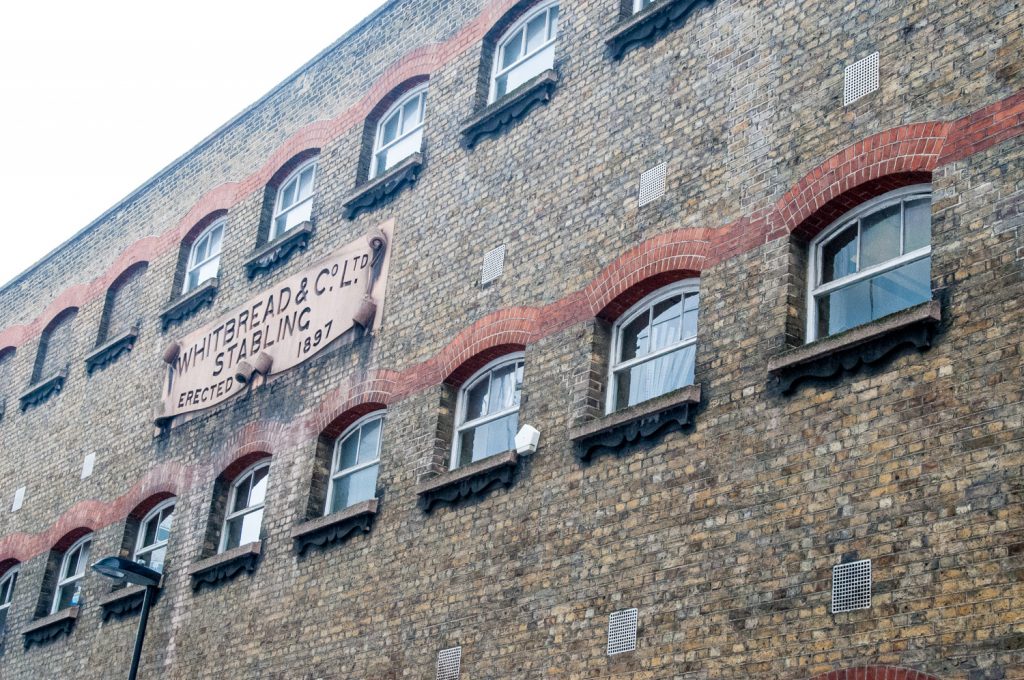
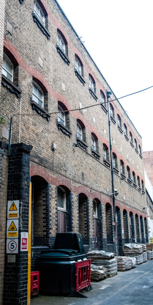
Take a stroll down Garrett Street (EC1Y 0TY) and you’ll soon be walking past a building that still survives to remind us of the end of two great eras – the age of horse-drawn transport and the once-thriving brewing industry in London. These were the stables custom-built for the dray horses that pulled the Whitbread Brewery wagons. When the brewery’s stables in Chiswell Street became full, Garrett Street was built to take the overflow – 13 horses on the ground floor, 36 on the first floor and over 50 on the top. The building had to be well constructed – a shire horse can weigh up to a ton.

When the horse numbers diminished, part of the third floor was turned into a firing range for the gun club and the windows bricked up

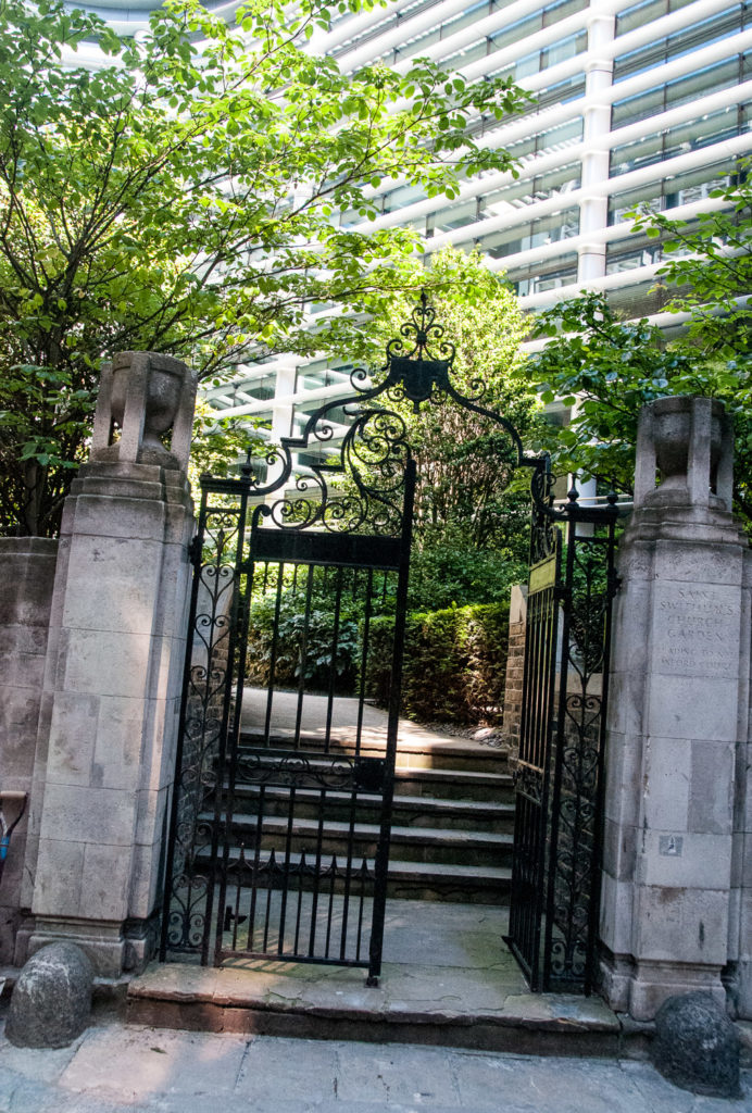
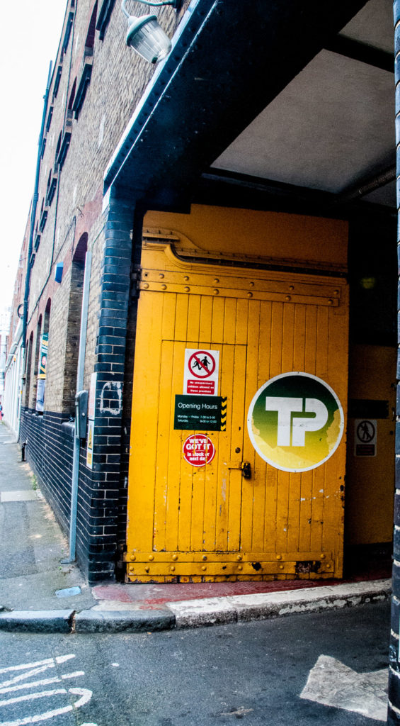
I think these are the original gates, now painted a rather dramatic yellow …

At the rear you can see the individual stables on the ground floor …

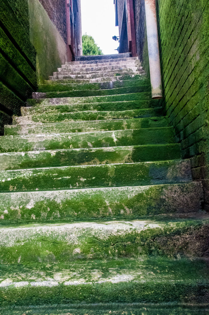
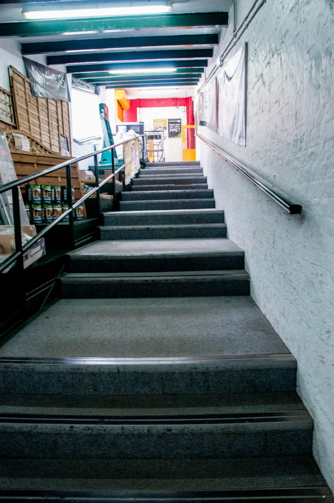
The internal stairs reflect the gentle slope underneath that made it easy for the horses to be led to the upper floors …

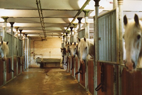
The first floor stables in 1991 …

Copyright John Sparks

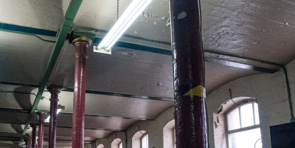
Some of the original features are still visible today …

In 1897, when the Garrett Street stables were built, there were over 50,000 horses transporting people around the city every day – several thousand horse buses (which needed 12 horses per day) and 11,000 Hansom cabs. In addition there were thousands of horse drawn carts and drays, like Whitbread’s, delivering goods around what was then the largest city in the world.

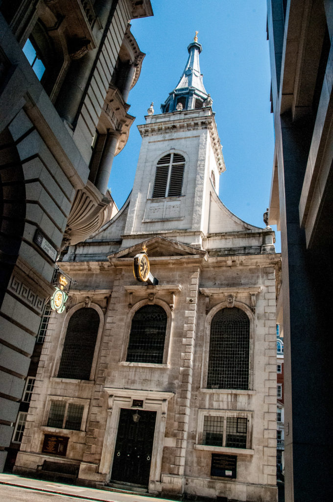
In this 19th century image you are looking east down Cheapside with the statue of Sir Robert Peel in the foreground (along with one of his uniformed ‘Bobbies’) …

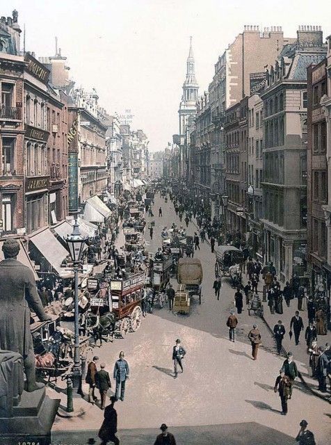
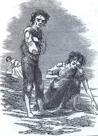
The presence of so many horses in the already congested city had major implications for the health of the population. On average each horse would produce between 15 and 35 pounds of manure every day plus several pints of urine and this attracted huge numbers of disease-carrying flies. Also, working horses only had a working life of about three years and many collapsed and died in the street. These carcasses had to be disposed of but often the bodies were left to putrefy so the corpses could be more easily sawn into pieces for removal.

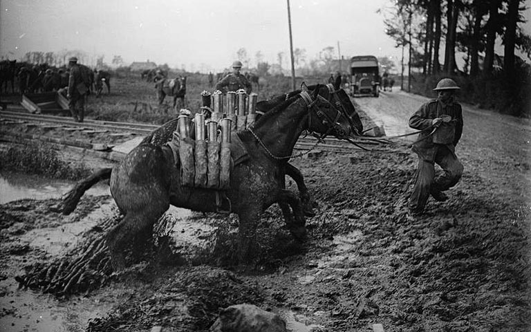
Some working animals led terrible, short, brutal lives, but clearly the Whitbread horses were far better cared for. We should spare a thought, though, for the 118 of their best horses that were commissioned by the Government for service in the battlefields of the First World War – none ever returned.

First World War horses carrying ammunition

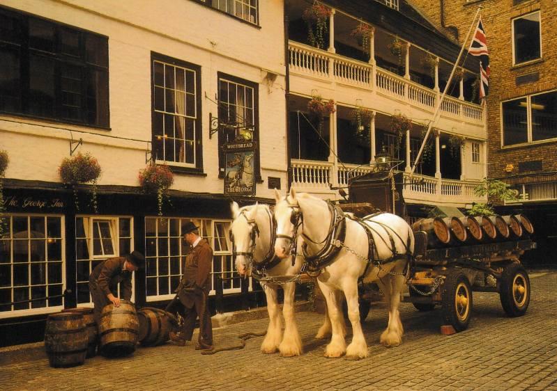
In happier times, Whitbread Shires were delivering ale well into the 20th century …

A delivery to the George Inn, Southwark

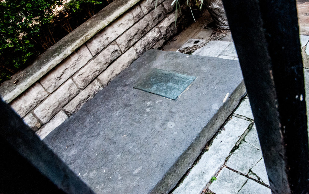
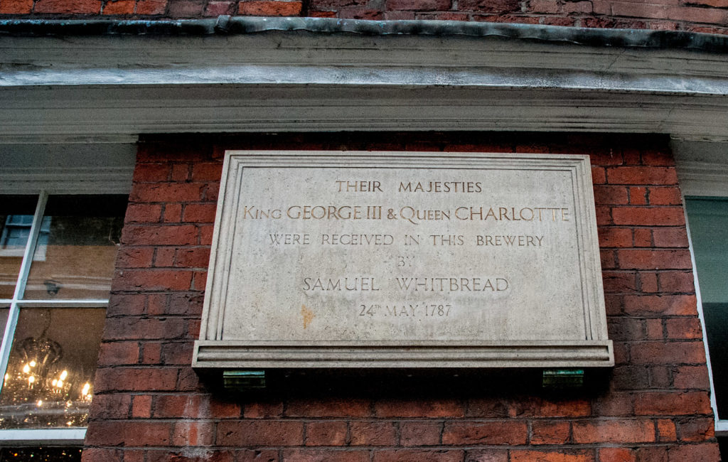
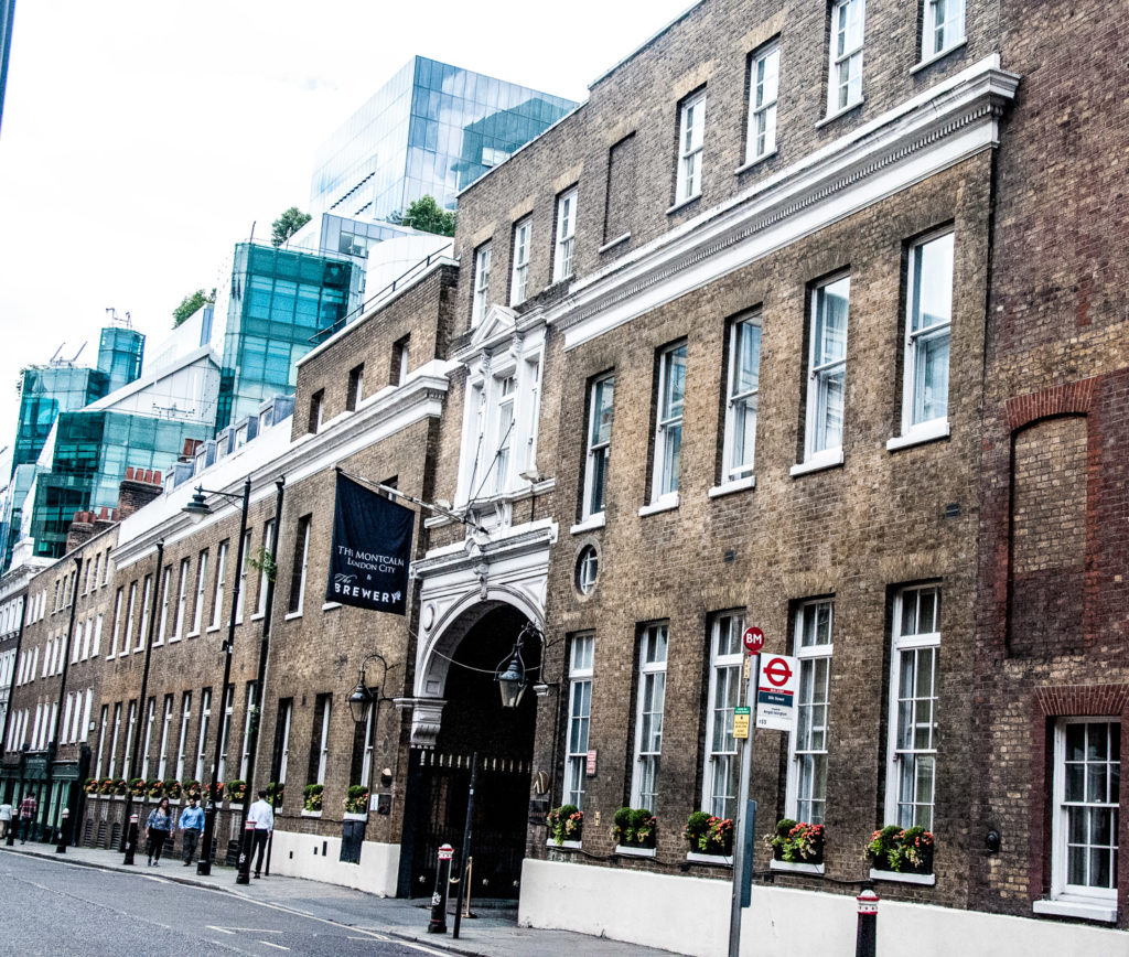
The brewing business was formed in 1742 when Samuel Whitbread formed a partnership with Godfrey and Thomas Shewell and acquired a small brewery at the junction of Old Street and Upper Whitecross Street and another brewhouse for pale and amber beers in Brick Lane. The entire operation was moved to Chiswell Street in 1750 and was spectacular enough to attract a visit from King George III and Queen Charlotte which this plaque commemorates …

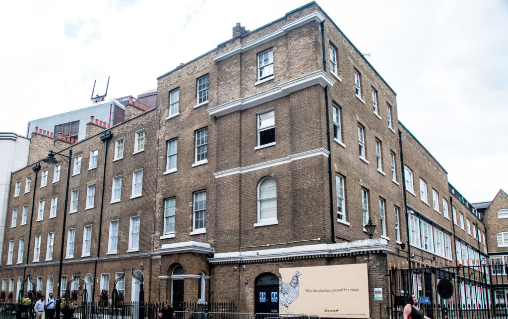
The size of the premises is still impressive today, although the building is now a hotel (EC1A 4SA) …

Viewed from the west
Viewed from the east

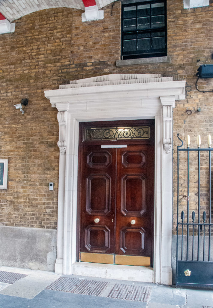
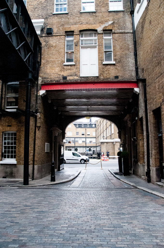
As you walk through the arched entrance you see an impressive mahogany door on the right …

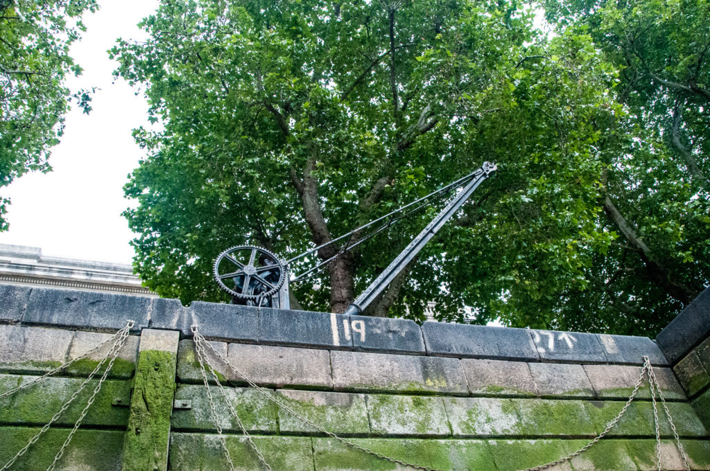
Then you enter the main yard itself with its overhanging gantries …

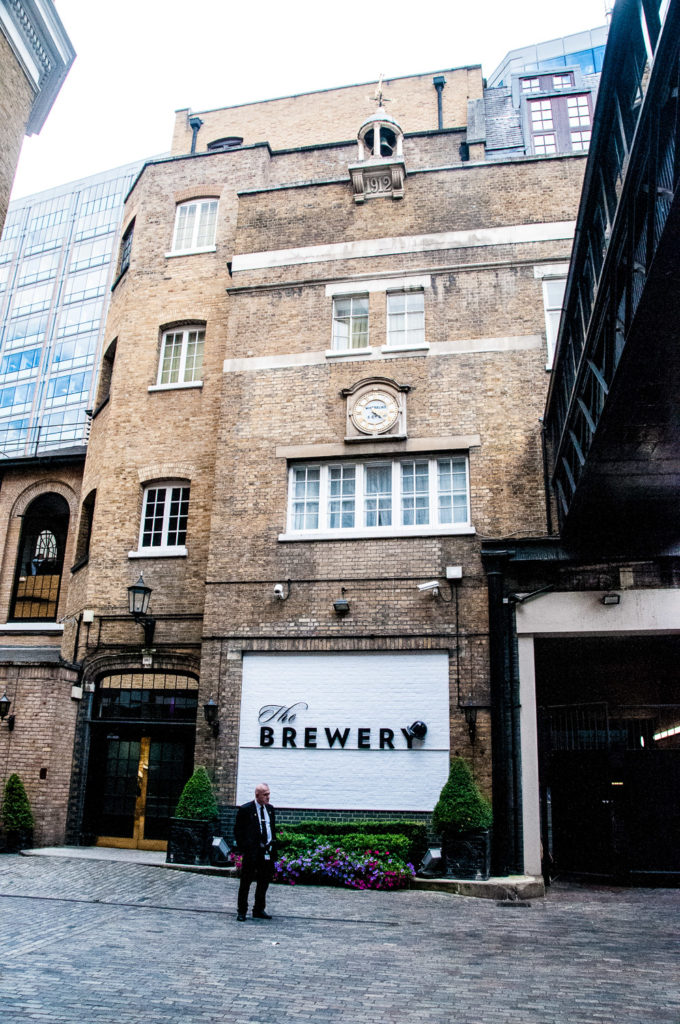
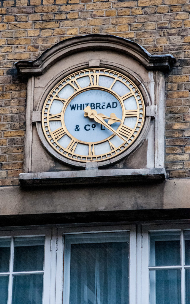
The old clock is still there …

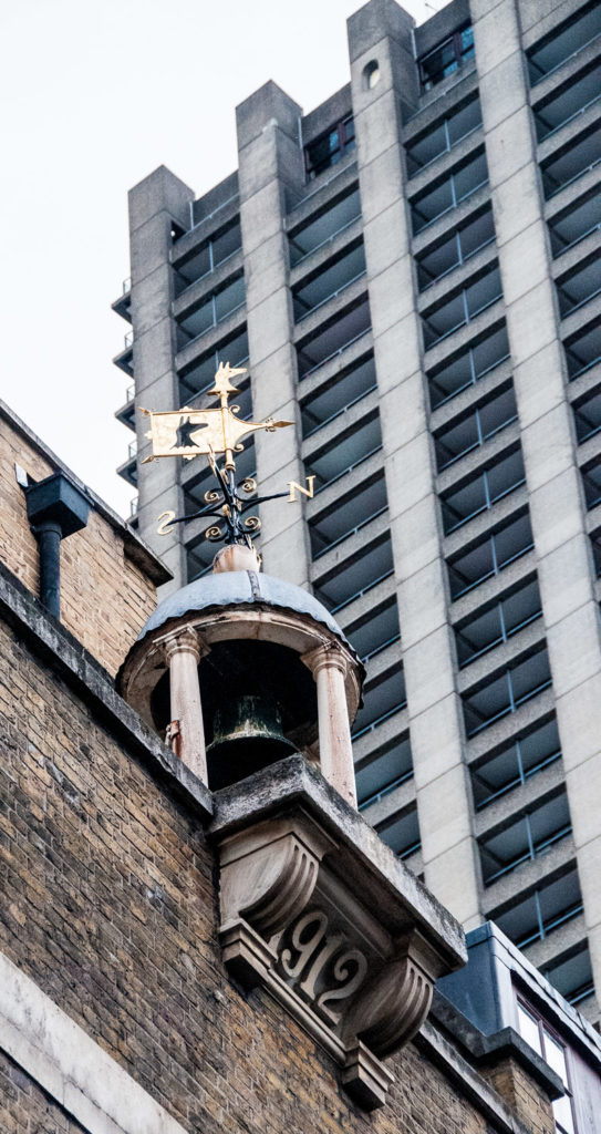
And there is a weathervane incorporating the old Whitbread hind’s head logo over the 1912 extension, now dwarfed by the Barbican’s Cromwell Tower …

The yard is still cobbled …

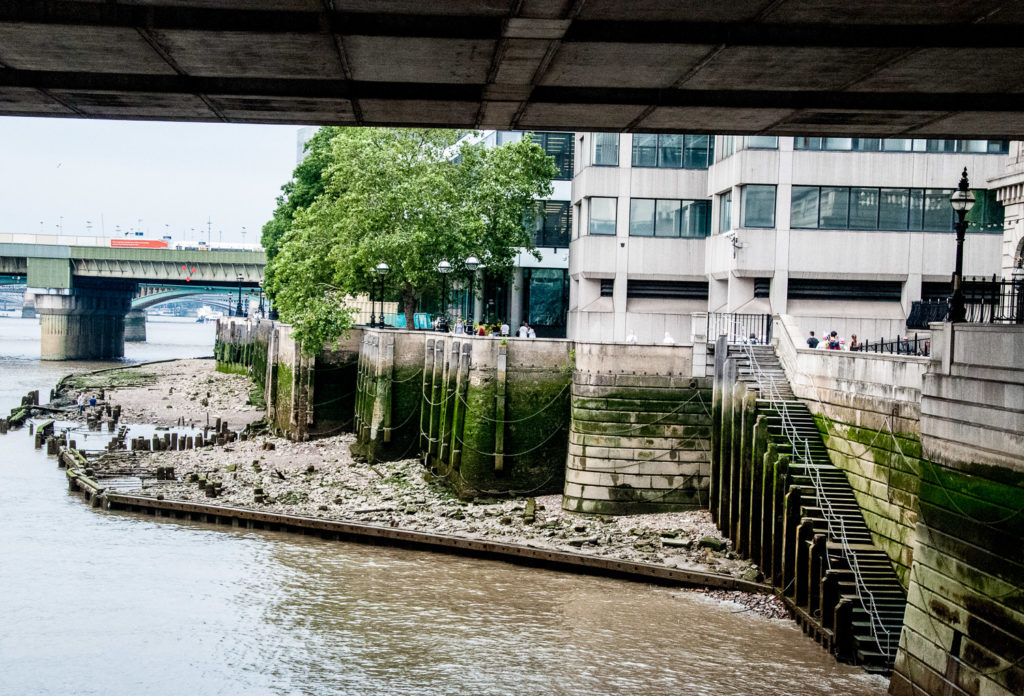
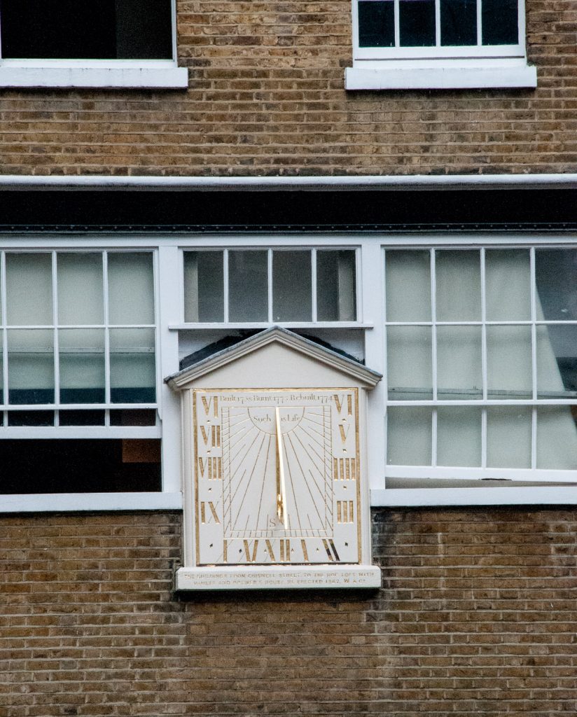
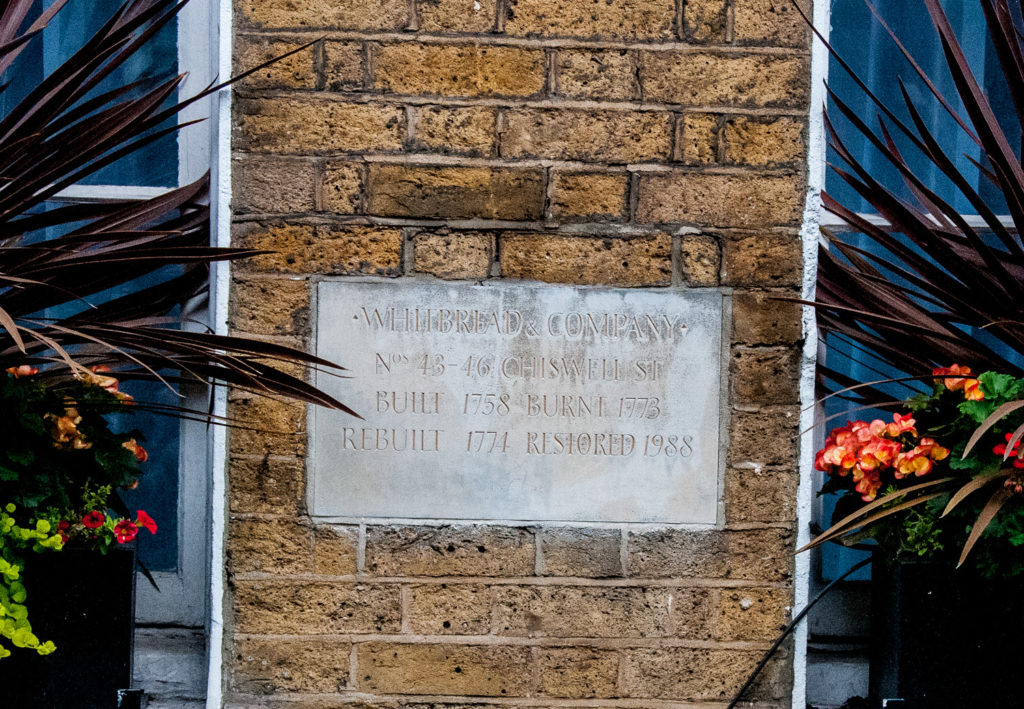
Just visible across the road is the appropriately named Sundial Court. Also once part of the Brewery site, the sundial itself is now behind locked security gates but is still visible from the road. It is made of wood, with its motto ‘Such is Life’, dating back to 1771. Around the sides it has the interesting inscription Built 1758, burnt 1773, rebuilt 1774. I have written about it and other City sundials in an earlier blog, We are but shadows.

Adjacent to Sundial Court are the houses used by the Brewery partners …

A plaque on the wall also references the fire of 1773 …

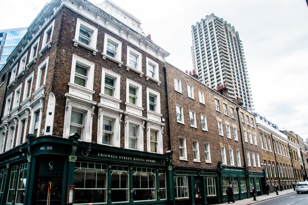
Brewing at Chiswell Street stopped in 1976 and Whitbread stopped brewing beer altogether in 2001, selling all its operations to the Belgian group Interbrew.

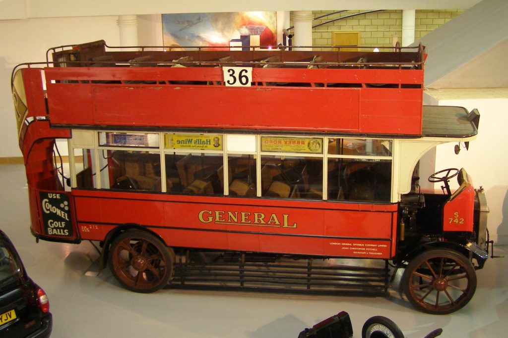
A mere ten years after the stables were built, horse traffic was rapidly vanishing from the streets of London to be replaced by motorised vehicles such as this …

A preserved London General Omnibus at the London Transport Museum Covent Garden

The last horses left the Garrett Street stables on Monday 16th September 1991, heading for their new home on the Whitbread hop farm in Paddock Wood, Kent.

If you want to know more about the fascinating history of the Whitbread Shire horses and their stables there is no better place to look than the website run by John Sparks : http://whitbreadshires.moonfruit.com/#

By the way, whilst doing my research I came across an interesting example of the danger of forecasting. In 1894 The Times newspaper predicted …

In 50 years, every street in London will be buried under nine feet of manure.

I now always think of this when reading forecasts in today’s press and there was an interesting article on this very subject in the Financial Times which you can read here.

Five tiny City churchyards (and a chatty lady)

Did you realise that, just off Cannon Street, is the final resting place of Catrin Glyndwr, daughter of Welsh hero Owain Glyndwr? She was captured in 1409 and taken with her children and mother to the Tower of London during her father’s failed fight for the freedom of Wales. A memorial to her, and the suffering of all women and children in war, was erected in the former churchyard of St Swithen where she was buried. It survives as a raised public garden and here is the pretty entrance gate on Oxford Court (EC4N 8AL) …

And this is the memorial …

Unveiled in 2001, it was designed by Nic Stradlyn-John and sculpted by Richard Renshaw

With its inscription …

The garden is a cosy, secluded space with seating where you can enjoy a break from the City hustle and bustle …

The Church itself was demolished as a result of World War II bombing.

St Clement’s Eastcheap isn’t on Eastcheap, for reasons I will go into in a future blog. It’s in the appropriately named St Clement’s Lane (EC4N 7AE). As you look down the Lane from King William Street it’s tucked away on the right …

Just past the church is St Clement’s Court, the narrow alley leading to the churchyard. There is an intriguing plaque on the wall of the adjacent building …

Obradović was a Serbian writer, philosopher, dramatist, librettist, translator, linguist, traveler, polyglot and as the plaque says, the first minister of education of Serbia. Here is a link to his Wikipedia entry. He was honoured in 2007 by a special Serbian stamp …

You enter the churchyard via three steps. City churchyards are frequently higher than street level, evidence of how may bodies were crammed in until graveyards were closed to new burials in the middle of the 19th century …

The churchyard was reduced in size in the 19th century by an extension that was added to the church and all that remains now are a couple of gravestones and two chest tombs …

The inscription on one is just about legible, it reads …

In memory of Mr JOHN POYNDER late of this Parish who departed this life on 11th April 1800 aged 48 years. Also four of his children who died in their infancy.

The narrow alleyway can be traced back to 1520 and St Clement’s Lane is also an old thoroughfare. Here it is on Roques map of 1746 leading then, as it does now, to Lombard Street directly opposite the Church of St Edmund King and Martyr …

The alley was then called Church Court

Here’s another view from King William Street, you can see St Edmund’s in the distance …

The church dates from 1674 having been rebuilt by Wren after the Great Fire (although the design was probably by his able assistant Robert Hooke). In 2001 it became the London Centre for Spirituality …

It was a lovely, warm sunny day and, looking at the church architecture, for a moment I had the overwhelming feeling that I was in Italy!

To find the churchyard, now a private garden, head down George Yard adjacent to the church (EC4V 9EA). It closed for burials in 1853 …

One tomb is visible from the street …

It has a fascinating inscription …

Sir HENRY TULSE was a benefactor of the Church of St Dionis Backchurch (formerly adjoining). He was also Grocer, Alderman & Lord Mayor of the City. In his memory this tombstone was restored in 1937 by THE ANCIENT SOCIETY OF COLLEGE YOUTHS during the 300th year of the Society’s foundation. He was also Master of the Society during his Mayoralty 1684.

St Dionis Backchurch was demolished in 1878 and the proceeds of the land sale used to resurrect it as a new church of the same name in Parsons Green. The Ancient Society of College Youths is the premier change ringing society in the City of London, with a national and international membership that promotes excellence in ringing around the world. Sir Henry owned significant estates in South London – you’ll be remembering him as your train trundles through Tulse Hill Station.

St Gabriel Fenchurch was destroyed in the Great Fire and not rebuilt but its churchyard remains – now called Fen Court (EC3M 6BA) it’s just off Fenchurch Street. If you are feeling stressed, or just need to take time out, you can use the labyrinth there to walk, meditate and practise mindfulness. It was the idea of The London Centre for Spiritual Direction and you can read more about it here.

The Fen Court labyrinth

Three chest tombs are evidence of it’s earlier burial ground function …

This vault was built in the year 1762 by MRS ANNE COTTESWORTH for a burying place for Herself she being born in this Parish And her nearest relations being buryed in the next Vault

Her family coat of arms is quite sheltered and has survived City pollution well

Also there is the striking Gilt of Cain monument, unveiled by Archbishop Desmond Tutu in 2008, which commemorates the abolition of the transatlantic slave trade in 1807. Fen Court is now in the Parish of St Edmund the King and St Mary Woolnoth, Lombard St, the latter having a strong historical connection with the abolitionist movement of the 18th and 19th centuries. The Rev John Newton, a slave-trader turned preacher and abolitionist, was rector of St Mary Woolnoth from 1780 to 1807 and I have written about him in an earlier blog St Mary Woolnoth – a lucky survivor.

The granite sculpture is composed of a group of columns surrounding a podium. The podium calls to mind an ecclesiastical pulpit or slave auctioneer’s stance, whilst the columns evoke stems of sugar cane and are positioned to suggest an anonymous crowd. This could be a congregation gathered to listen to a speaker or slaves waiting to be auctioned.

The artwork is the result of a collaboration between sculptor Michael Visocchi and poet Lemn Sissay. Extracts from Lemn Sissay’s poem, Gilt of Cain, are engraved into the granite. The poem skilfully weaves the coded language of the City’s stock exchange trading floor with biblical Old Testament references.

And finally here is another meditation labyrinth …

It’s in one of my favourite places, St Olave Hart Street churchyard in Seething Lane (EC3R 7NB) …

You walk in through the gateway topped with gruesome skulls, two of which are impaled on spikes …

Charles Dickens nicknamed it ‘St Ghastly Grim’

It leads to the secluded, tranquil garden …

The labyrinth is in the corner on the left

This was Samuel Pepys’s local church. He is a hero of mine and I have devoted an earlier blog to him and this church : Samuel Pepys and his ‘own church‘.

In 1655 when he was 22 he had married Elizabeth Michel shortly before her fifteenth birthday. Although he had many affairs (scrupulously recorded in his coded diary) he was left distraught by her death from typhoid fever at the age of 29 in November 1669.

Do go into the church and find the lovely marble monument Pepys commissioned in her memory. High up on the North wall, she gazes directly at Pepys’ memorial portrait bust, their eyes meeting eternally across the nave where they are both buried. When he died in 1703, despite other long-term relationships, his express wish was to be buried next to her.

Take a close look at her sculpture – I am sure it is intended to look like she is animatedly in the middle of a conversation …

As you leave the church, notice how much higher the churchyard ground level is …

It’s a reminder that it is still bloated with the bodies of plague victims, and gardeners still turn up bone fragments. Three hundred and sixty five were buried there including Mary Ramsay, who was widely blamed for bringing the disease to London. We know the number because their names were marked with a ‘p’ in the parish register.

Sorry not to end on a more cheerful note! I have written before about City churchyards and you can find the blog here.

Down by the River – wharves, beaches and desperate immigrants

Once upon a time, access by foot to the River Thames was absolutely essential since it was London’s main highway. These ‘Watermen’s Stairs’ were also of great benefit if you were unfortunate enough to fall into the river. A Waterman would usually be nearby plying for hire and might be inclined to rescue you (and the stairs were often adjacent to a public house, where such accidents could be more likely to happen!).

Although wharves and later rudimentary docks began to be used to offload goods, most ships simply moored in lines in the middle of the river and their cargo was rowed to shore and carried up shoreline stairs.

John Rocque’s London Map of 1756 showed literally dozens of such access points and last Sunday I decided to go in search of what was left of them, starting at the east side of the Millennium Bridge. These are the steps leading to the foreshore …

This is the exact spot where the ancient Trig Lane access to the River was located and back in the 1970s redevelopment work revealed a 14th century wharf. Here is a picture of some of the site taken in 1974, now totally covered by riverside office development …

Read more on Adrian Procter’s blog

There was some amateur excavation taking place when I visited …

Looking all around you see lots of pieces of pottery, tiles and bricks along with lumps of chalk …

Large chalk beds were once laid down to provide a soft settling place for barges at low tide.

It’s rather a strange feeling standing on the river bed and gazing along the foreshore …

As I walked east I looked back and spotted a sandy beach. You can see the Trig Steps in the distance …

My next stop was the Cousin Lane steps next to Cannon Street railway station …

As is common along the River, you can see the remains of old wharves …

And a barge resting nearby …

I got a distinct feeling that I was trespassing.

These steps at London Bridge are no longer open to the public. Again the remains of old wharves are visible at low tide …

Further along the Thames Walk a capstan reminds us of the days when this part of the river was a major commercial shipping hub …

Looking over the riverside wall, lots more lumps of chalk are clearly visible …

Next on my list was Custom House Stairs – here is how they appear in Roque’s Map of 1746 …

And here they are today …

I encountered lots of oyster shells on my walk, once a very cheap source of food for Londoners …

An old winch still decorates the pedestrian walkway …

As I walked past the Tower I was reminded of pictures I had seen of the beach there that was opened up in July 1934 for the use of people who couldn’t afford to go to the seaside. Apparently 1,500 bargeloads of sand were used to create it …

It was finally closed in 1971 due to river pollution. There is a nice blog about it here.

My final set of stairs were located just past St Katharine Dock along St Katharine’s Way. The entrance is easy to miss since the signage is quite high up …

Here I hesitated …

It’s all a bit slimy and slippery …

When you reach the bottom it’s clear you are definitely below the level of high tide …

The view looking west …

As I looked back up the steps I was reminded of a story in the London Inheritance blog.

On the 24th April 1847, the Illustrated London News reported on arrivals at Alderman’s Stairs …

IRISH IMMIGRATION INTO LONDON – The importation of Irish paupers, so much complained of in Liverpool and Glasgow, begins to wear a threatening aspect in London. On Sunday, the Prussian Eagle, from Cork, and the Limerick, from Dublin, landed 1200 Irish Paupers at Alderman’s Stairs, Lower East Smithfield. The new comers, who were in the most wretched state of distress, were forthwith distributed over the eastern part of the metropolis. The same vessels landed 1200 Irish paupers on Sunday week.

I hope these steps led to a better life for some of those poor souls, many surely victims of the Great Irish Famine of 1845 to 1849.

The scene at Skibbereen during the Great Famine, by Cork artist James Mahony (1810–1879), commissioned by The Illustrated London News.

Page 101 of 133

Powered by WordPress & Theme by Anders Norén

Symbols & Secrets
Privacy Overview

This website uses cookies so that we can provide you with the best user experience possible. Cookie information is stored in your browser and performs functions such as recognising you when you return to our website and helping our team to understand which sections of the website you find most interesting and useful.