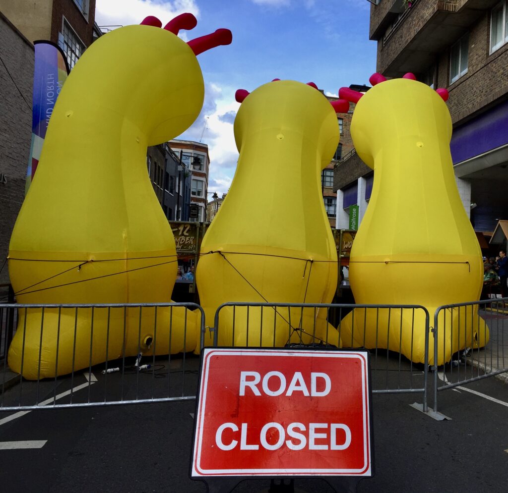
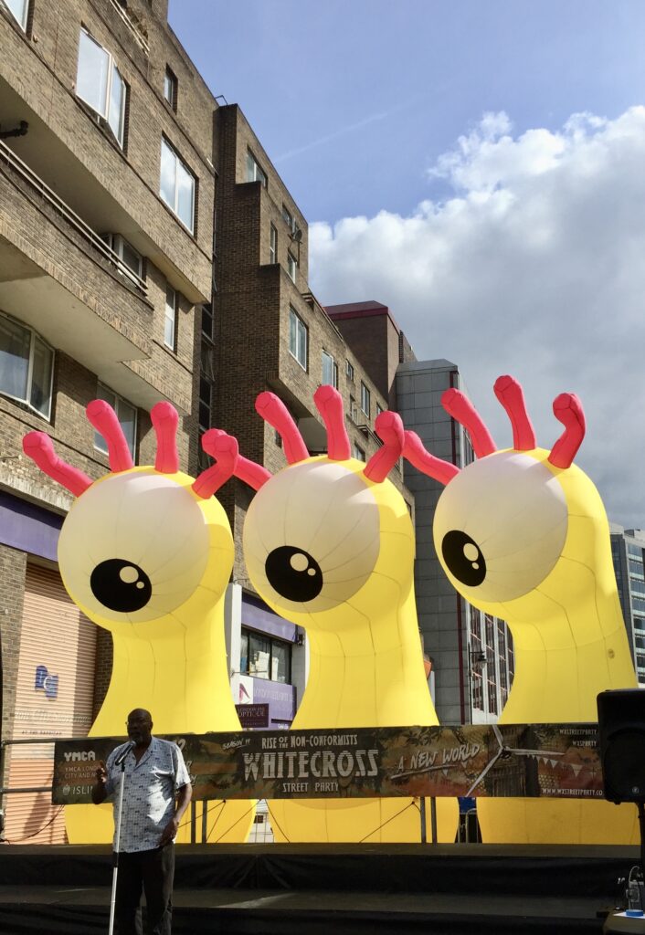
Last Saturday I knew I would be in for a treat when I saw these creatures blocking the road …
Poetry on one of the performance stages …
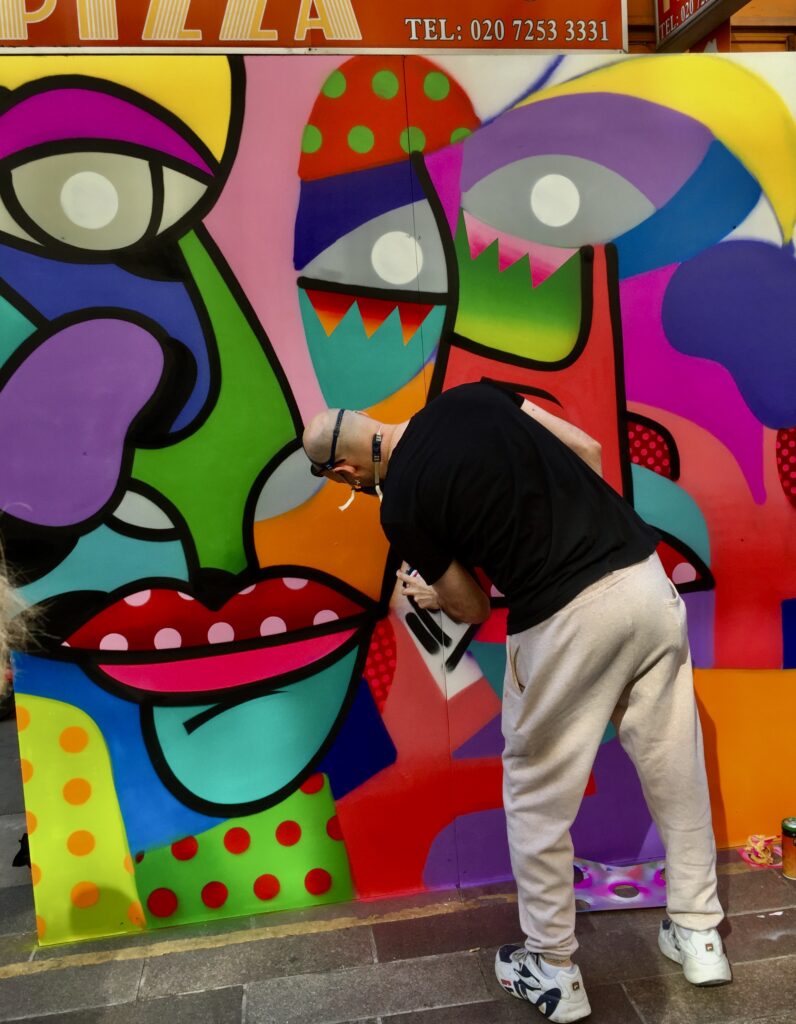
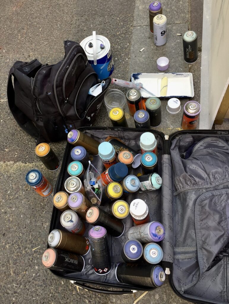
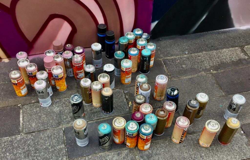
Time to get creative …
Who needs brushes when a handful of paint will do!
Concentration is so important …
There were lots of places to hunker down and enjoy the day …
Learn about saving our planet whilst having fun …
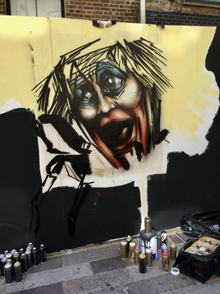
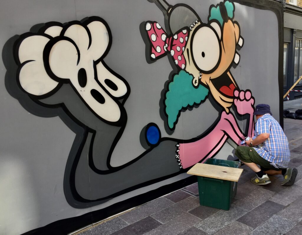
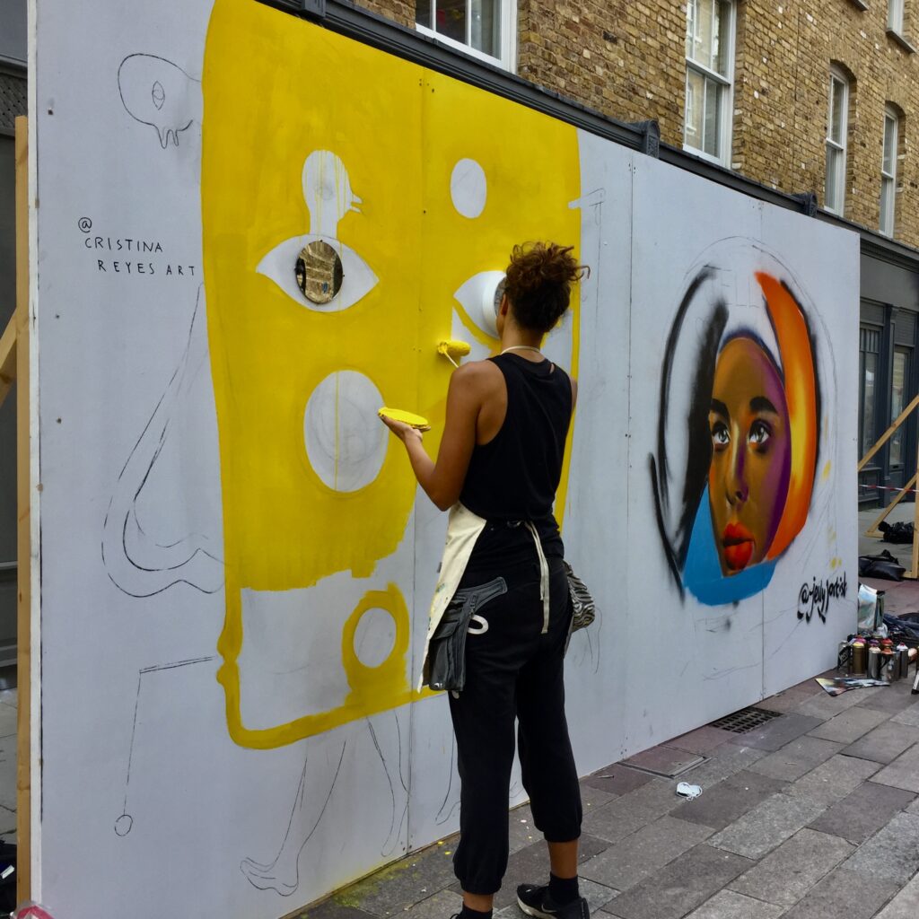
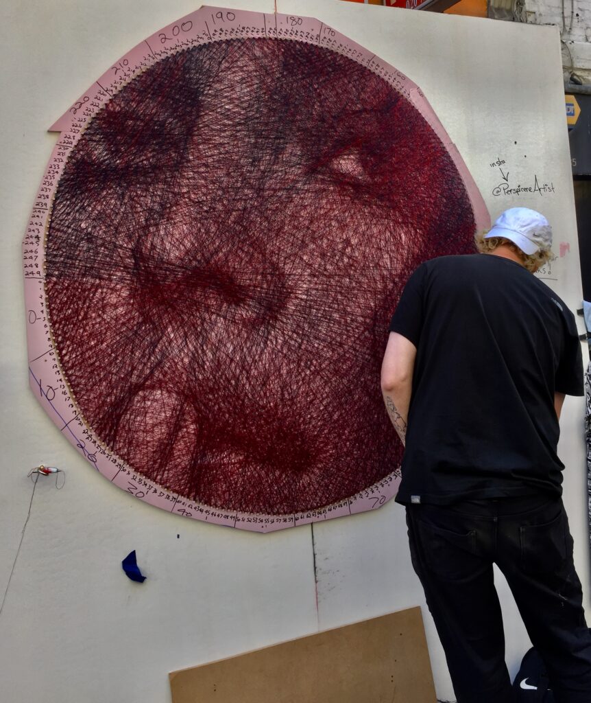
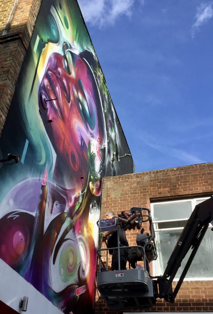
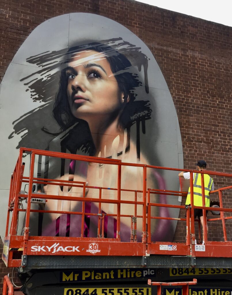
The grown-ups get to work on Saturday and Sunday …
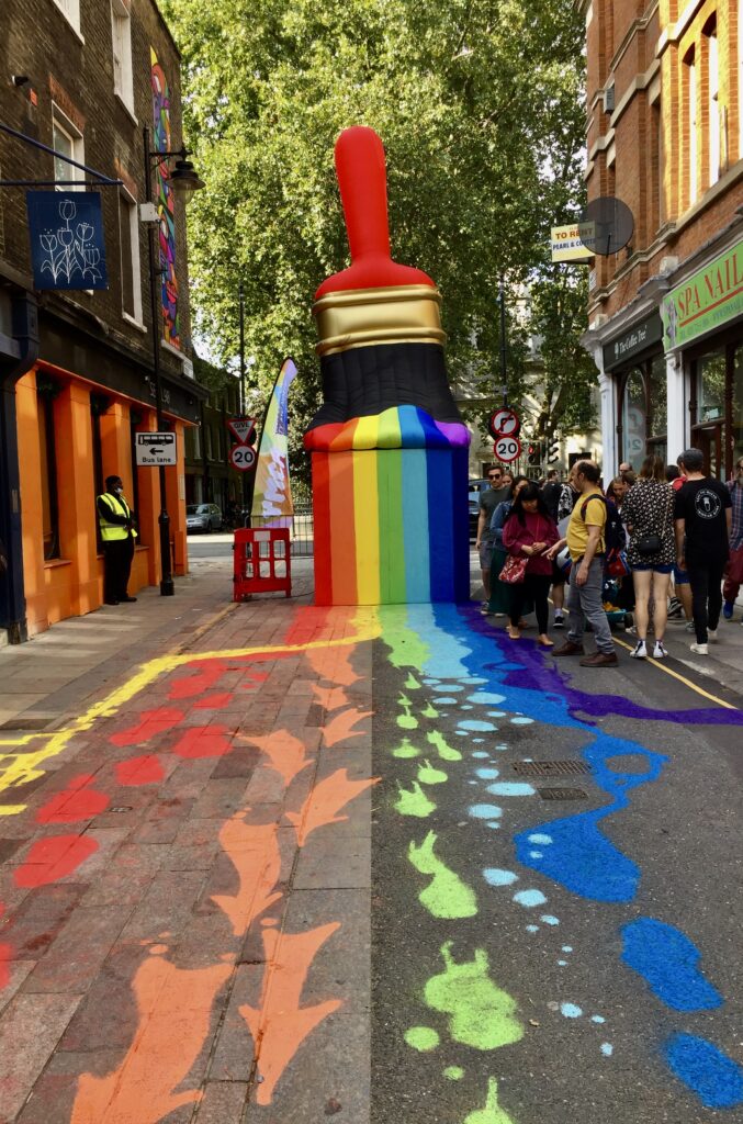
The big paintbrush is back!
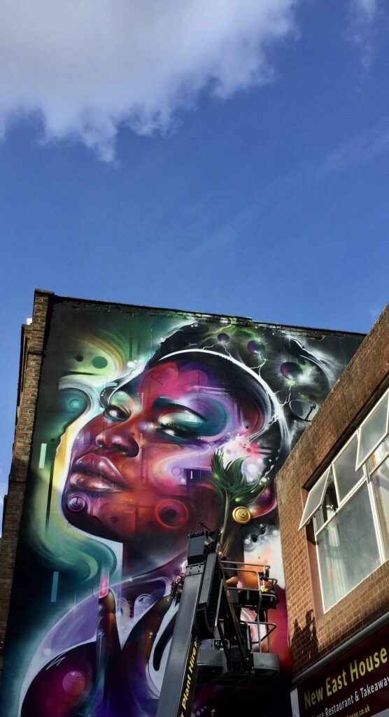
New murals take shape …
Artists at work …
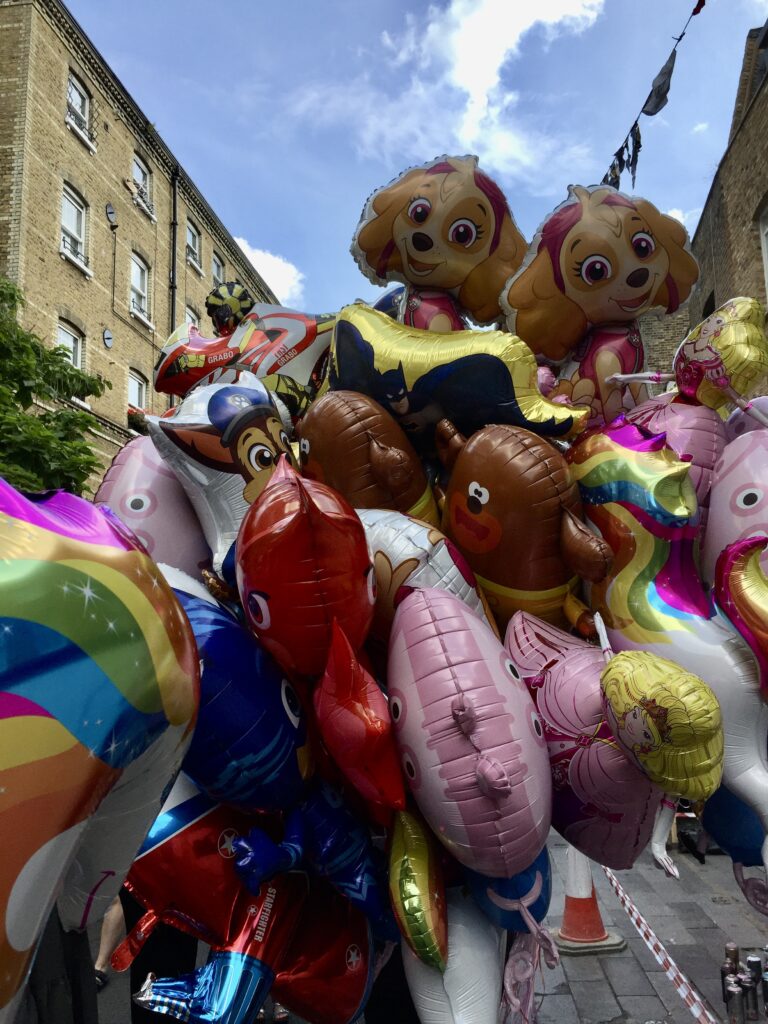
The day wouldn’t be complete without the bonkers balloons …
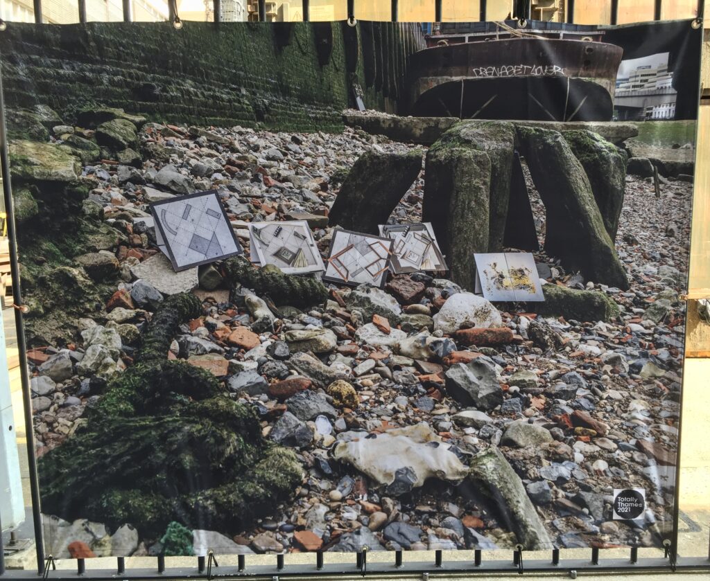
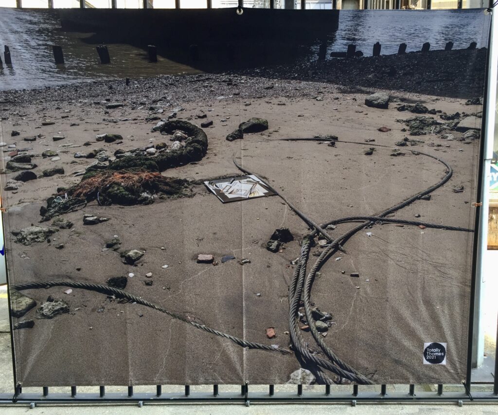
Don’t forget, there’s an exciting new installation created by my friend Natalie Robinson now set up for you to visit. The display is based on her body of work ‘Reflection: what lies beneath – new maps’ and will be part of the Totally Thames 2021 Festival until the 30th.
You’ll find Natalie’s banners on the Thames Path at Walbrook Wharf. Here are a few images to whet your appetite …
You can find more details of her display here and its digital counterpart here
If you would like to follow me on Instagram here is the link …
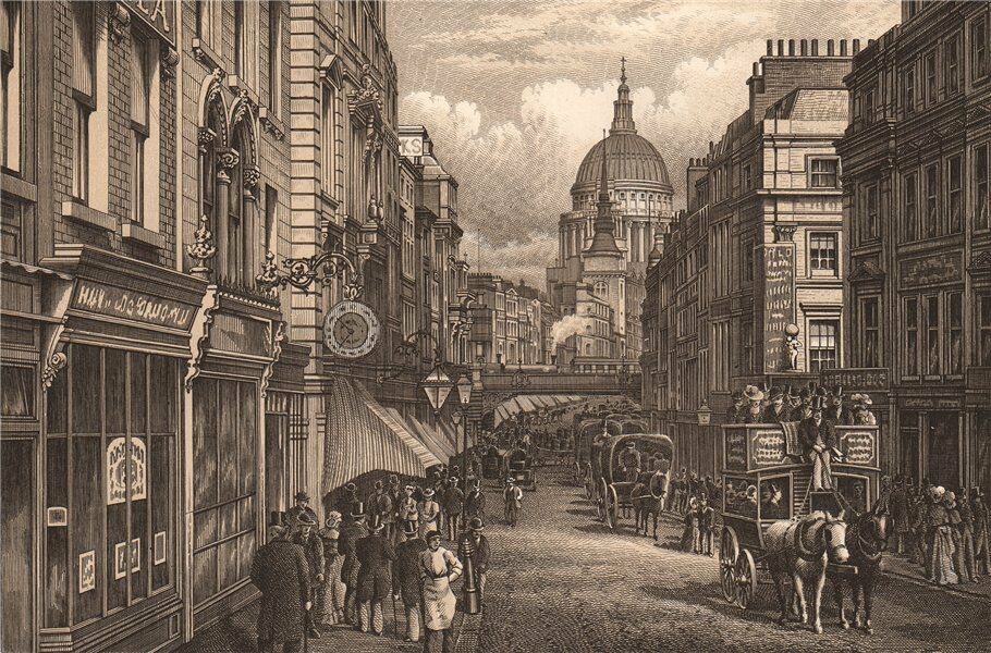
I was going to write about the unusually narrow frontage of some of Fleet Street’s buildings but ended up writing a short history of the area. I found doing the research fascinating and I hope you enjoy reading what I discovered.
The street is, of course, named after the ancient River Fleet that flows from its sources in the hills of Highgate and Hampstead down to the River Thames at Blackfriars. A major river in Roman times, it gradually deteriorated into an open sewer and even as early as 1290 the Carmelite monks of nearby Whitefriars Abbey were complaining to the King of the ‘putrid exhalations of the Fleet’ which overpowered the incense at Mass.
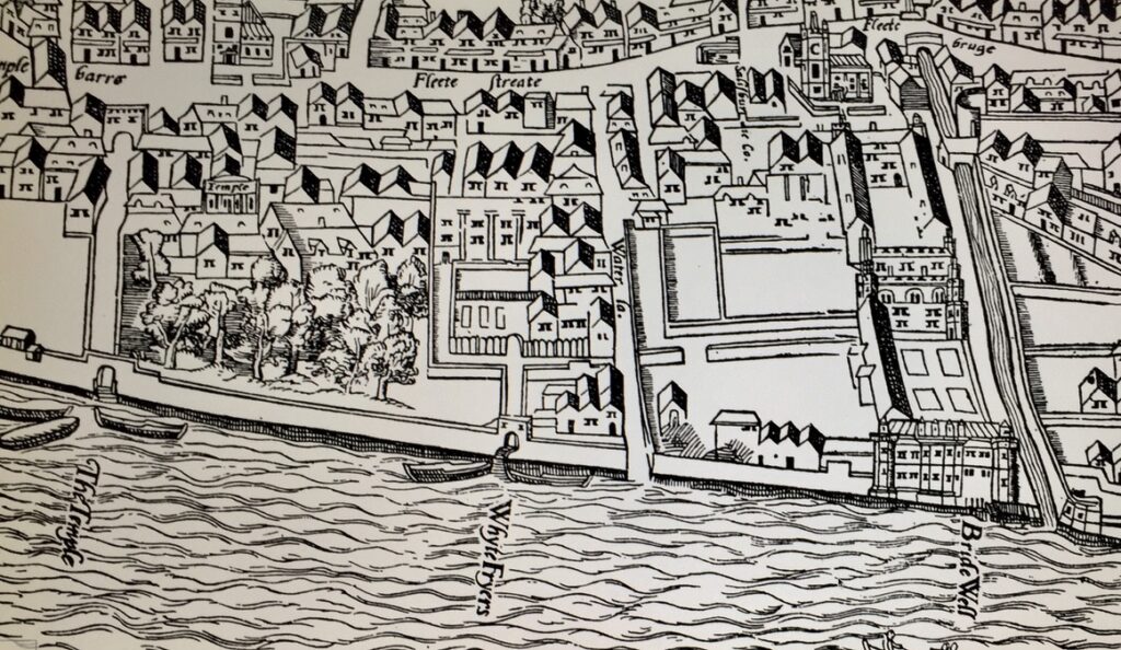
I have found two very early maps showing Fleet Street and the surrounding areas. The first by Braun and Hogenberg (1560/72) …
The street is not named on the map but it is the main road in the middle of the picture running west to east. You’ll see fields, gardens and orchards to the north and south west but the street itself is already lined with buildings. It proved a convenient link between the Court at Westminster and the commercial City as well as being an ideal location for printing with the growing number of legal and teaching establishments nearby. The wonderfully named Wynkyn de Worde, a colleague of William Caxton’s, moved to the Sign of the Sun near Shoe Lane around 1500 and printed approximately 800 works until his death in 1535. Many more printing enterprises were founded as the century progressed.
Also fascinating is the Agas Map from 1561 (as reproduced in 1633). To the east you can see the Fleet as it continues its flow south to the Thames entering it at Bridewell. Also on the Thames, between Bridewell and The Temple, is the Whitefriars Abbey but the monks were no longer there to complain about the smell. They had been thrown out during Henry the Eighth’s dissolution of the monasteries in 1538 …
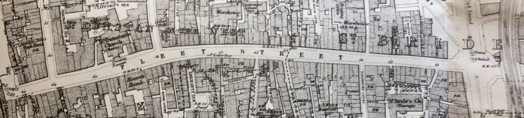
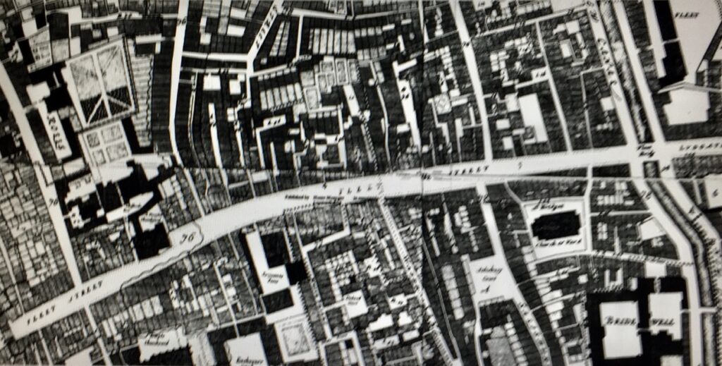
The Great Fire in 1666 obliterated two-thirds of the street and its environs but was halted at Fetter Lane to the north and the Temples to the south. The street layout survived the Fire, with rebuilding following the same medieval plots as before, which explains the skinny nature of some of the buildings here in the 21st century. The plot narrowness is very apparent from the 1873 Ordnance Survey Map …
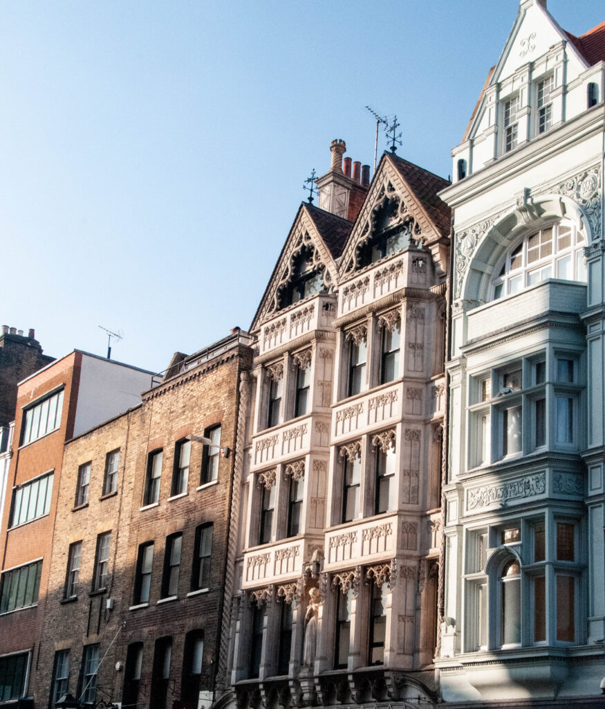
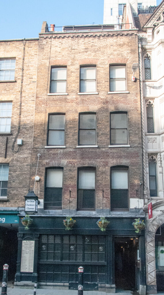
Here are some of the buildings you can see today that have been squeezed in ….
The one on the right was the Kings and Keys pub where the journalists from The Telegraph newspaper next door used to hang out. It closed in 2007.
By the 17th century the area was more urbanised and much of the remaining open space had been developed. To the north the surviving system of alleys and courts came into being, while to the south riverside land was parcelled up into tenements. You can see the growth of developments in the 1676 map by Ogilby and Morgan …
Already a notorious, stinking open sewer, in later years waste from slaughterhouses and tanneries made matters far worse. Observing a flood during a storm in 1710 Jonathan Swift penned the following lines …
Sweepings from Butchers Stalls, Dung, Guts and Blood, Drown’d Puppies, stinking Sprats, all drench’d in Mud, Dead Cats and Turnip-Tops come tumbling down the Flood.
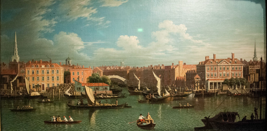
The southern end of the Fleet was finally completely covered over in 1766. I must say, however, that this picture of circa 1750 by a follower of Samuel Scott (1702-1772) makes its entrance to the Thames look positively Venetian. You can see the obvious influence of Canaletto …
Guildhall Picture Gallery.
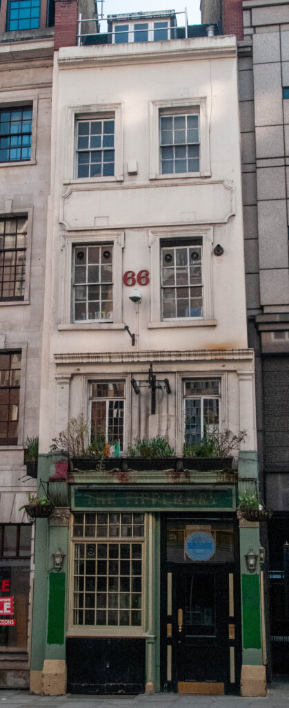
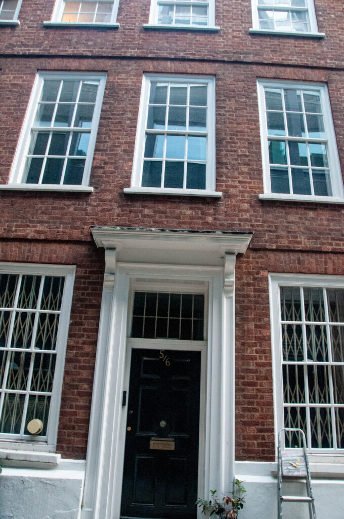
A few buildings survive from the massive rebuilding that took place after the Great Fire.
The Tipperary pub, circa 1667, on its narrow plot …
The rear of The Old Bell Inn, circa 1669 …
Numbers 5 and 6 Crane Court, circa 1670 (but largely reconstructed after a fire in 1971) …
The Cheshire Cheese pub, a merger of two 17th century houses …
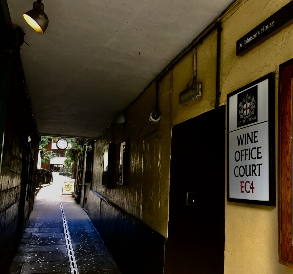
The entrance is down the alley on the left of the picture …
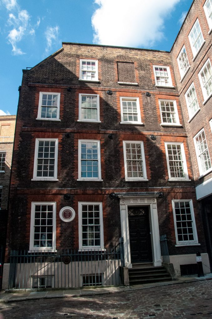
The house built in 1700 where Dr Johnson lived from 1748 to 1759, 17 Gough Square …
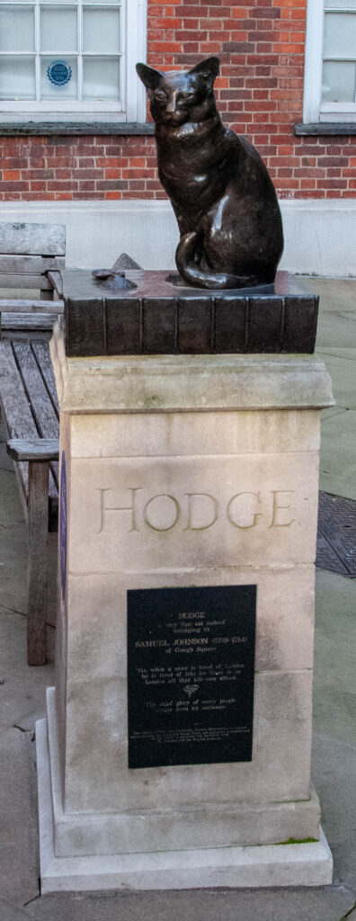
Incidentally, Dr Johnson’s favourite cat, Hodge, gazes at his old home from across the Square. He’s sitting on his owner’s famous dictionary having just eaten an oyster …
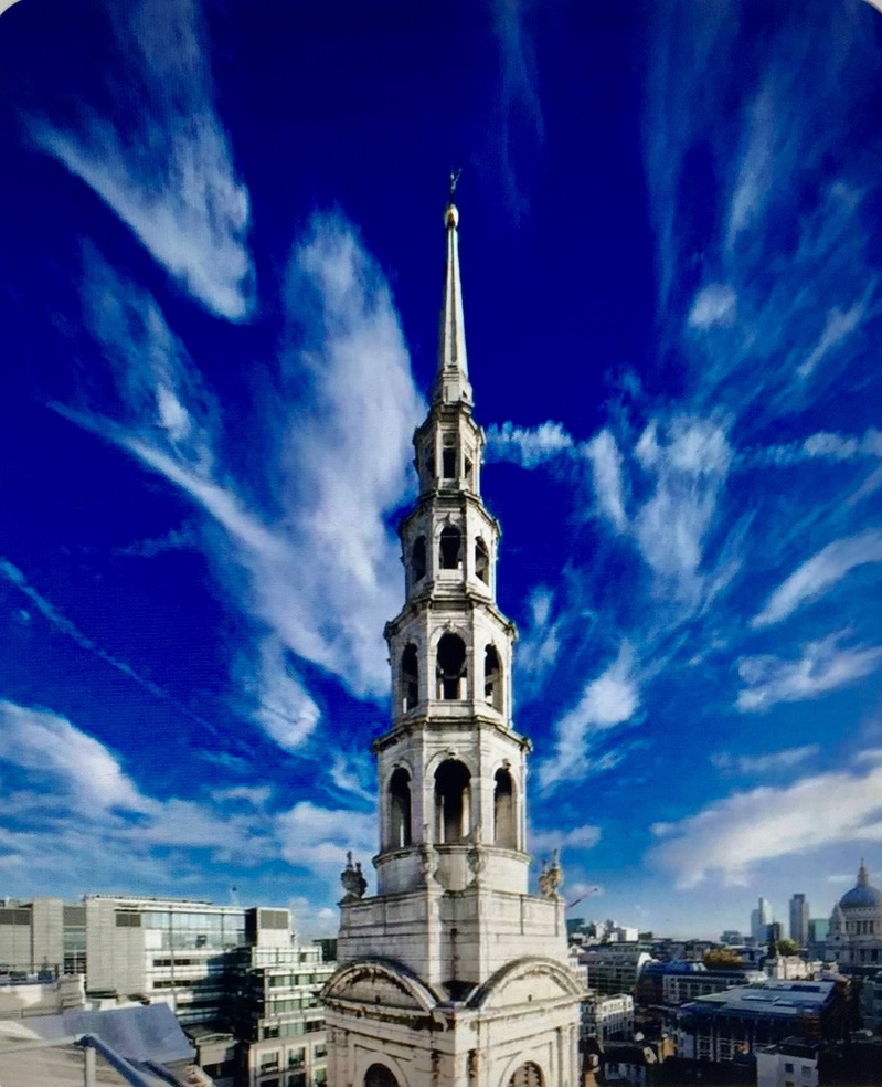
No history of Fleet Street would be complete without mentioning another survivor from the 17th century, St Bride’s church. Built by Christopher Wren between 1671 and 1678, the famous ‘wedding cake’ spire was added 1701-3 and rebuilt after a lightning strike in 1764 …
It’s still known as ‘The Journalists’ Church’. Photo credit : Pinterest.
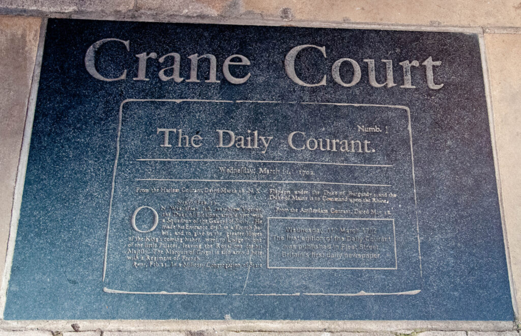
The entrance to Crane Court has a plaque celebrating the publishing of the first British daily newspaper, the Daily Courant, on 11 March 1702 …
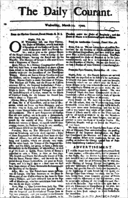
It consisted of a single page with advertisements on the reverse …
It lasted until 1735 when it merged with the Daily Gazetteer.
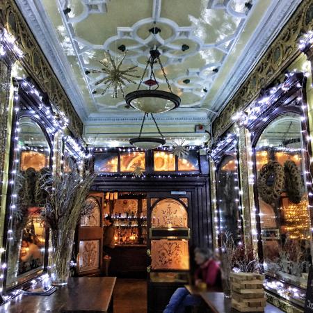
Over the next century Fleet Street gradually became more and more commercial and in 1855 the repeal of stamp duty resulted in an immediate drop in the price of newspapers. Readership boomed. New printing works opened up and taverns and ‘gin palaces’ flourished of which the Punch Tavern (built 1894-7) is a good example that is still around today. This is an image from Tripadvisor since the pub is closed at the moment …
Here’s how the Street looked just before Punch’s construction started …
Fleet Street in 1893.
There’s a great ten minute documentary on Fleet Street’s newspaper architecture here, especially worth viewing because it takes you into the magnificent Art Deco interior of the Daily Express building. This has been hidden behind curtains since Goldman Sachs took over the building.
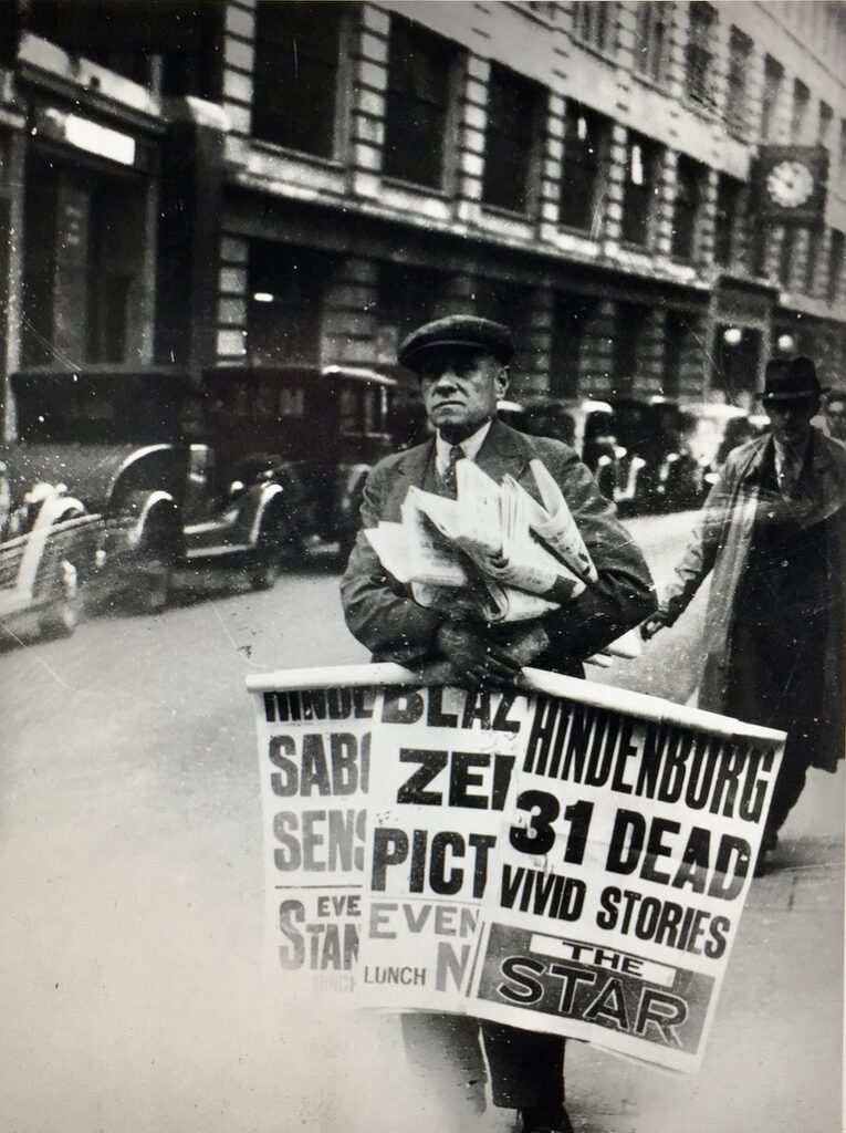
‘Read all about it!’ – 7th May 1937, the day after the Hindenberg disaster. That’s the headquarters of The Daily Telegraph in the background …
Photo credit : Getty images.
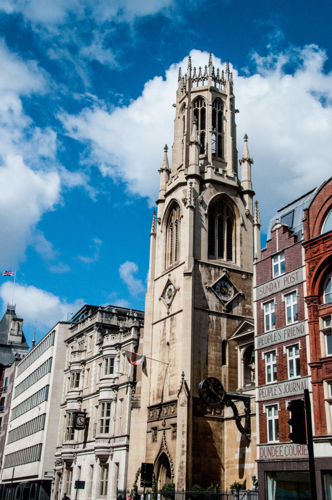
The 1980s and ’90s saw the dispersal of the newspaper industry to sites in the Docklands and in other parts of London but some of the old signage remains, next door to St Dunstan-in-the-West …
The last journalists left in August 2016 – they worked for the Sunday Post in the office shown in the photograph.
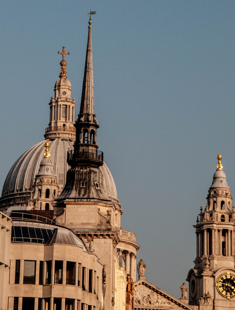
Do pause at the east end of Fleet Street and look up Ludgate Hill. You’ll be enjoying a view that would have been familiar to every denizen of the City since 1710 – the spire of St Martin within Ludgate piercing the sky between the western towers of St Paul’s Cathedral (although the view was obstructed for a while by a railway bridge!) …
I am indebted to the City of London Corporation’s Fleet Street Conservation Area document for many of my sources and will end with a quote from it, written pre-Brexit …
Today, Fleet Street is a vibrant street enhanced by past religious, ceremonial and institutional associations and its links with the newspaper industry, with one of the longest ensembles of pre-war buildings in the City. It is part of the established processional route and the route of the Lord Mayor’s show.
Let’s hope that its full vibrancy will one day return.
I have written about Fleet Street before and here are links to the blogs:
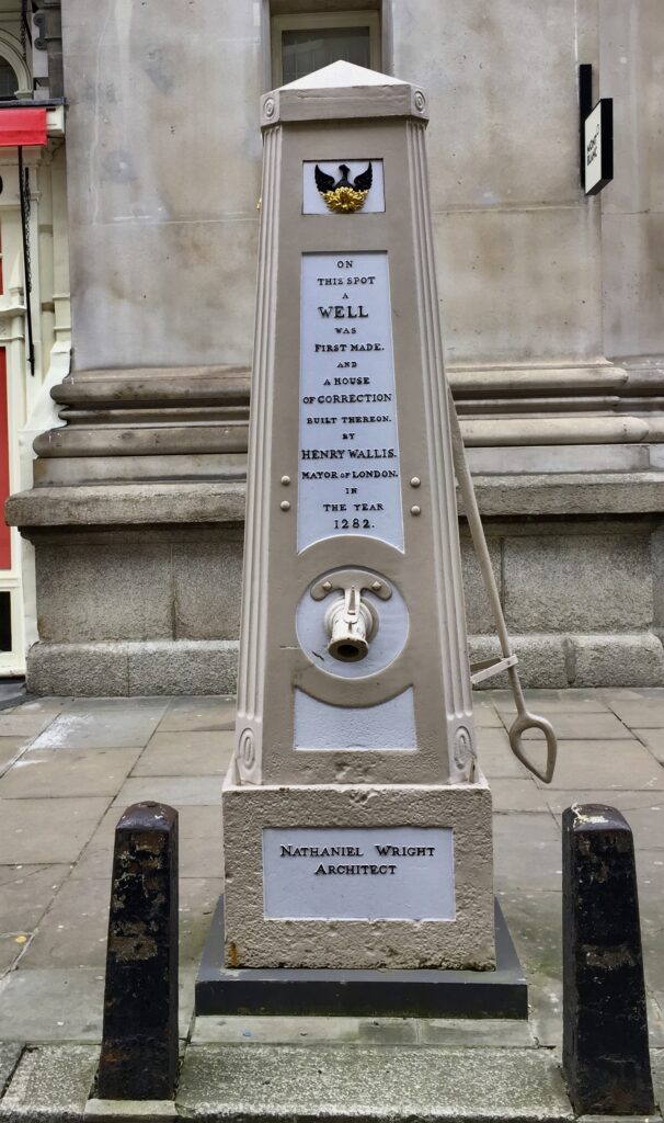
Credit: The water pump in Cornhill designed by Nathaniel Wright. Engraving by S. Rawle, 1800.Wellcome Collection.
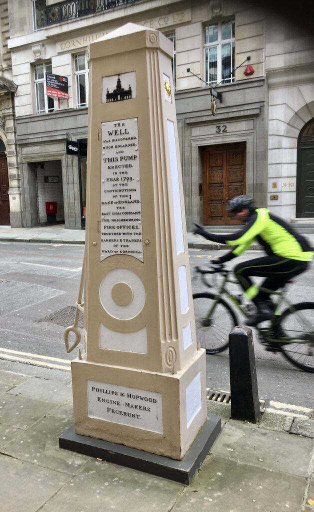
Now it has been restored to its former glory (EC3V 3LL) …
I didn’t notice the cyclist waving at me when I took the picture!
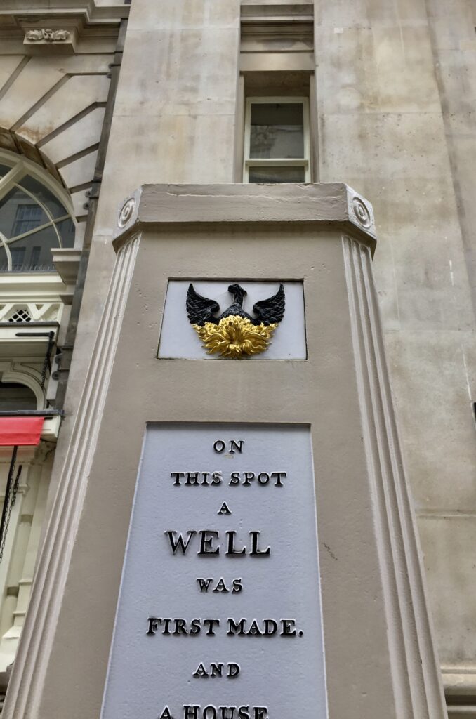
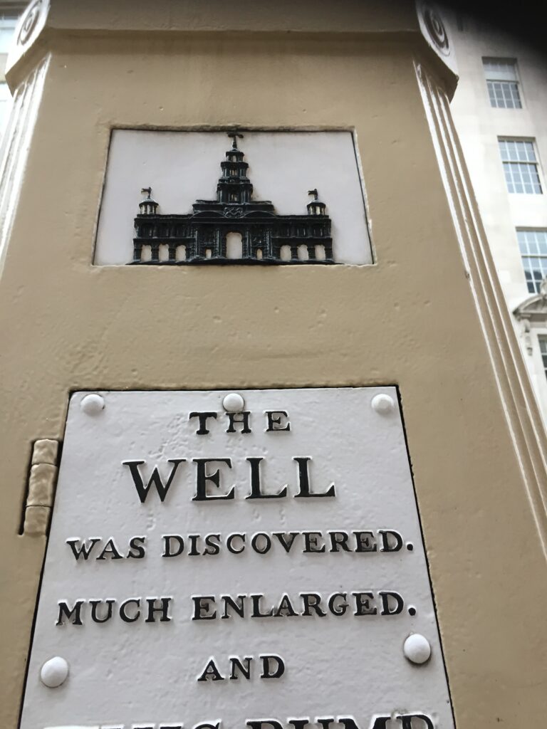
Two sides of the pump record its history. This is the side facing the pavement …
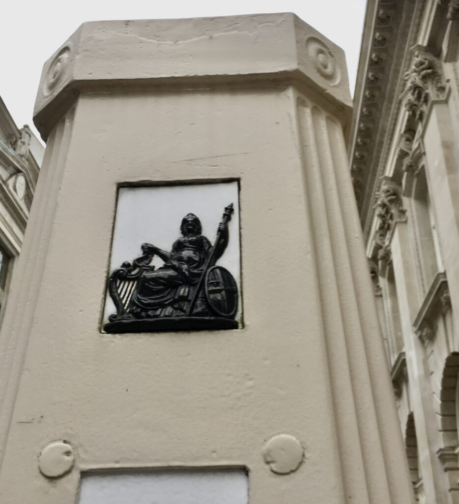
The ‘neighbouring fire offices’ were insurance companies who made sure that passers-by learnt of their generous contributions by incorporating their emblems into the pump’s design. It was, of course, also in their own interest to have a reliable source of water should there be an outbreak of fire. There had been a particularly ferocious fire in nearby Change Alley in 1748 with many buildings destroyed. You can read more about it in my blog More City Courtyards and Alleys – Change Alley.
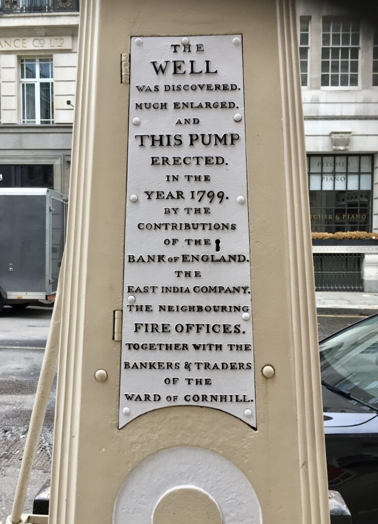
The Gentleman’s Magazine of 16 March 1799 tells the pump’s story in a little more detail …
By the sinking of the pavement nearly opposite the front gate of the Royal Exchange a very large deep well of great antiquity has been discovered. The water is of excellent quality, and the ward of Cornhill propose erecting a pump near the spot… What is remarkable, the top of the well was not secured by either arch or brickwork, but only covered with planks.
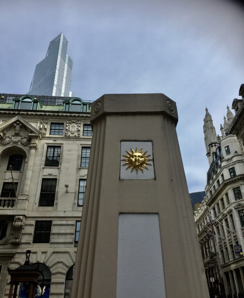
The emblem of the Sun Fire Office.The emblem of the Phoenix Fire Office.The emblem of the LondonFire Office.The emblem of the Royal Exchange Fire Office.
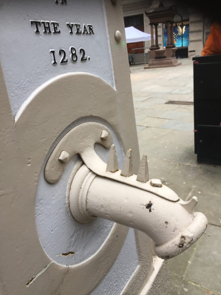
This is the inscription on the side of the pump facing the road …
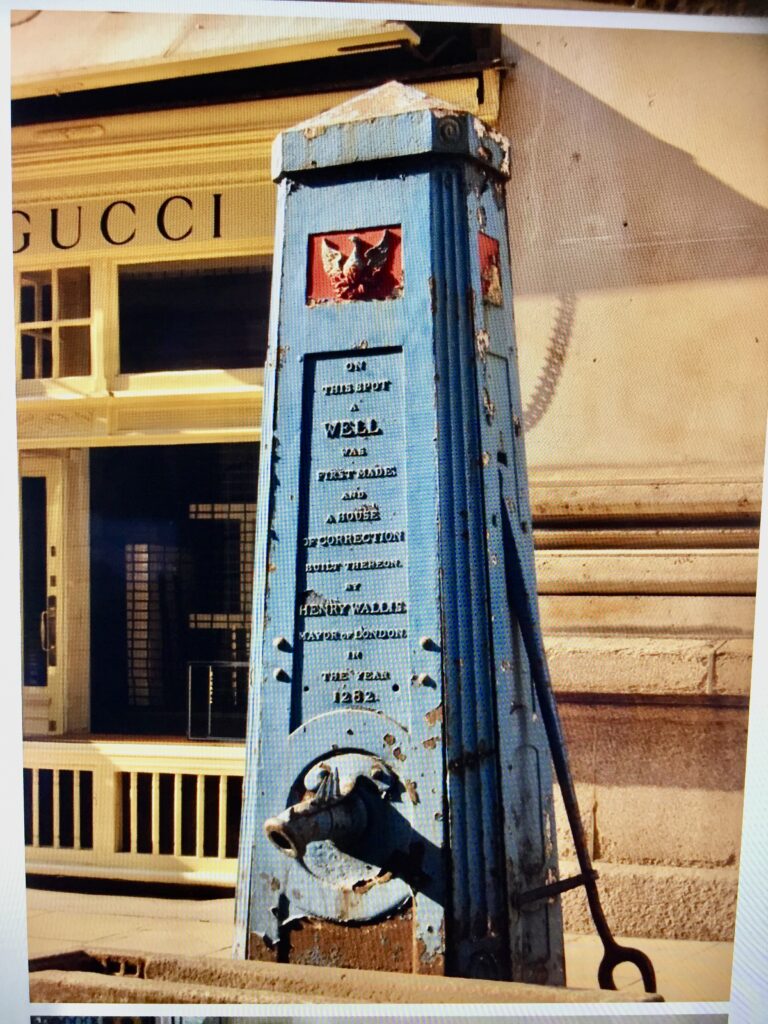
It refers to a well and a ‘House of Correction built thereon by Henry Wallis Mayor of London in the year 1282’. Also known as Henry le Walleis and Henry le Waleys, he was elected Mayor an impressive five times and was an incredibly active and creative individual. You can read more about him here and here.
The House of Correction was, according to one chronicler …
… to be a Prison for Night-walkers, and other suspicious persons, and was called the Tunne upon Cornhill; because the same was builded somewhat in fashion of a Tunne (barrel), standing on the one end.
Anyone walking about the City at night came under suspicion since at sunset all fires and lights were extinguished and great peals of bells heralded the closing of the gates in the city wall until dawn. Night air was known to be unhealthy. It was therefore believed that those who walked in it were, at best, eavesdroppers at neighbours’ windows or at worst potential burglars, murderers or prostitutes. They would be held at the Tunne until morning and then brought before a judge. For further reading on the subject I recommend Matthew Beaumont’s fascinating book :Nightwalking: A Nocturnal History of London. You can read more about the Tunne here in British History Onlineincluding details of the nasty punishments meted out to women ‘taken in fornication or aduouterie (sic)‘.
I suppose the spikes on the spout are there to stop people resting their bottoms on it …
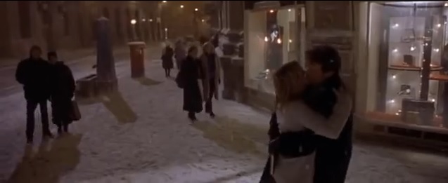
I am indebted to Metro Girl’s blog for this piece of fun trivia. The pump in it’s original blue state can be seen in the climax of the first Bridget Jones’s Diary movie, where Renee Zellweger’s Bridget enjoys her first kiss with Colin Firth’s Mark Darcy after he buys her a new diary from the Royal Exchange …
Copyright : Working Title Films (2001).
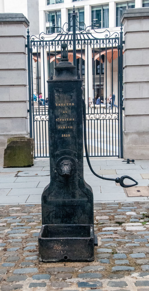
In the shadow of St Paul’s Cathedral this old Parish Pump, dated 1819, bears the name of St Faith’s Parish despite the fact that the church after which it was named was demolished in 1256 (yes, over 700 years ago) to allow for the eastern expansion of St Paul’s.
That’s Paternoster Square in the background. The pump is in St Paul’s Churchyard.
From the 1250s until the reign of Edward VI, the parish known as St Faith under St Paul’s literally worshiped beneath St Paul’s Cathedral, using a space the end of the west crypt under St Paul’s Quire. After the Great Fire of 1666 the parish was united with St Augustine Watling Street. The pump was once situated against railings of St Paul’s Churchyard close to St Paul’s Cross, but was moved to its present position in 1973.
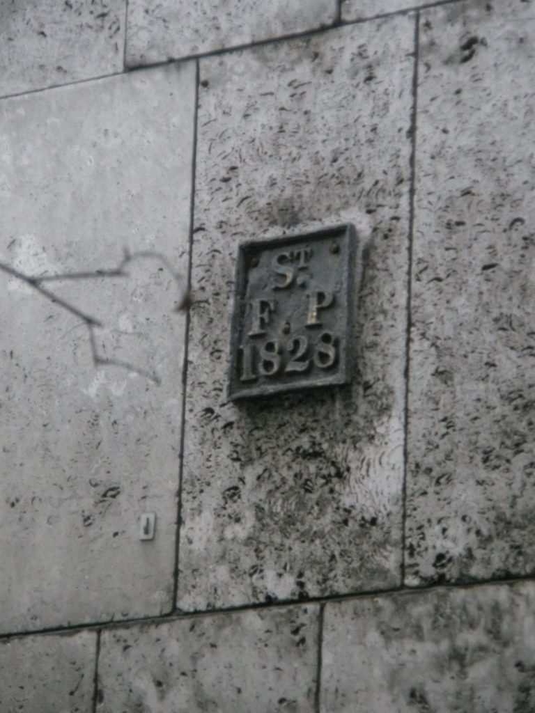
The old parish still has a boundary marker on the wall of St Paul’s Cathedral School …
You can read my blog about parish boundary markers here.
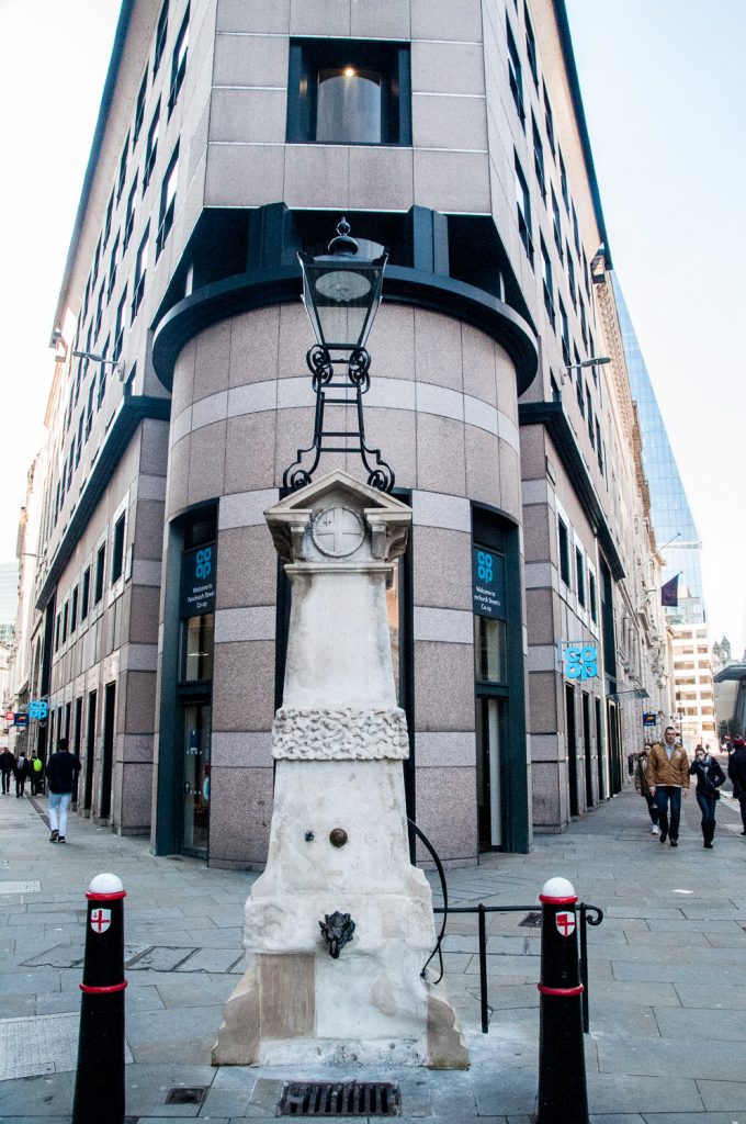
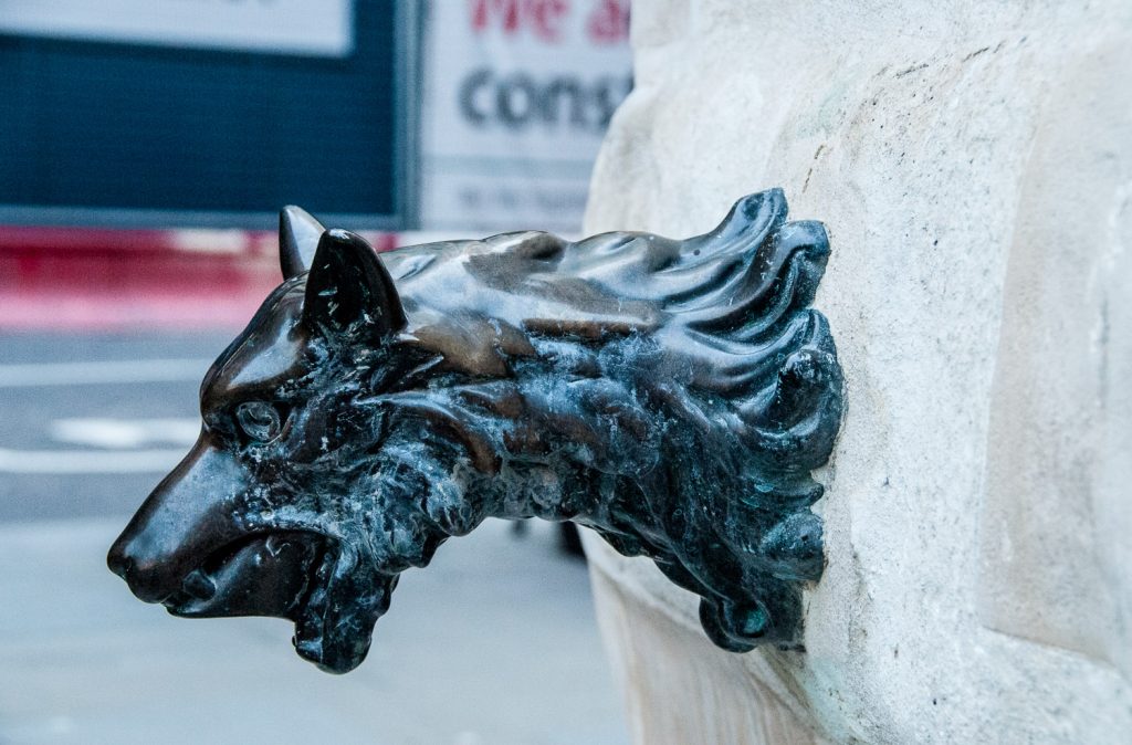
I’m very fond of Aldgate pump and its wolf’s head spout so, although I wrote about it just over a year ago, I hope regular readers will forgive me for writing about it again. At the junction of Fenchurch Street and Leadenhall Street people usually hurry past it without a second glance, not knowing anything about some gruesome aspects of its history …
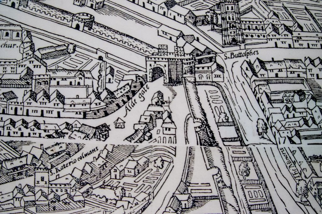
There was a well here for centuries and one appears to be shown on the Agas map of 1561 …
Look under the ‘A’ of Aldegate
After a pump was installed in the sixteenth century the water gained a reputation for being ‘bright, sparkling, and cool, and of an agreeable taste’. In the early 1870s, however, people started noticing the taste deteriorate and become foul. Then people who had drank the water started dying in great numbers in a tragedy that became known as the Aldgate Pump Epidemic.
It was known that Thames water was dangerous as illustrated by this 1850s drawing entitled The Silent Highwayman …
But Aldgate water originated in the healthy springs of Hampstead and Highgate and flowed underground – so it should have been safe.
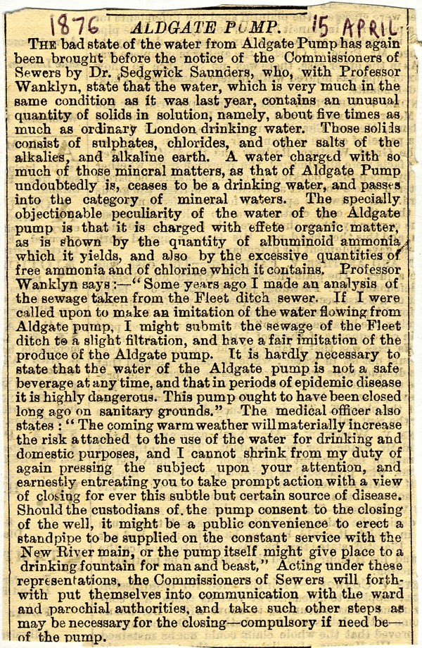
The bad news broke publicly in April 1876 …
An investigation by the Medical Officer of Health for the City revealed the terrible truth. During its passage from north London it had passed through and under numerous new graveyards thereby picking up the bacteria, germs and calcium from the decaying bodies. The pump was immediately closed and eventually reconnected to the safer New River Company’s supply later in 1876. You will find a fascinating history of the New River Company if you access the splendid London Inheritance blog.
The epidemic was obviously a distant memory by the nineteen twenties when Whittard’s tea merchants used to …
… always get the kettles filled at the Aldgate Pump so that only the purest water was used for tea tasting.
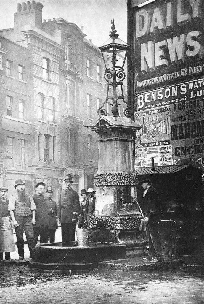
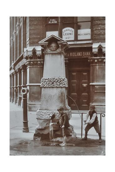
I have discovered a few old pictures …
The pump in 1874- picture from the Wellcome Collection.
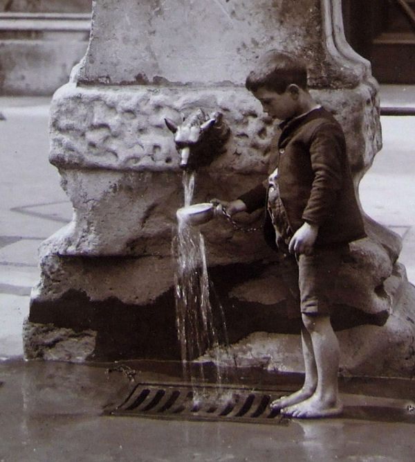
And in August 1908 a little bare footed East End boy refreshes himself using the cup attached to the pump by a chain …
In the full picture his pal is doing the pumping …
The wolf’s head spout is said to reference the last wolf killed in the City of London …
Nice that it has survived intact into the 21st century.
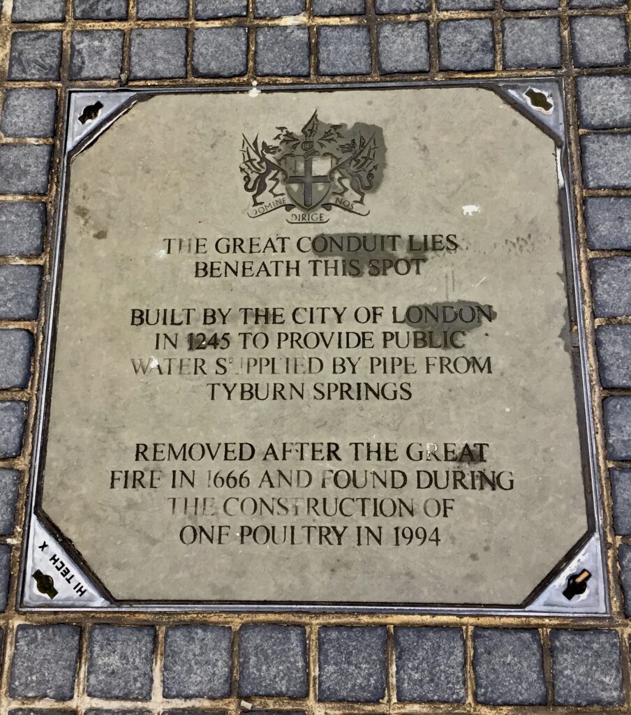
Outside Tesco’s on Cheapside is this intriguing manhole cover …
For a fascinating talk by Chris Dyson about this and other aspects of the City’s water supply history click here : This City is Made of Water.