I was going to write about the unusually narrow frontage of some of Fleet Street’s buildings but ended up writing a short history of the area. I found doing the research fascinating and I hope you enjoy reading what I discovered.
The street is, of course, named after the ancient River Fleet that flows from its sources in the hills of Highgate and Hampstead down to the River Thames at Blackfriars. A major river in Roman times, it gradually deteriorated into an open sewer and even as early as 1290 the Carmelite monks of nearby Whitefriars Abbey were complaining to the King of the ‘putrid exhalations of the Fleet’ which overpowered the incense at Mass.
I have found two very early maps showing Fleet Street and the surrounding areas. The first by Braun and Hogenberg (1560/72) …

The street is not named on the map but it is the main road in the middle of the picture running west to east. You’ll see fields, gardens and orchards to the north and south west but the street itself is already lined with buildings. It proved a convenient link between the Court at Westminster and the commercial City as well as being an ideal location for printing with the growing number of legal and teaching establishments nearby. The wonderfully named Wynkyn de Worde, a colleague of William Caxton’s, moved to the Sign of the Sun near Shoe Lane around 1500 and printed approximately 800 works until his death in 1535. Many more printing enterprises were founded as the century progressed.
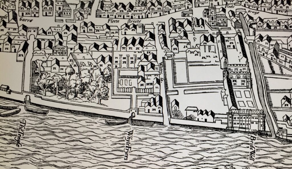
Also fascinating is the Agas Map from 1561 (as reproduced in 1633). To the east you can see the Fleet as it continues its flow south to the Thames entering it at Bridewell. Also on the Thames, between Bridewell and The Temple, is the Whitefriars Abbey but the monks were no longer there to complain about the smell. They had been thrown out during Henry the Eighth’s dissolution of the monasteries in 1538 …
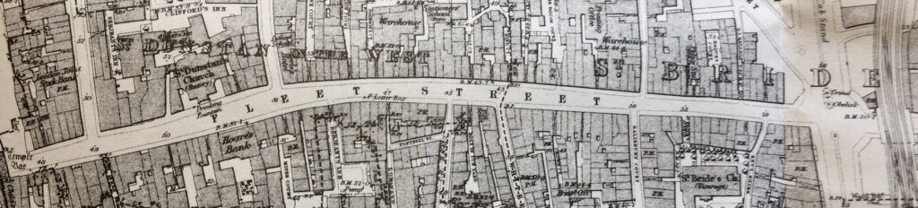
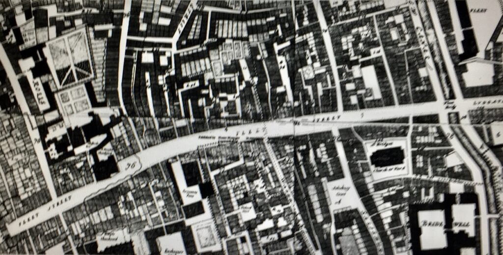
The Great Fire in 1666 obliterated two-thirds of the street and its environs but was halted at Fetter Lane to the north and the Temples to the south. The street layout survived the Fire, with rebuilding following the same medieval plots as before, which explains the skinny nature of some of the buildings here in the 21st century. The plot narrowness is very apparent from the 1873 Ordnance Survey Map …
Here are some of the buildings you can see today that have been squeezed in ….
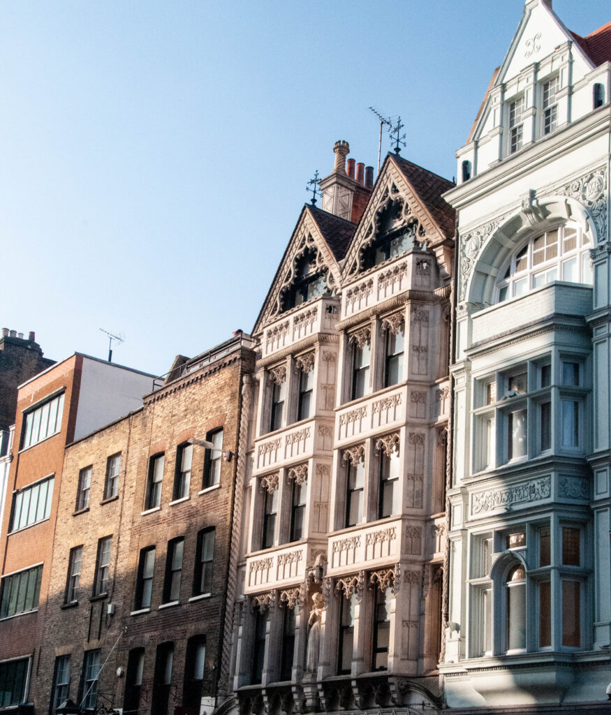
The one on the right was the Kings and Keys pub where the journalists from The Telegraph newspaper next door used to hang out. It closed in 2007.
By the 17th century the area was more urbanised and much of the remaining open space had been developed. To the north the surviving system of alleys and courts came into being, while to the south riverside land was parcelled up into tenements. You can see the growth of developments in the 1676 map by Ogilby and Morgan …
Already a notorious, stinking open sewer, in later years waste from slaughterhouses and tanneries made matters far worse. Observing a flood during a storm in 1710 Jonathan Swift penned the following lines …
Sweepings from Butchers Stalls, Dung, Guts and Blood,
Drown’d Puppies, stinking Sprats, all drench’d in Mud,
Dead Cats and Turnip-Tops come tumbling down the Flood.
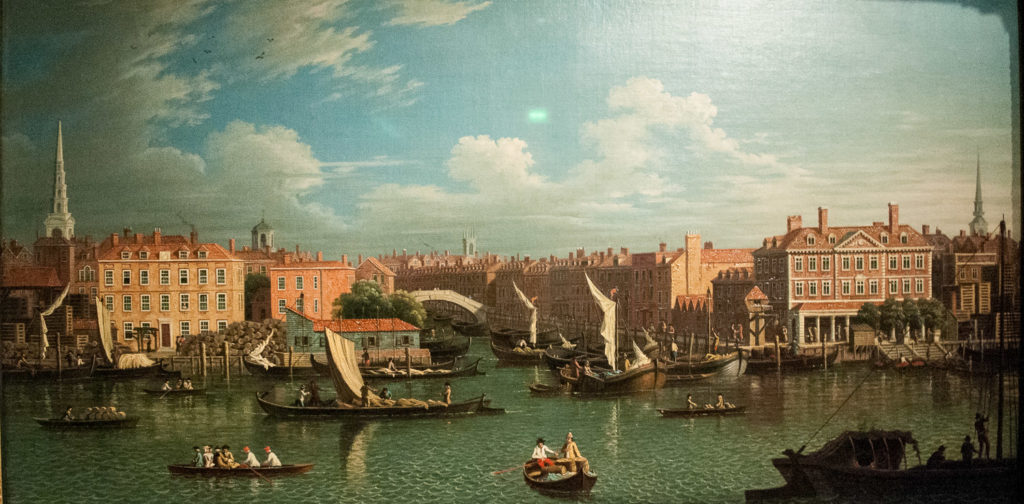
The southern end of the Fleet was finally completely covered over in 1766. I must say, however, that this picture of circa 1750 by a follower of Samuel Scott (1702-1772) makes its entrance to the Thames look positively Venetian. You can see the obvious influence of Canaletto …
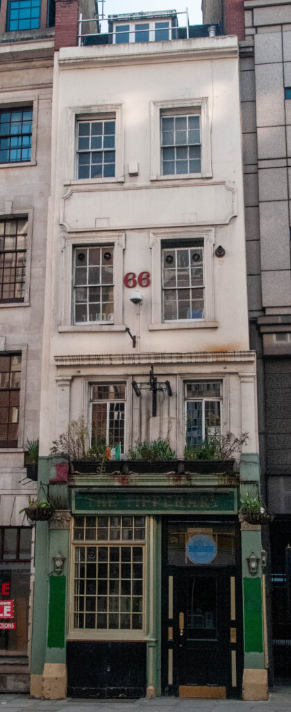
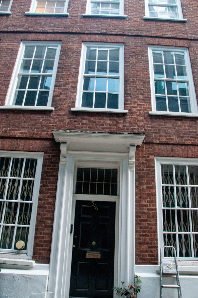
A few buildings survive from the massive rebuilding that took place after the Great Fire.
The Tipperary pub, circa 1667, on its narrow plot …
The rear of The Old Bell Inn, circa 1669 …
Numbers 5 and 6 Crane Court, circa 1670 (but largely reconstructed after a fire in 1971) …
The Cheshire Cheese pub, a merger of two 17th century houses …
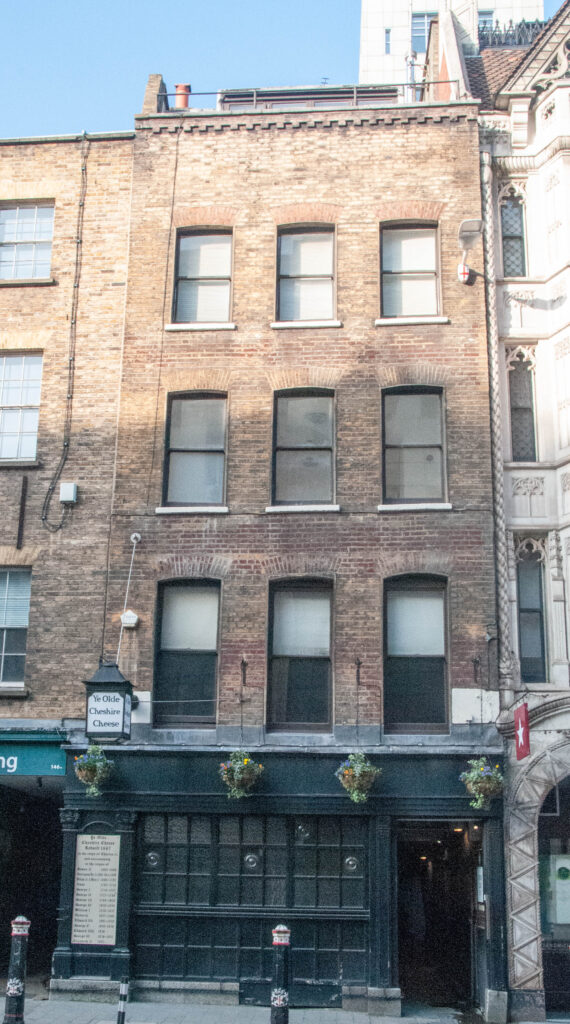
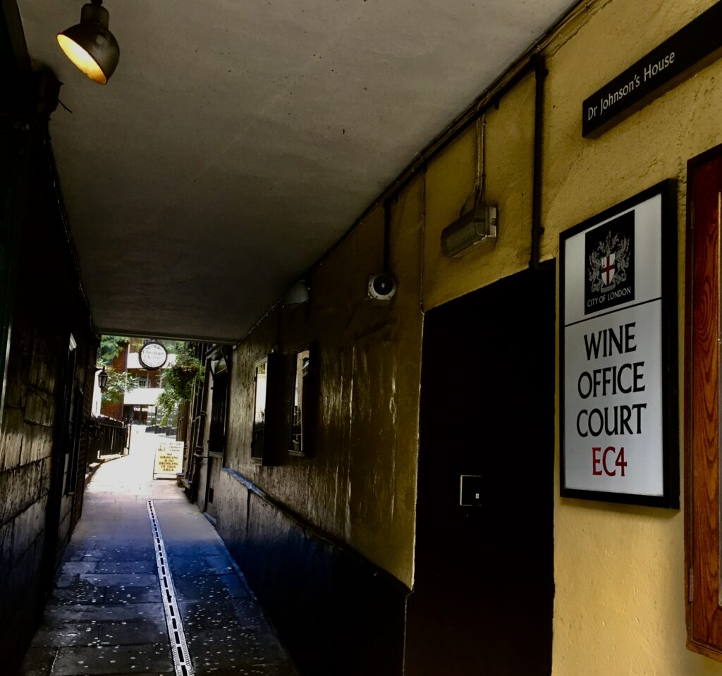
The entrance is down the alley on the left of the picture …
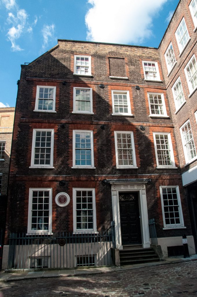
The house built in 1700 where Dr Johnson lived from 1748 to 1759, 17 Gough Square …
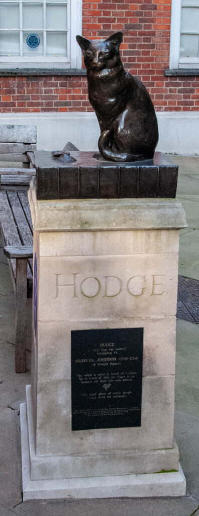
Incidentally, Dr Johnson’s favourite cat, Hodge, gazes at his old home from across the Square. He’s sitting on his owner’s famous dictionary having just eaten an oyster …
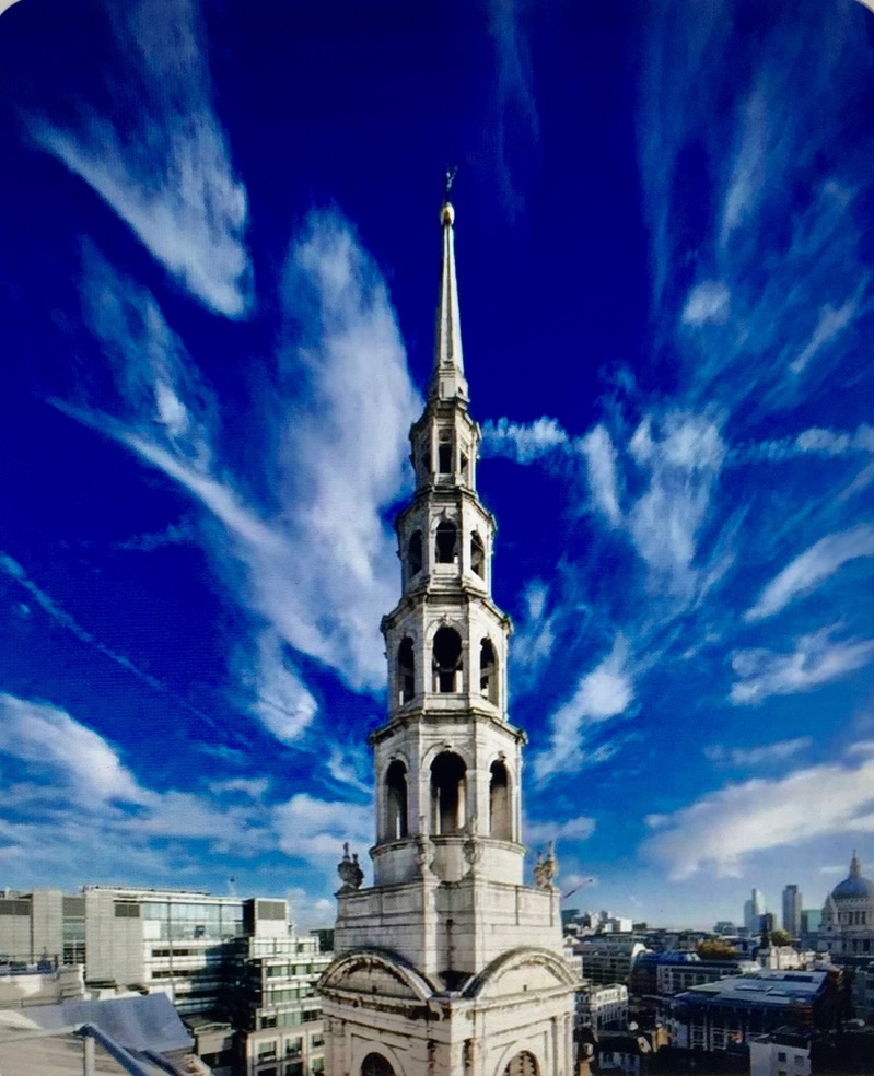
No history of Fleet Street would be complete without mentioning another survivor from the 17th century, St Bride’s church. Built by Christopher Wren between 1671 and 1678, the famous ‘wedding cake’ spire was added 1701-3 and rebuilt after a lightning strike in 1764 …
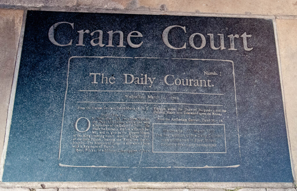
The entrance to Crane Court has a plaque celebrating the publishing of the first British daily newspaper, the Daily Courant, on 11 March 1702 …
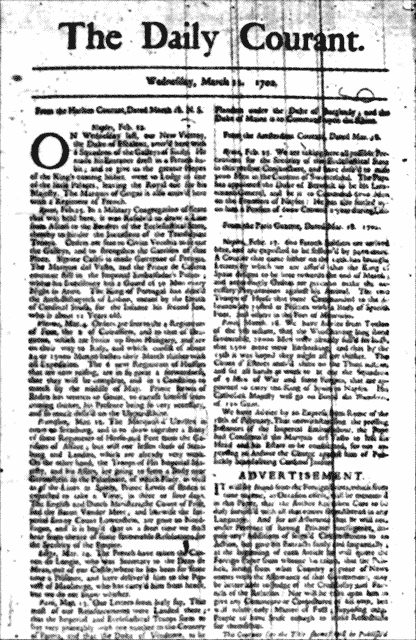
It consisted of a single page with advertisements on the reverse …
It lasted until 1735 when it merged with the Daily Gazetteer.
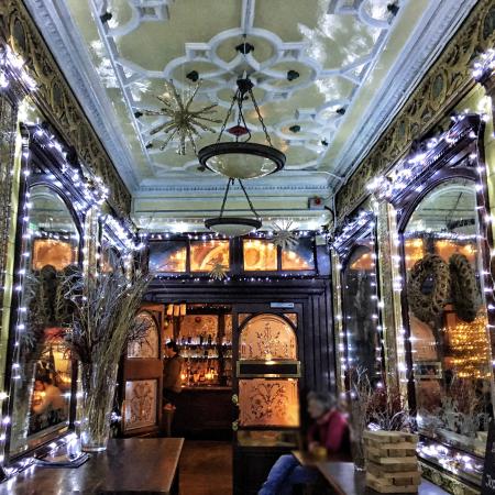
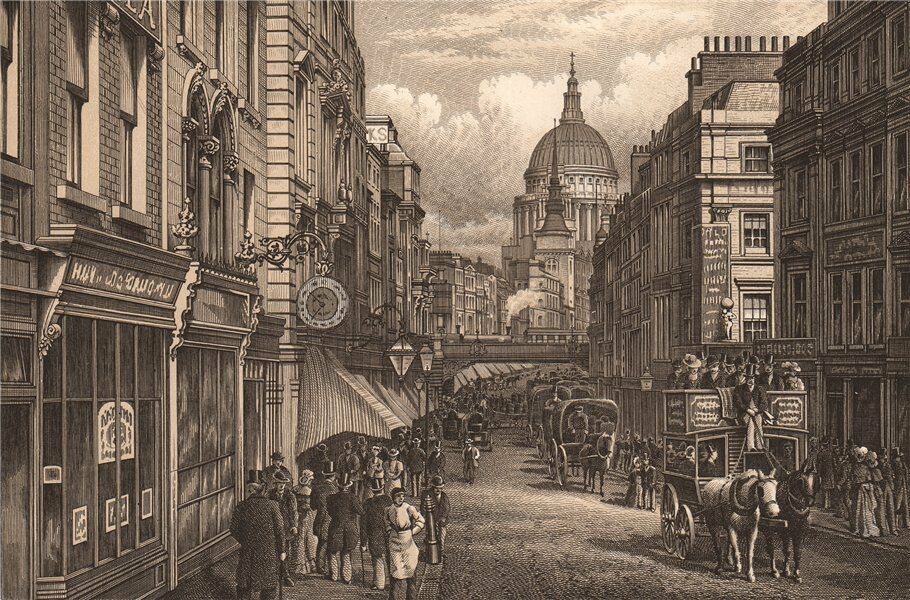
Over the next century Fleet Street gradually became more and more commercial and in 1855 the repeal of stamp duty resulted in an immediate drop in the price of newspapers. Readership boomed. New printing works opened up and taverns and ‘gin palaces’ flourished of which the Punch Tavern (built 1894-7) is a good example that is still around today. This is an image from Tripadvisor since the pub is closed at the moment …
Here’s how the Street looked just before Punch’s construction started …
There’s a great ten minute documentary on Fleet Street’s newspaper architecture here, especially worth viewing because it takes you into the magnificent Art Deco interior of the Daily Express building. This has been hidden behind curtains since Goldman Sachs took over the building.
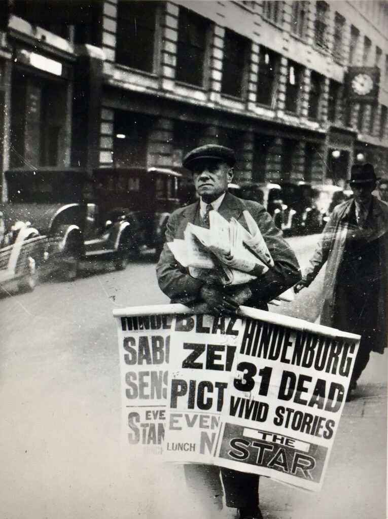
‘Read all about it!’ – 7th May 1937, the day after the Hindenberg disaster. That’s the headquarters of The Daily Telegraph in the background …
The 1980s and ’90s saw the dispersal of the newspaper industry to sites in the Docklands and in other parts of London but some of the old signage remains, next door to St Dunstan-in-the-West …
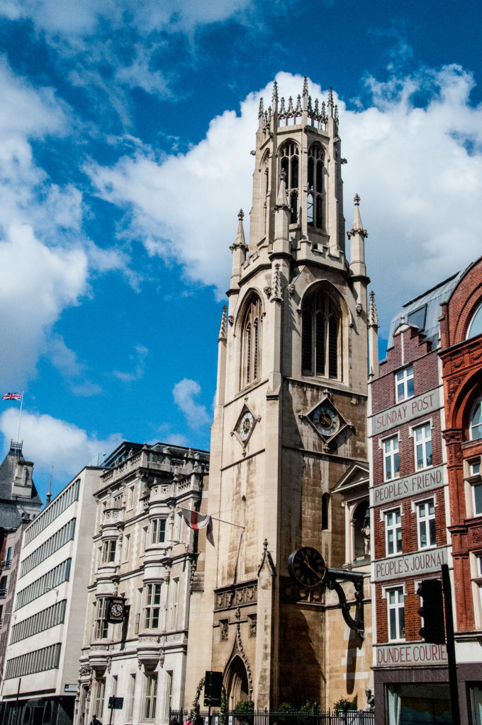
The last journalists left in August 2016 – they worked for the Sunday Post in the office shown in the photograph.
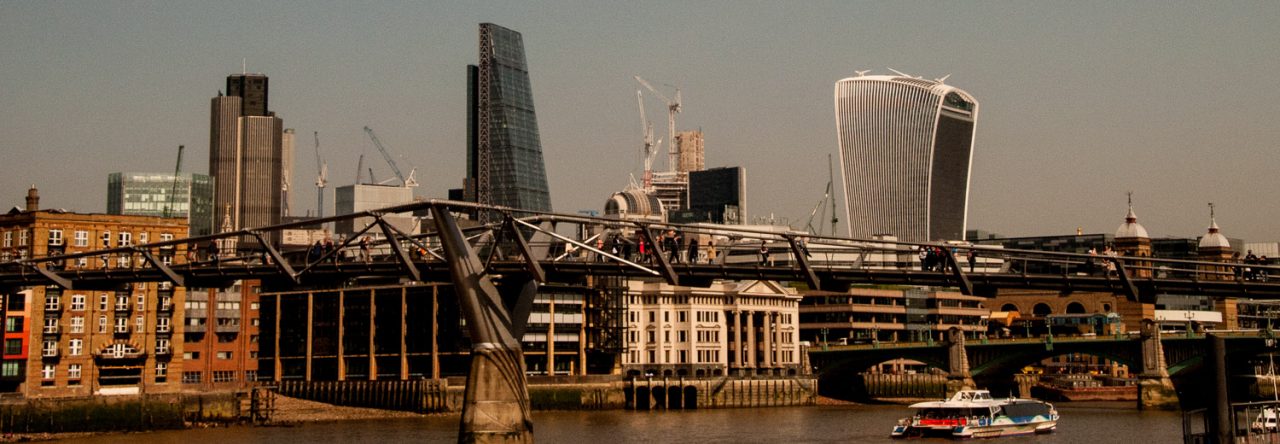
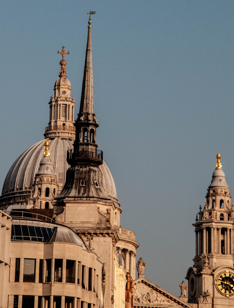
Do pause at the east end of Fleet Street and look up Ludgate Hill. You’ll be enjoying a view that would have been familiar to every denizen of the City since 1710 – the spire of St Martin within Ludgate piercing the sky between the western towers of St Paul’s Cathedral (although the view was obstructed for a while by a railway bridge!) …
I am indebted to the City of London Corporation’s Fleet Street Conservation Area document for many of my sources and will end with a quote from it, written pre-Brexit …
Today, Fleet Street is a vibrant street enhanced by past religious, ceremonial and institutional associations and its links with the newspaper industry, with one of the longest ensembles of pre-war buildings in the City. It is part of the established processional route and the route of the Lord Mayor’s show.
Let’s hope that its full vibrancy will one day return.
I have written about Fleet Street before and here are links to the blogs:
Fleet Street Ghosts – people, buildings and places from the past.
Fleet Street Legends – great newspapermen.
Fleet Street’s Courts, Lanes and Alleys – lots of snippets of City history.
I have also written at some length about the Fleet River under the title Secret & Sacred Rivers.
If you would like to follow me on Instagram here is the link …