Walking the City of London

Category: Roman London Page 3 of 4

Cruise liners and curves – my Barbican architecture tour Part 1

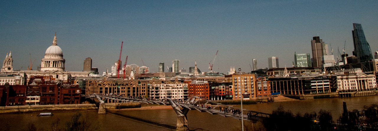
Last week I finally went on a Barbican architecture tour and boy was it fascinating, and as an added bonus has given me enough material for two blogs. If you live or work near the estate, or attend performances here, do please have a look and hopefully you will find it interesting enough to make you want to come and explore. The architects were Chamberlin, Powell and Bon and the Barbican was their Utopian vision and masterpiece.

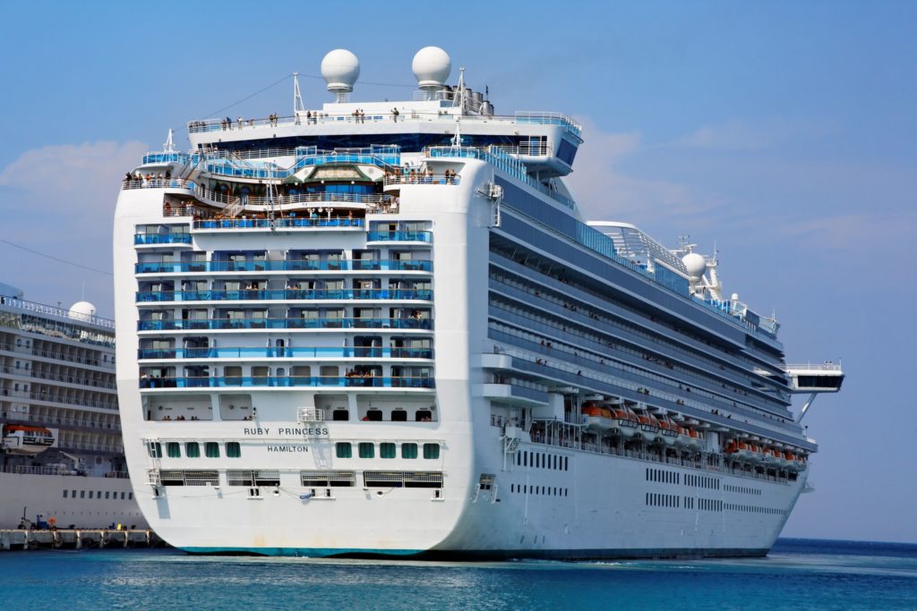
Standing on the terrace by the lake, our attention was drawn to the fact that Defoe House bore a distinct resemblance to a cruise liner bearing down on us …

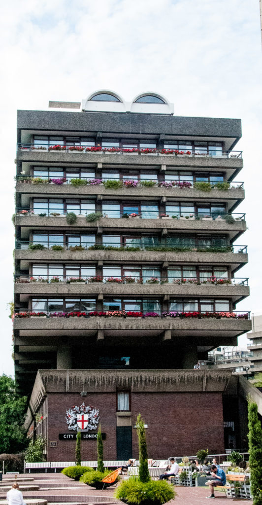
A comparison that became even more apparent as we viewed the building from the north side …

Do you see what I mean?

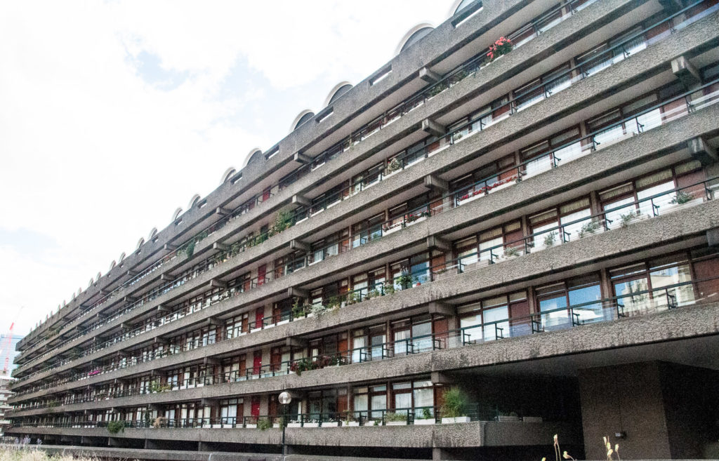
In another maritime allusion, the elegantly curved tips of the cantilevered balconies resemble the hull of a ship …

And don’t these ventilation shafts look like classic ocean liner funnels …

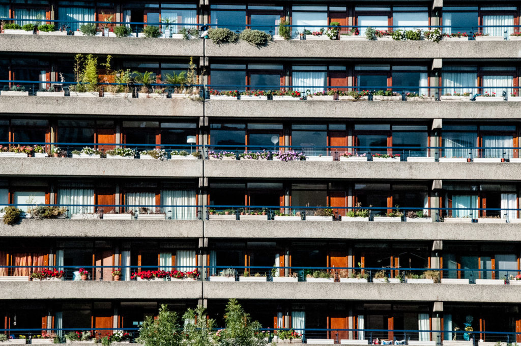
The layout of the apartments was designed to maximize the amount of natural light in the rooms that would most benefit from it. Bedrooms, dining rooms and living rooms are therefore positioned along external walls, while kitchens and bathrooms are placed against inner walls.

In 1963 this ran into a technical problem. The London County Council had recently passed bye-laws requiring all kitchens to have windows or equivalent ventilation. Many of the Barbican kitchens did not have ventilation so a deal was struck. Approval was gained when what had previously been called ‘kitchens’ were instead renamed as ‘cooking areas’ and designated part of the living room. You can read the full fascinating story here in Barbican Living.

There is another maritime connection. To make the kitchens as efficient and space-saving as possible, the architects took their cue from the compact design of boats and brought in Brooke Marine, a firm of yacht designers. A full-size mock-up of a kitchen was erected by the Gas Council, Watson House Research Centre, and was tested by going through the motions of preparing several different kinds of meals.

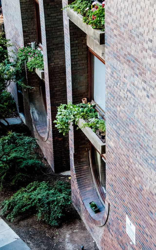
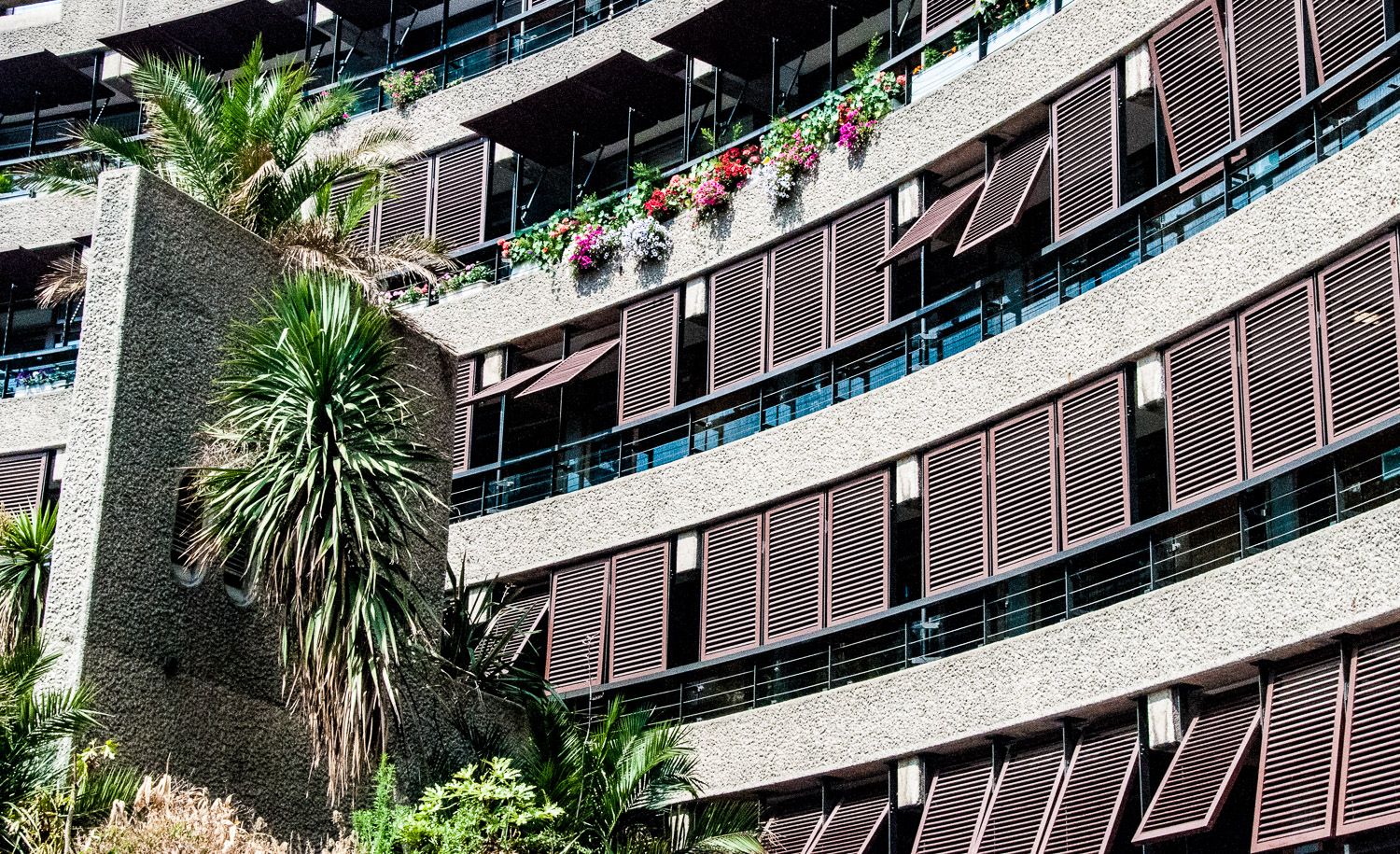
Very good quality hardwood was used for the windows and their surrounds and the wood was painted with clear varnish. The overall effect from a distance is to give a warm honey colour to the buildings …

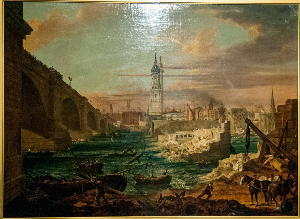
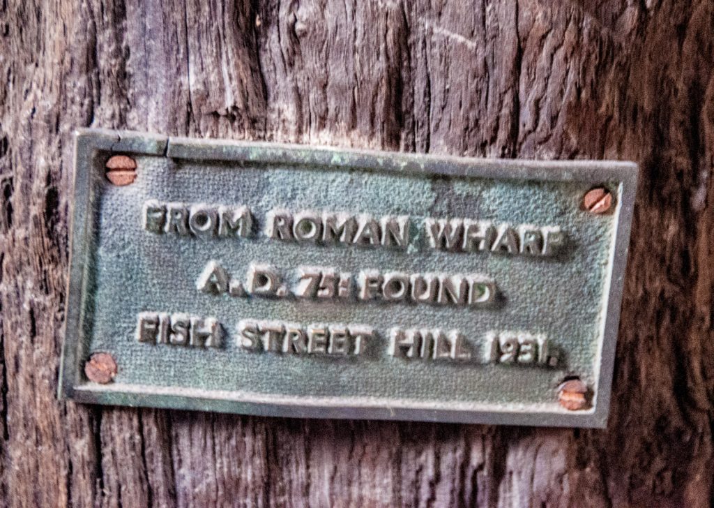
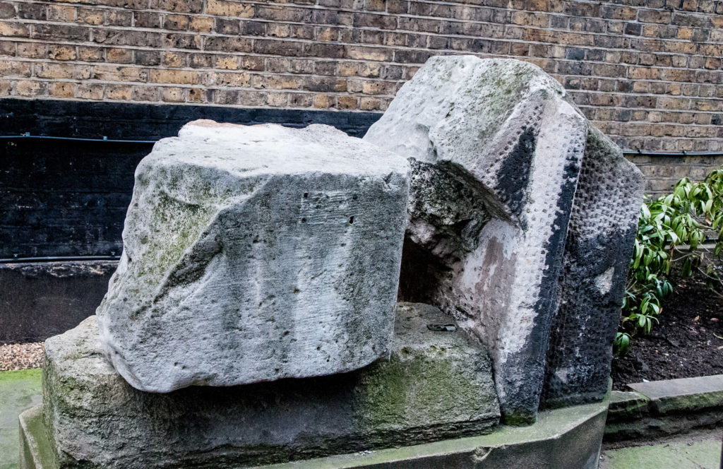
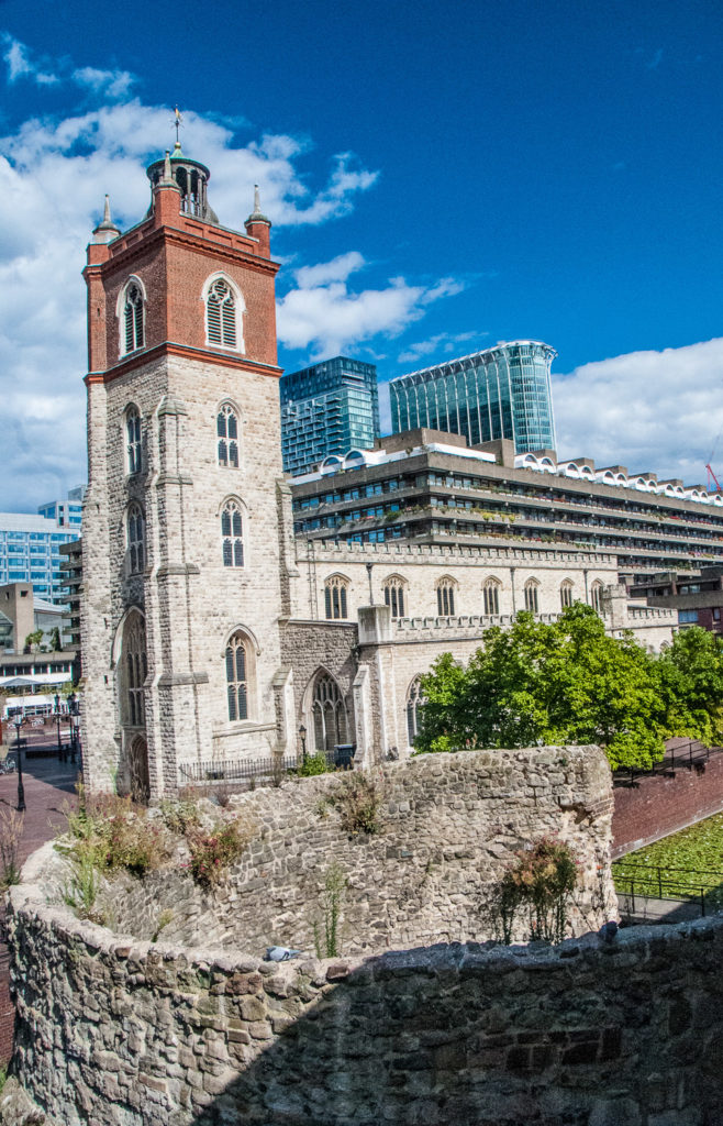
This fragment of the Roman and Medieval wall survived the Blitz …

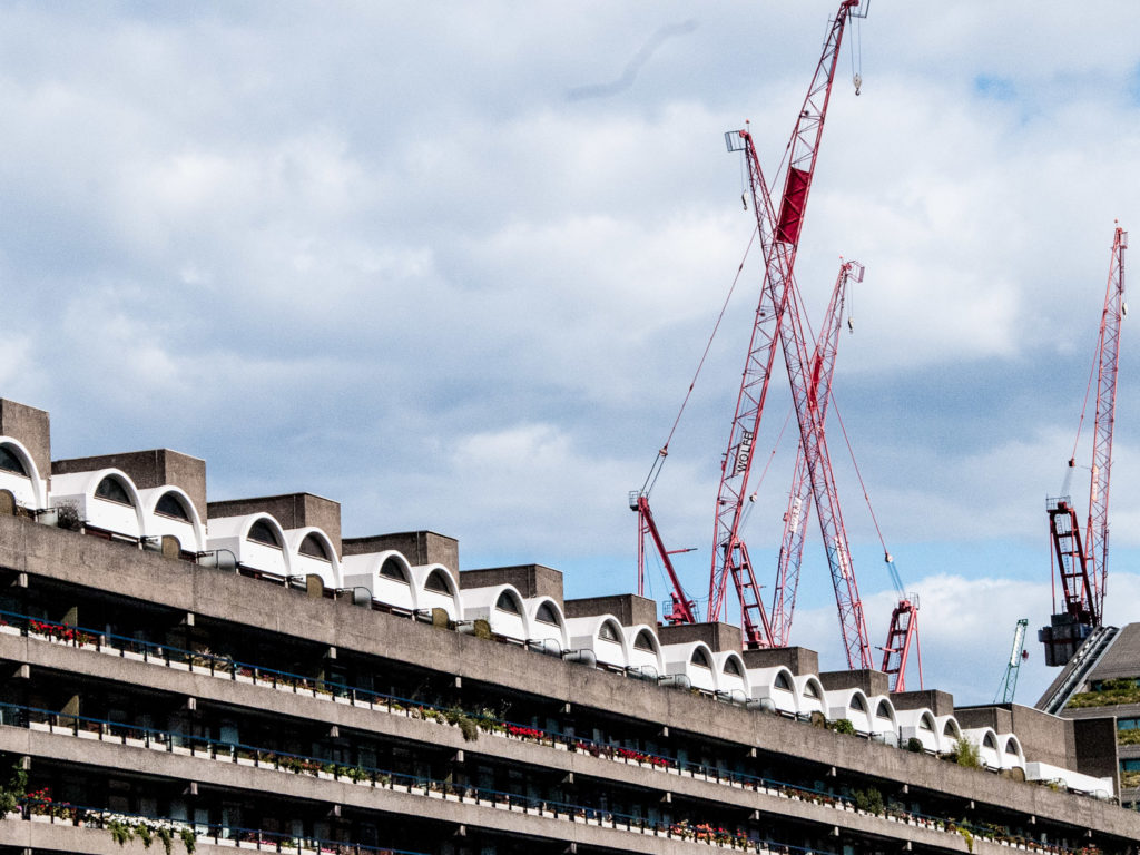
Note the barrel vault roofs of the top floor flats, a feature widely employed in Roman architecture …

I noticed these curving stairs complementing one another …

Part of the site was occupied by railway yards before the wartime destruction. The architects have acknowledged this by inverting the curved brick arches that were once a feature of the area and using them to frame the windows …

The architects loved Venice and cited the canals, bridges and pavements of that city as the model for the pedestrian systems of the Barbican, describing it as ‘the best example of a city where foot and service traffic is completely segregated. This segregation,’ they continued, ‘has worked admirably for many centuries and there is no good reason why the principle should not be applied equally effectively in the City of London’.

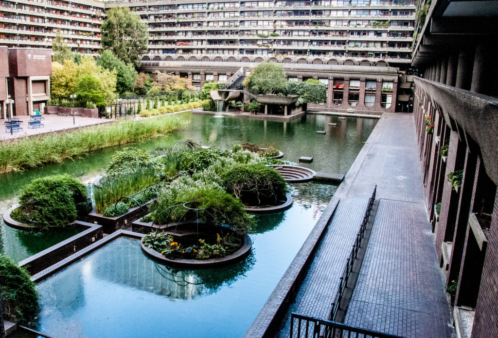
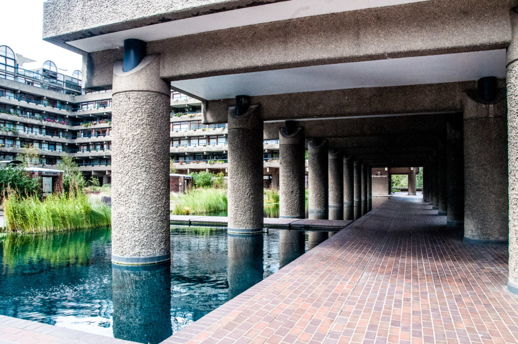
There is lots of water, interesting reflections and great views, like this one from Gilbert Bridge as you approach the Centre entrance. Note the pretty circular ‘igloos’ covered in their Summer plumage …

And the wooden shutters on Frobisher Crescent look like they belong in more sunny climes …

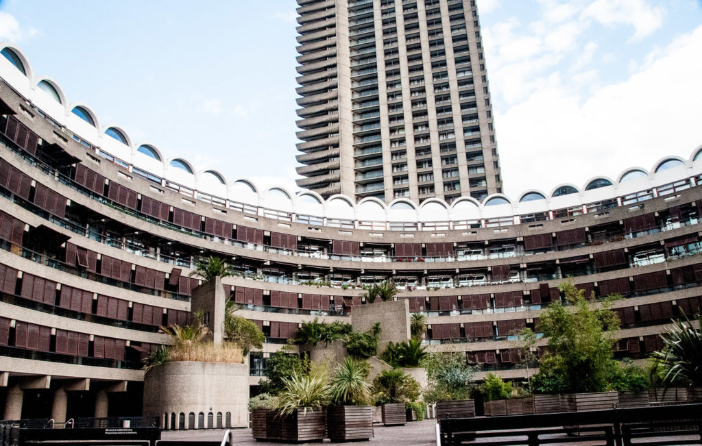
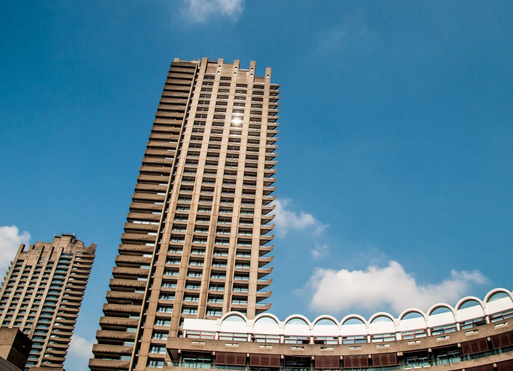
Chamberlin, Powell and Bon’s original plans featured five tower blocks of twenty stories. These designs were rejected by the planning authority, primarily on the grounds that the scheme had insufficient outdoor space. In response, the architects reduced the number of tower blocks to three in order to minimize the buildings’ footprints. At the same time, they more than doubled their height to maintain housing density, making them for many years the tallest residential towers in Europe.

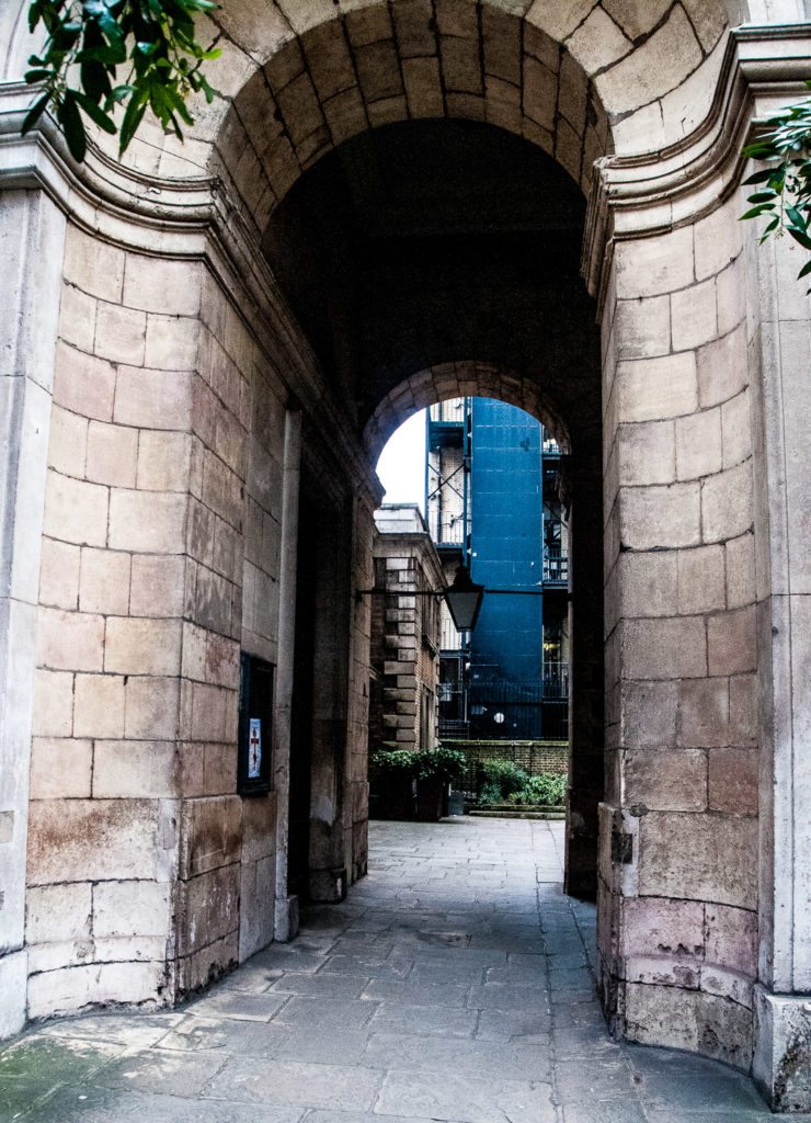
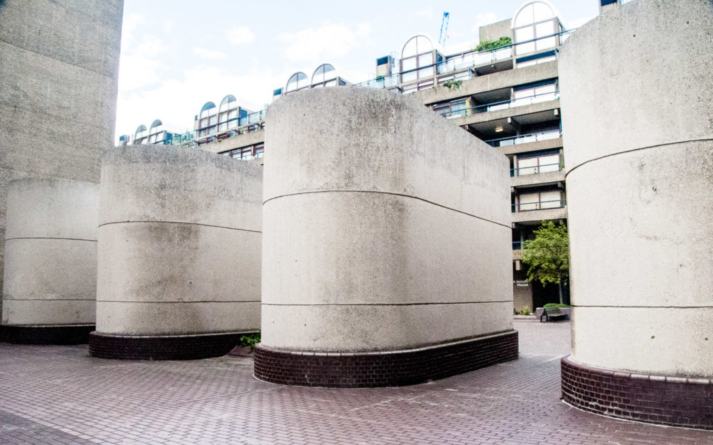
All three tower blocks and the majority of the terrace blocks stand above the podium on piloti, enabling pedestrians to navigate the estate unimpeded by buildings …

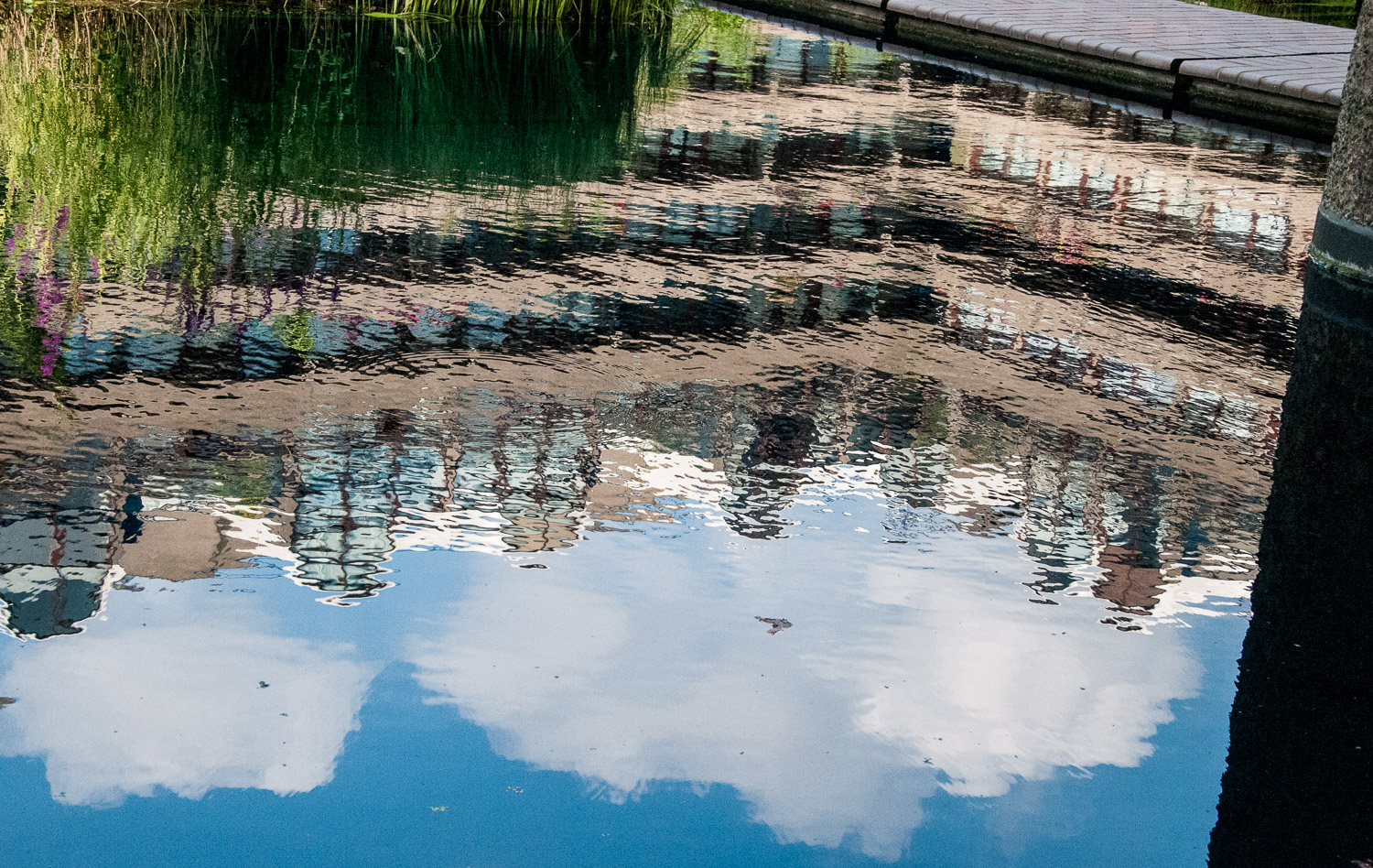
Occasionally you can also catch some interesting reflections …

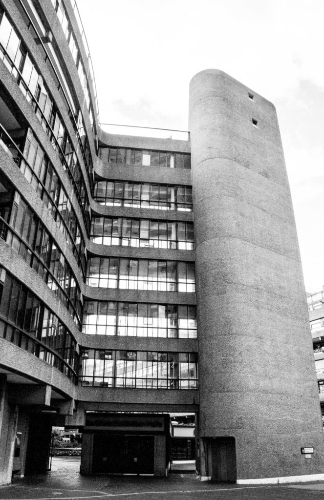
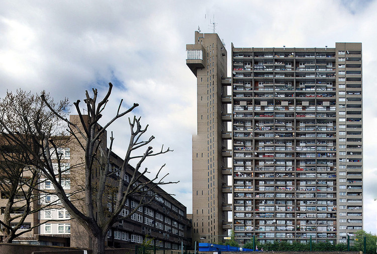
The architects admired, and I believe corresponded with, the Brutalist architect Ernő Goldfinger and liked his idea of separating lifts and services from the main body of buildings. Our guide pointed out this example on the Estate …

Sometimes I think taking images in monochrome works best.

By way of comparison, here is one of Goldfinger’s most celebrated buildings …

Goldfinger’s Trellick Tower in Kensal Town west London – picture copyright ArchDaily

In 1964 the City of London Corporation presented the architects with a revised brief which demanded an expanded theatre and concert hall. The outcome of this was the Barbican Centre, a building which had to be shoehorned into the master plan after construction had already begun.

The theatre, to be used by the Royal Shakespeare Company, required a fly tower to accommodate scenery. The clever solution to disguising this feature above ground was the creation of the second largest conservatory in London after Kew …

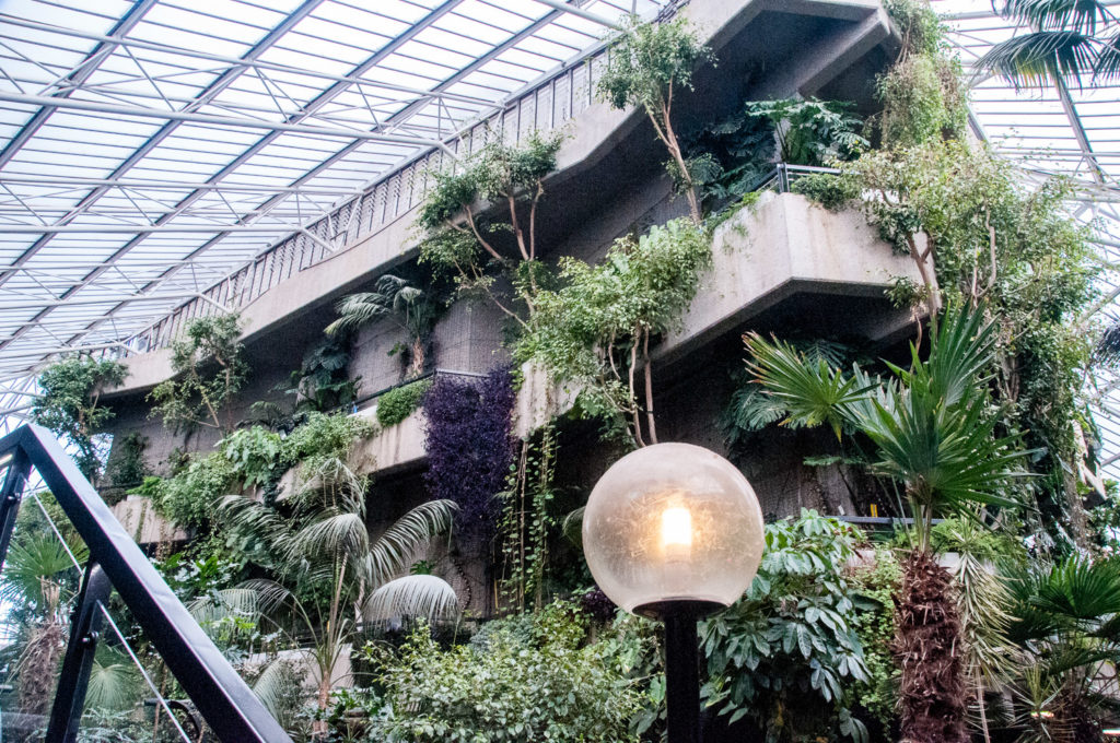
Housing over 2,000 species of tropical plants and trees it a great place to visit. Opening times are limited, however, and it is sometimes closed for private events, so it’s best to check the website first to make sure you can get in.

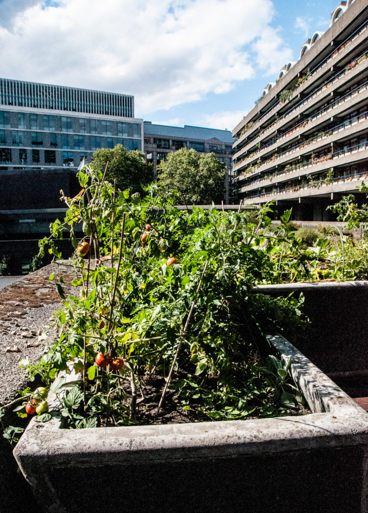
And finally, they might not be exotic, bit I did like the look of these tomatoes that are being cultivated by a resident …

If you want to read more about the architectural history of the Barbican here is a link to an article that I found extremely useful and quoted often in this blog. It’s called AD Classics: The Barbican Estate / Chamberlin, Powell and Bon Architects.

I will be writing more about what I learnt on my tour in next week’s blog, but in the meantime you can find lots more pictures here when I wrote about the Estate and toured the Conservatory in July last year.

If you want to go on a tour (it’s free) here is the link to the website.

Secret & Sacred Rivers

I’m always intrigued by Londoners’ capacity to ignore odd behaviour. For example, I spent a good ten minutes bending over this grating, some of it virtually on my knees, and no one showed the slightest curiosity …

Junction of Greville Street and Saffron Hill (EC1M 3JF)

I was, of course, trying to hear the sound of running water since, directly underneath, runs probably the most famous of London’s ‘lost’ subterranean rivers, the Fleet. Its headwaters are two streams on Hampstead Heath, each of which was dammed into a series of ponds in the 18th century. At the southern edge of the Heath these descend underground as sewers which join in Camden Town. The waters flow four miles from the ponds to the River Thames, just underneath Blackfriars Bridge. Incidentally, it didn’t run down Fleet Street, it merely ran past its eastern, lower end.

This map, showing the route of the Fleet and various other waterways, is on display at the excellent Secret Rivers exhibition at the Museum of London Docklands …

Because of its later reputation, I always had a view that the Fleet where it joined the Thames would be a deeply unpleasant place, so this picture rather surprised me …

This painting (by a follower of Samuel Scott) was obviously influenced by Canaletto, who was based in England until 1755. Looking north across the Thames, it shows the entrance to the Fleet circa 1750 with Bridewell Foot Bridge, the City Wharf and Dock, and Blackfriars Stairs. The Fleet was developed into a canal up to Holborn, lending this view a Venetian appearance. This grand aspect, however, did not last long as the wharves proved unprofitable and Londoners continued to dump their rubbish in the river.

Originally a green river valley, the Fleet River had been gradually transformed into the Fleet Ditch, infamous for being a source of filth, corruption and disease. Observing a flood during a storm in 1710 Jonathan Swift penned the following lines …

Sweepings from Butchers Stalls, Dung, Guts and Blood,
Drown’d Puppies, stinking Sprats, all drench’d in Mud,
Dead Cats and Turnip-Tops come tumbling down the Flood.

Pope made this small literary contribution in 1728 …

To where Fleet Ditch, with disemboguing streams, rolls the large tribute of dead dogs to the Thames.

On display at the exhibition is sad little exhibit. Found during excavations of the old river bed, it’s a dog’s collar with the inscription ‘Tom at Ye Greyhound Bucklersbury’. Poor Tom.

There is a reminder in the exhibition of how muddy and dirty the City’s streets were. This pair of wooden pattens date from the 15th century and were used to protect shoes and raise the wearer above the mud. They have a leather hinge to aid walking …

London’s population grew rapidly through the seventeenth century from about 200,000 to about half a million which resulted in a significant rise in the need for coal. This was brought from the north east of the country in barges which offloaded at wharves in the tidal Fleet. Street names that survive today remind us of this …

And the thoroughfare that ended at the canal, so you couldn’t go any further …

The Fleet Valley from Clerkenwell to the Thames housed many of London’s prisons and all manner of vice was practised in the dingy, stinking claustrophobic rookeries (slums). Nor was there much privacy if you had to go to the loo. This medieval oak three-seater toilet seat was found over cesspit in a yard behind buildings that faced on to modern day Ludgate Hill …

This picture tells a story. It’s an 1841 drawing by Antony Crosby of the Fleet River at Holborn Bridge – note the wooden latrine projecting over the ditch on the left …

Holborn Viaduct was built between 1863 and 1869 in order to span the Fleet and provide level access from east to west – a great improvement in an era of horse-drawn traffic. You can see it reaches over a deep valley …

Looking north whilst standing on what was the bank of the old Fleet canal.

When I climbed the stairs to take a picture from above a curious City dragon popped his head up to see what I was doing …

Gradually the entire river was enclosed in Victorian sewer tunnels and it now flows into the Thames under Blackfriars Bridge (just below where the banker Roberto Calvi was found hanged in 1982) …

Rivers, such as the Thames and the Walbrook, influenced where the Romans founded Londinium and the Museum of London exhibition also illustrates the fact that our connection to water goes beyond the practical, reaching into the spiritual. While most objects found in London’s rivers are lost items, rubbish or remnants of river-related activities, some cannot be explained so easily. These bear witness to the spiritual importance of rivers.

On display, for example, is this first or second century AD small representation of a river god, possible Neptune, apparently cast or placed into the Walbrook …

And this piece of a marble offering is particularly fascinating …

The inscription has been translated thus:

To the Divinities of the Emperors (and) to the god Mars Camulus. Tiberinius Celerianus, a citizen of the Bellovaci, moritix, of Londoners the first …

It is the first example from the capital to use the word Londiniensi or ‘Londoners’. The language suggests a man who hailed from northern France and probably traded or travelled regularly within that region but whose home seems to have become London.

If you want to read more about Roman London I have written three earlier blogs on the subject: The Romans in London – Mithras, Walbrook and the Games, The Romans in London … and two Roman ladies and The Roman Wall revisited.

The Museum of London Docklands exhibition runs until 27th October this year. I highly recommend it.

The bridges of London Bridge – Part 1

When I discovered that, at one time, the London Bridge authorities employed a Keeper of the Heads I was inspired to write about the many reincarnations of London Bridge since the Romans built the first crossing about AD 50. The relationship between the bridges and London is fascinating and so I want to do it justice with two blogs.

There is an artist’s impression of Roman London, including the bridge, on display at the Guildhall Art Gallery …

The picture reflects the fact that the river was very much wider then (about five times what we see today) and consequently much shallower. The bridge was probably built of oak and, being the only fixed crossing below Staines, it became a major contributor to the prosperity of London which soon replaced Colchester as the Roman capital.

The earliest written reference to the bridge (Lundene brigce) appears in the Anglo-Saxon Chronicle of AD 984 when mention is made of a woman being taken there to be drowned for witchcraft. From 1176 a new stone bridge was constructed under the leadership of a cleric, Peter of Colechurch, and was to last for well over 600 years.

This painting by Samuel Scott (1702-1772) gives some idea of what the bridge looked like around the middle of the 18th century. People in the houses had a magnificent view and could fish from their windows as the buildings overhung the water by several feet. In the mid-1750s, the naturalist Thomas Pennant also observed that …

People living on the Bridge soon grew deaf to the noise of the falling waters, the clamours of the watermen, or the frequent shrieks of drowning wretches.

Copyright Corporation of London – Guildhall Art Gallery

Do pop into St Magnus-the-Martyr on Lower Thames Street (EC3R 6DN) and have a look at this splendid model of the Bridge (a photo really doesn’t do it justice) …

The bridge was supported by 18 boat-shaped ‘starlings’. These effectively blocked half the river and tidal surges and the build up of waste made the current notoriously uneven. The drop in water level could be as much as eight feet and navigating the arches was known as ‘shooting the bridge’. Wary passengers would alight on one side and be picked up by their boat on the other – assuming their waterman had not drowned, which many of them did, hence the 1670 saying …

London Bridge was made for wise men to pass over, and fools to pass under.

Such was the proliferation of buildings, people crossing the bridge for the first time (which could take an hour) often did not realise they were not in a normal street. At some points it was only twelve feet wide.

I have to mention the heads.

Beheading was a common form of execution at the time and reserved for higher-born individuals since it was swifter and less barbaric than hanging or burning at the stake. Heads also became available when individuals suffered the terrible death of being hanged, drawn and quartered (usually for high treason).

From ‘Visscher’s Panorama1616

Between 1305 when the first head was placed atop a pike over the Drawbridge Gate, and 1678 when the practice was stopped, there was a near-permanent display of decapitated heads grinning down from their spikes that pedestrians would have passed beneath. There was a plentiful supply, a visitor in 1592 counted 34 ‘heads of persons of distinction’.

The first head to be displayed in this way was the Scottish patriot and rebel William Wallace in 1305 after he had been hanged, drawn and quartered at Smithfield. The Bridge authorities employed a Keeper of the Heads who maintained security since relatives of the deceased were often desperate to reclaim the head in order that it could be reunited with the body (thereby restoring the immortal soul). When the flesh had rotted away the Keeper usually tossed the skull into the river.

I am indebted to the historian Heidi Nichols for her research – read her full article here.

The width of the river, its slow current, and the obstruction caused by London Bridge all contributed to the river frequently freezing over for two months at a time. This enabled the famous Thames Frost Fairs whose heyday was during the Little Ice Age between the 17th and early 19th Century (although the river had frozen before – Henry VIII travelled the river from Westminster to Greenwich by sleigh in 1536).

This picture, The Thames During the Great Frost of 1739, shows the Frost Fair in the foreground and figures inspecting the incomplete piers of Westminster Bridge on the right. In the distance is a view of the City of London including St Paul’s Cathedral and spires of the City churches …

Painting by Jan Griffier the Younger (1688-1750) at the Guildhall Art Gallery. It was reported that ‘The Thames floated with rocks and shoals of ice; rising everywhere in hillocks and huge rocks of ice and snow‘.

Between 1607 and 1814 there were a total of seven major fairs. There were football pitches, bowling matches, fruit-sellers, shoemakers, barbers… even a pub or two. To keep the shopkeepers warm, there were even fires within their tents. During the four days of the final 1814 Fair an elephant was led across the river below Blackfriars Bridge.

A Frost Fair in full swing (from the Londonist blog) …

The fairs ended as the weather became warmer and their possibility finally eliminated when the old London Bridge was demolished in 1831.

Demolition of Old London Bridge as seen from the Southwark side 1832 Guildhall Art Gallery

I will write about the bridges that subsequently replaced it next week.

In the meantime, if you visit St Magnus, pause outside for a few minutes. Firstly, you will be standing on the pedestrian approach to the old bridge …

And under the arch you will see this piece of wood …

Two remnants of the medieval bridge sit within the church gardens; originally part of the bridge’s northern archway, these stones now lie unmarked …

My next blog about the bridges will take us up to the present day.

Page 3 of 4

Powered by WordPress & Theme by Anders Norén