Symbols & Secrets

Walking the City of London

Resurrection! More tales from City Lanes, Courts and Alleys

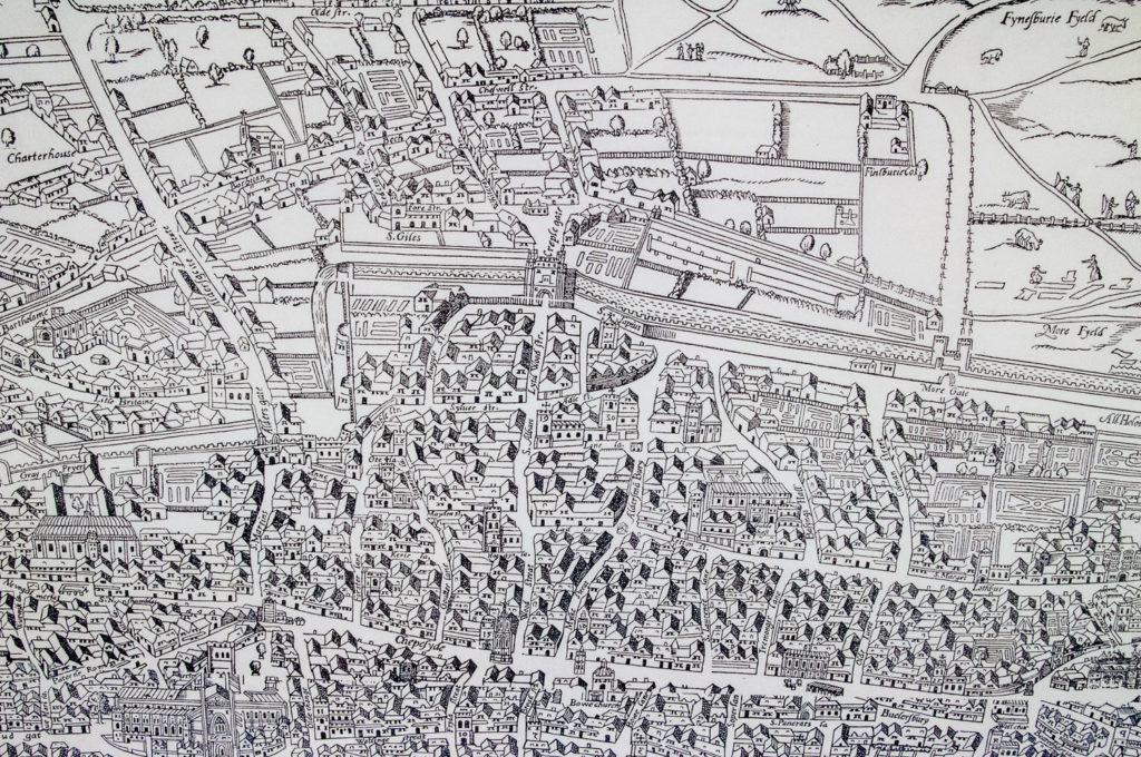
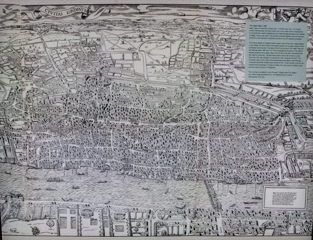
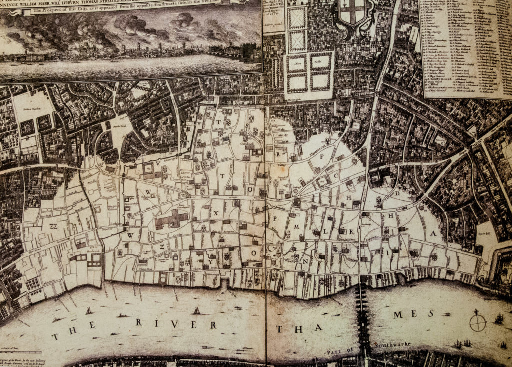
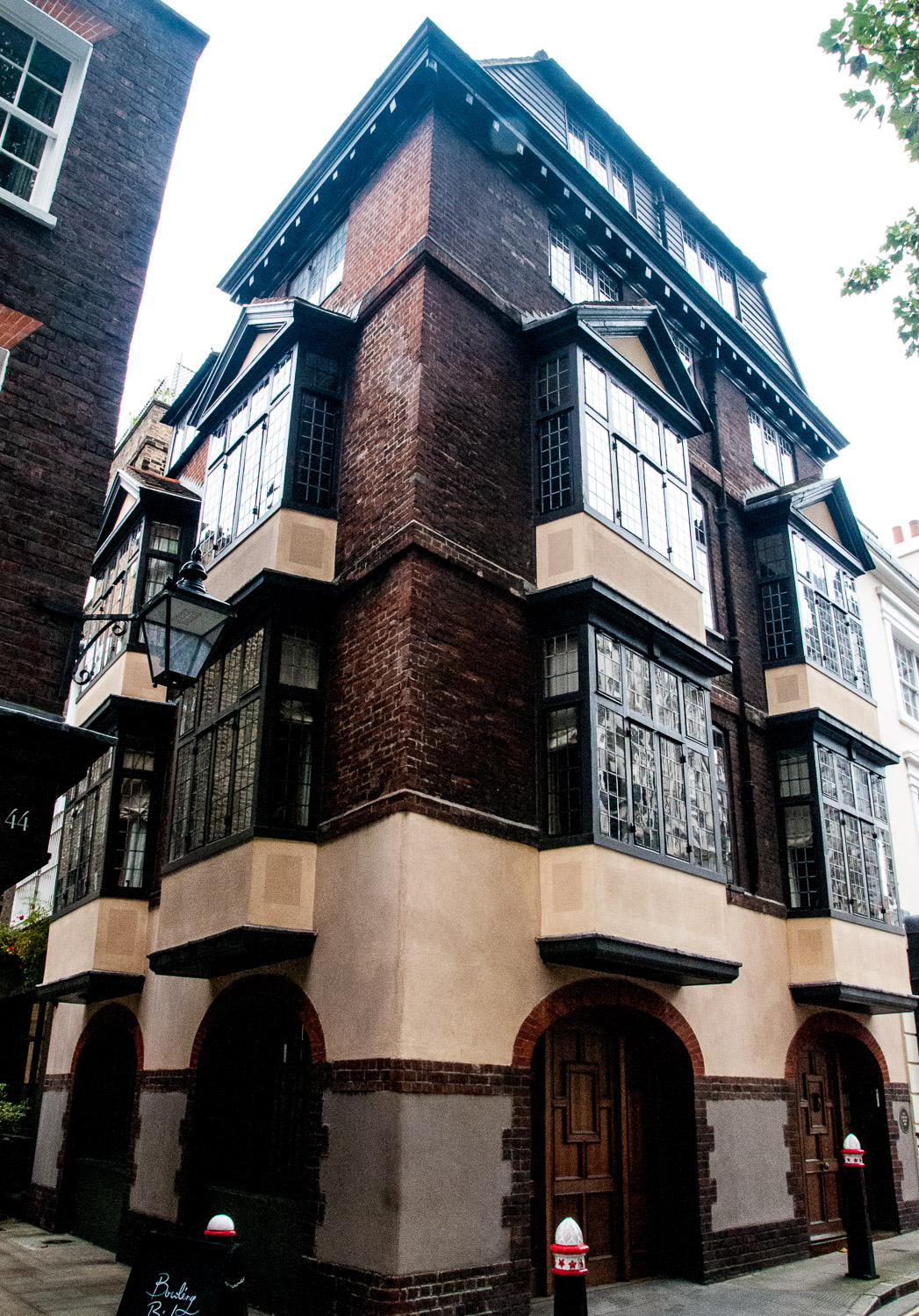
Lovat Lane, which runs between Eastcheap and Lower Thames Street, reminds one of the old City with its cobbled surface and narrow winding shape …

St Mary-At-Hill EC3R 8EE

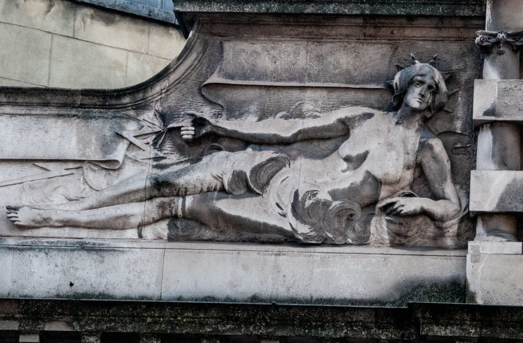
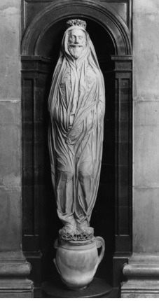
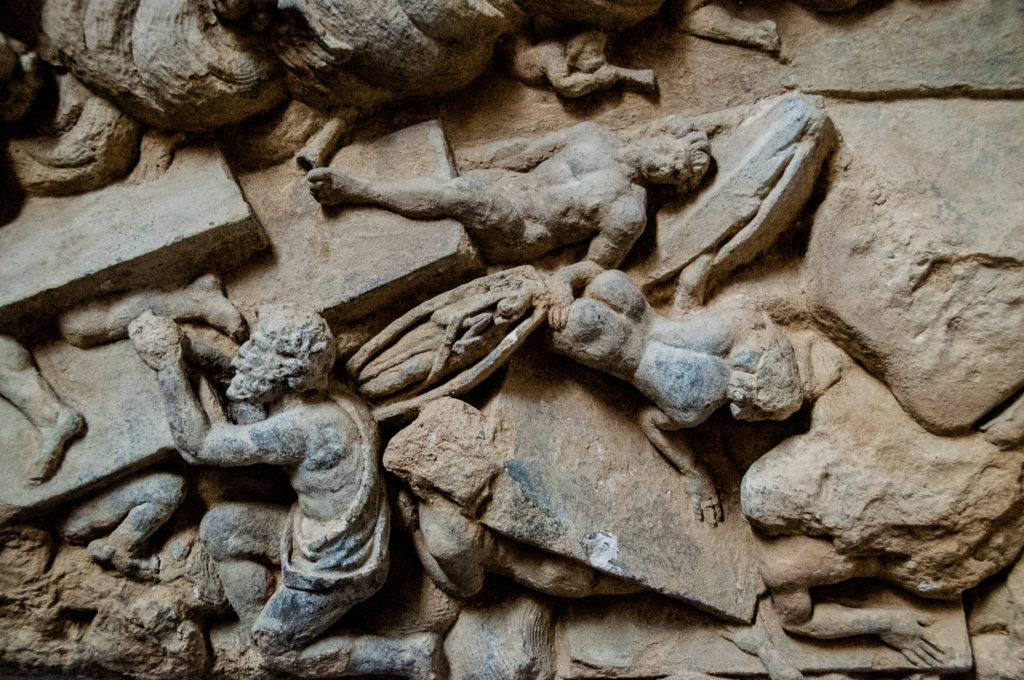
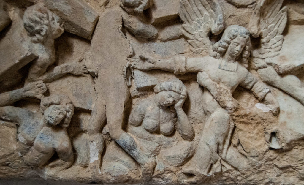
If you pop into St Mary-At-Hill church you will immediately encounter on your left this extraordinary representation of Resurrection on the Day of Judgment …

Christ holding a banner stands amidst clouds. Satan, a figure with large claws, is being trampled under his feet

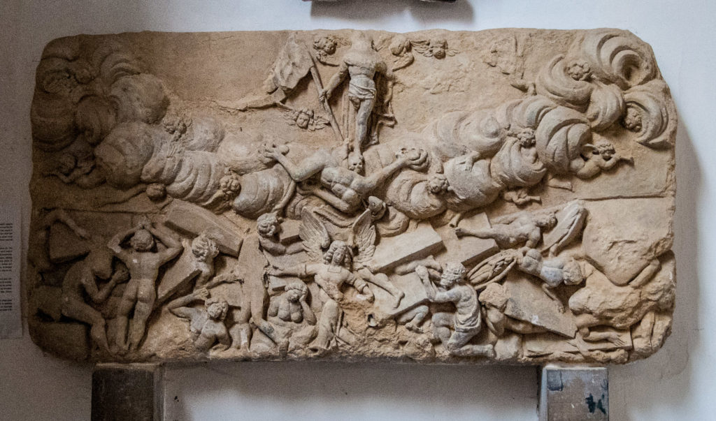
It’s a very unusual example of late 17th century English religious carving and most likely dates from the 1670s. Its carver is unknown, but it is known that the prominent City mason Joshua Marshall was responsible for the rebuilding of the church in 1670-74 and his workshop may have produced the relief.  Exactly where it was originally positioned is uncertain; most likely it stood over the entrance to the parish burial ground and was brought inside in more recent times.

You can see open coffins among the chaos
The winged Archangel Michael helps people rise again

If you visit the little churchyard you will see evidence of another form of resurrection …

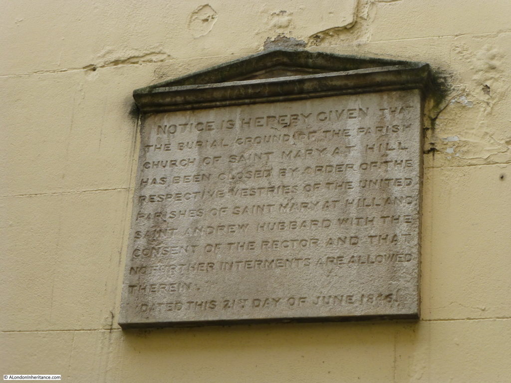
A plaque on the wall informs us that ‘the burial ground of the parish church of St. Mary-At-Hill has been closed by order of the respective vestries of the united parishes of St. Mary-At-Hill and Saint Andrew Hubbard with the consent of the rector and that no further interments are allowed therein – Dated this 21st day of June 1846’. Following closure, all human remains from the churchyard, vaults and crypts were removed and reburied in West Norwood cemetery. You can read more on the excellent London Inheritance blog.

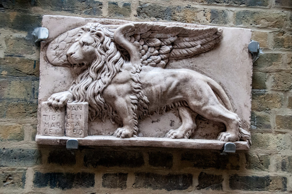
I spotted this splendid winged lion outside number 31 – placed their by the owners of the Salotti 31 restaurant …

The St Mark Lion is the symbol of Venice, where the restaurant owners come from

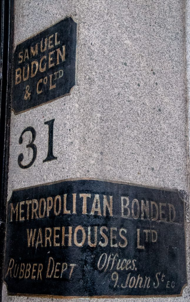
And there are some nice ghost signs …

Walking along Old Jewry last week I noticed this little courtyard …

26 Old Jewry EC2R 8DQ

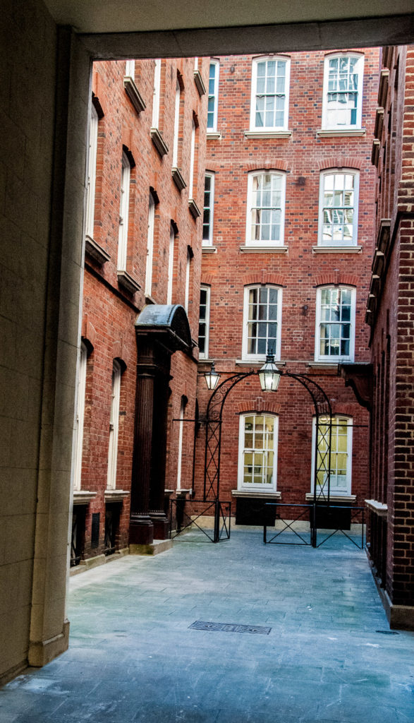
Tucked away behind locked gates is what was once the City of London Police Headquarters (the Old Jewry address gave the force its former radio call sign of ‘OJ’). They originally moved there in 1842 but this building, in neo-Georgian style, was constructed between 1926 and 1930. The police moved out, to Wood Street, in 2001.

There are two alleys off Bishopsgate that are quite easy to miss but reward investigation. The first I explored was Swedeland Court (EC2M 4NR) …

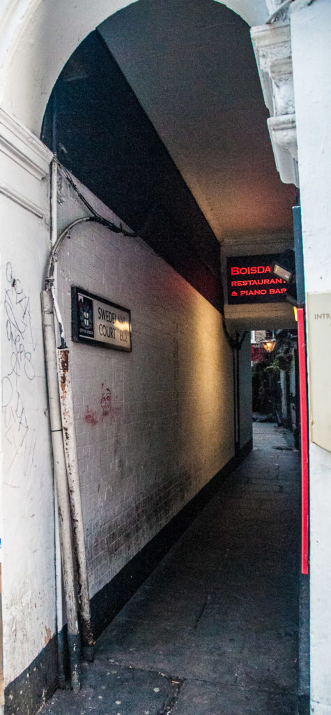
I can’t find out why it’s called Swedeland Court (or why it’s a ‘court’ and not an ‘alley’). At the end is the interesting Boisdale Restaurant. It’s worth walking to the end and looking back towards the street as there are some charming old lamps and it’s very atmospheric …

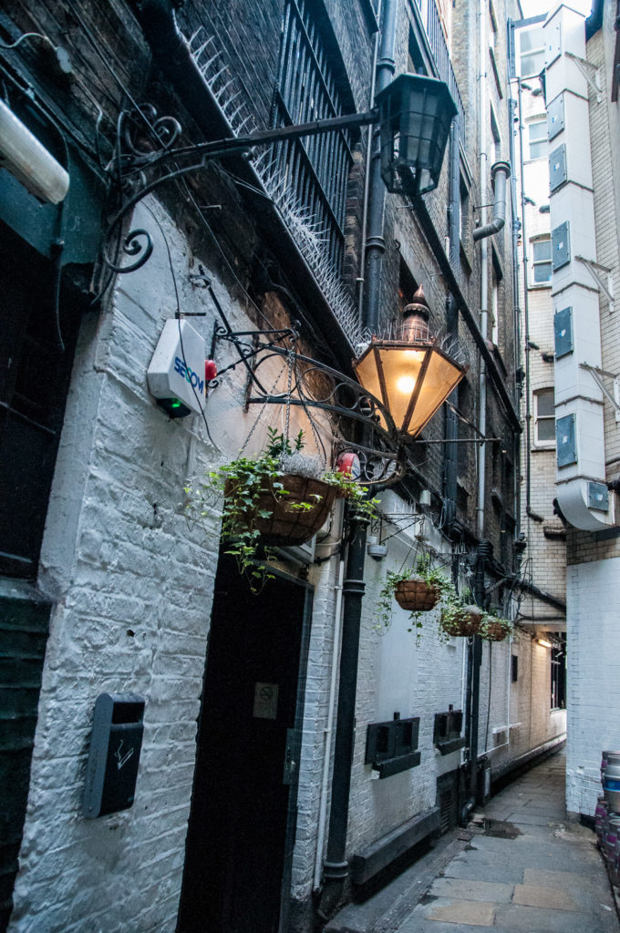
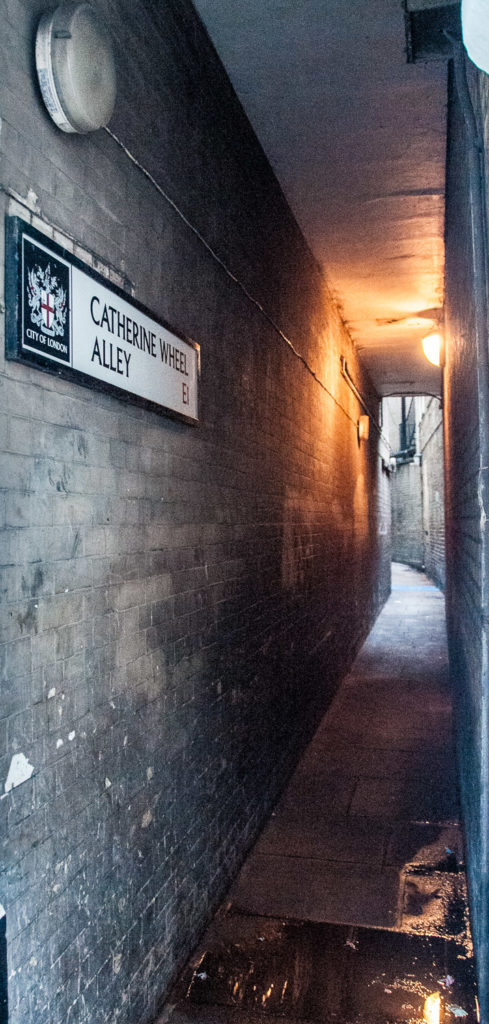
Nearby is the rather uninviting looking Catherine Wheel Alley which will eventually lead you to Middlesex Street …

I entered with some trepidation

Looking back you get the true canyon effect …

The Catherine Wheel pub stood here for 300 years until it burned down in 1895. It’s said that the name was changed at one point to the Cat and Wheel in order to placate the Puritans who objected to its association with the 9th century saint. It’s also claimed that the highwayman Dick Turpin drank here, but if he drank in every pub that has since claimed a connection he would never have been sober enough to ride a horse.

When I worked near here in the 1970s it was always a pleasure to walk through this covered passage since the enclosed area was redolent with the aroma of spices, once stored here in the heyday of London Docks. It had the nickname ‘Spice Alley’ …

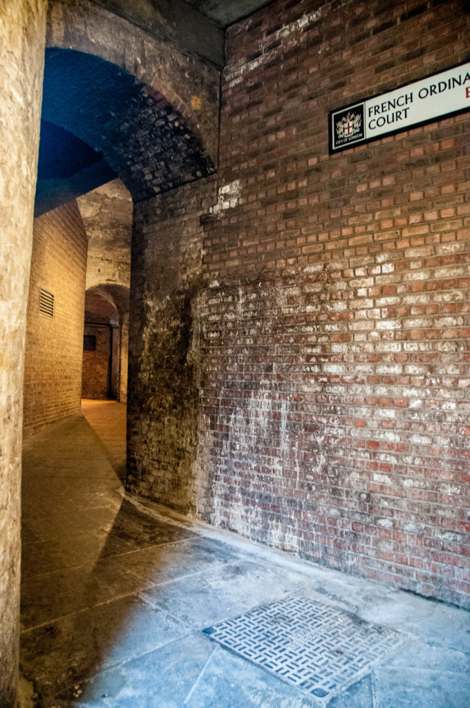
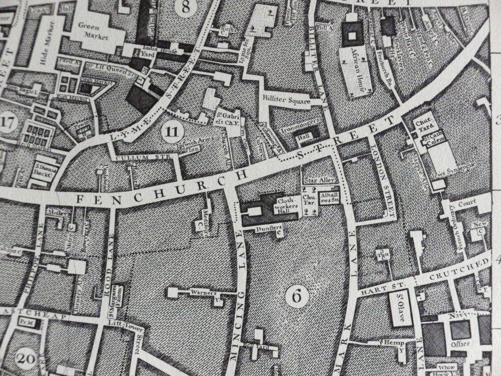
The pathway from Fenchurch Street (just beside the East India Arms EC3M 4BR) leads to Crutched Friars and by the time of Rocque’s map of 1746 it had acquired the name French Ordinary Court …

John Rocque’s map of 1746

The lane itself dates from the 15th century and perhaps even earlier. It was further enclosed in the 19th century as Fenchurch Street railway station was constructed above, transforming it into a cavernous passage.

Looking towards Crutched Friars

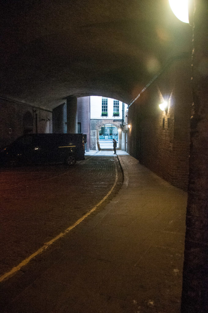
When you emerge, cross the road and look back …

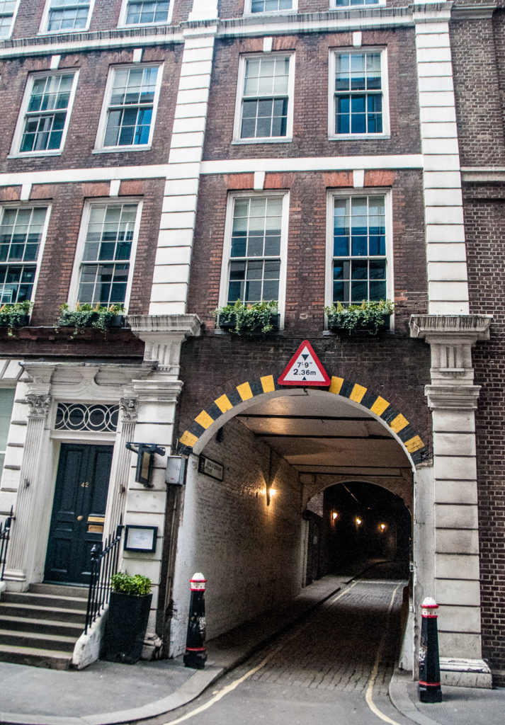
The Court was named for the fact that, in the 17th century, Huguenots were allowed by the French Ambassador, who had his residence at number 42 next door, to sell coffee and pastries there. They also served fixed price meals and in those days such a meal was called an ‘ordinary’.

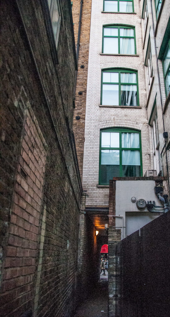
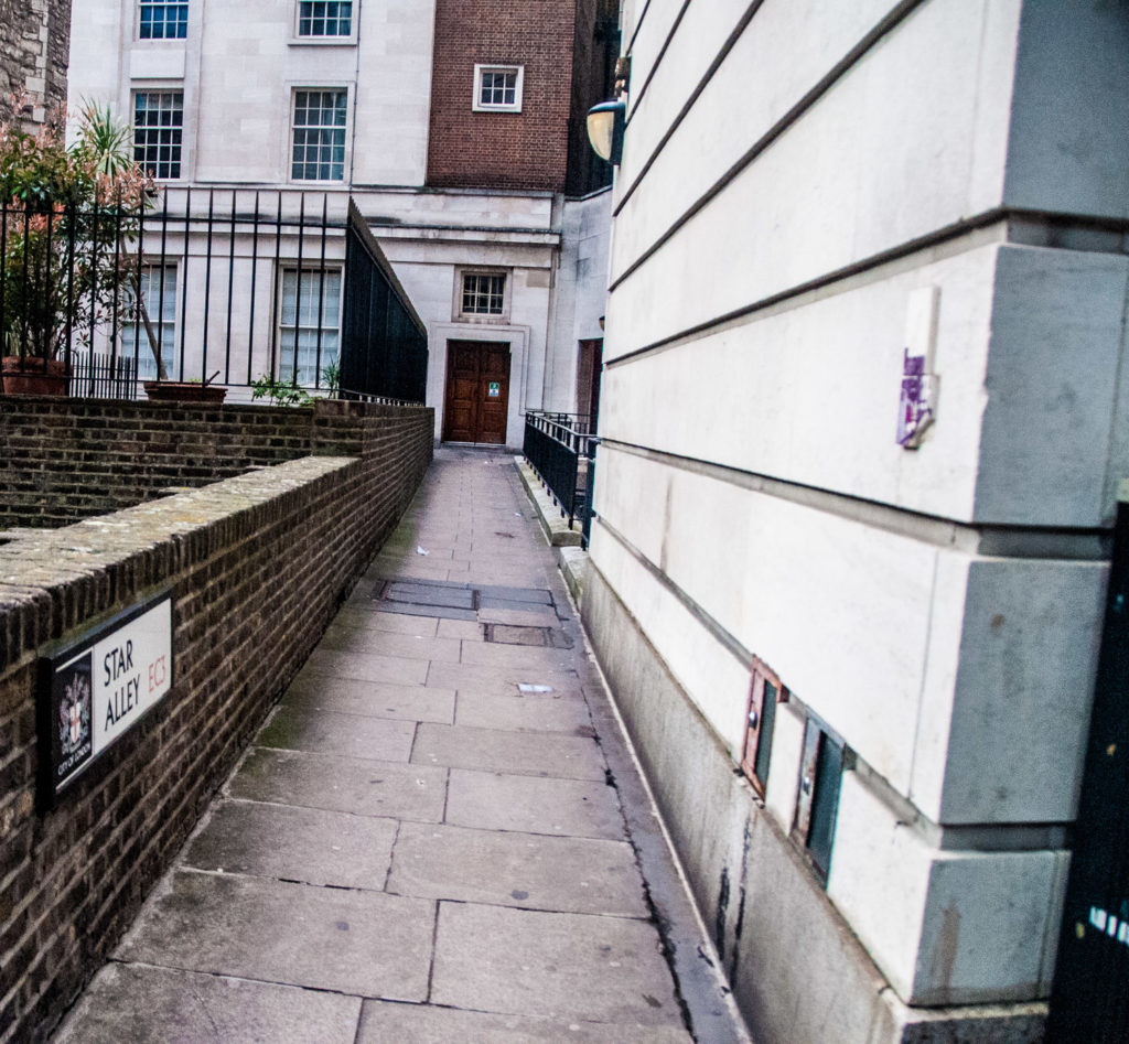
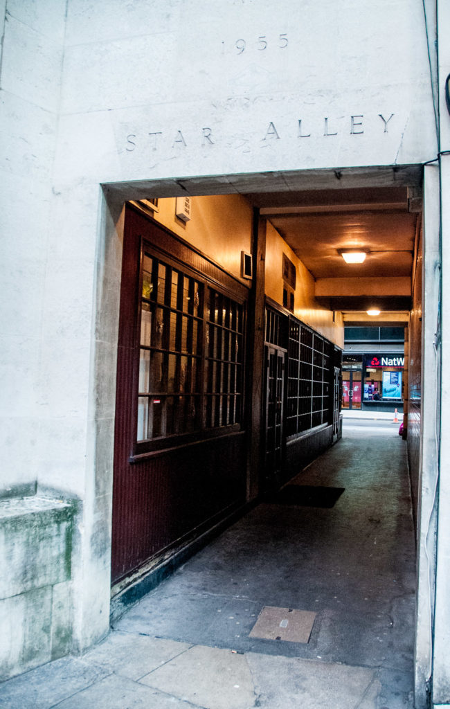
Star Alley (EC3M 4AJ) links Mark Lane with Fenchurch Street and you can also find it on Rocque’s map …

The view from Mark Lane

On the left is the tower of All Hallows Staining …

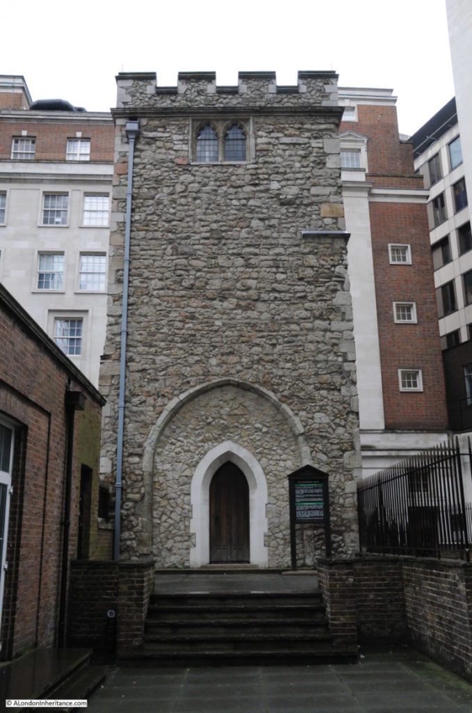
First mentioned in the late 12th century, ‘staining’ meant it was made of stone unlike other City churches which were made of wood. It was rebuilt in 1674 after collapsing four years earlier (possibly because of too many burials near the building). You can read more about it here in the London Inheritance blog.

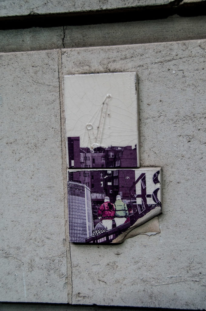
I found a few odd things here. These mysterious tiles, which look quite modern, have what I think are construction workers in the foreground and a tower crane in the background …

They are nowhere near number 48 or 43


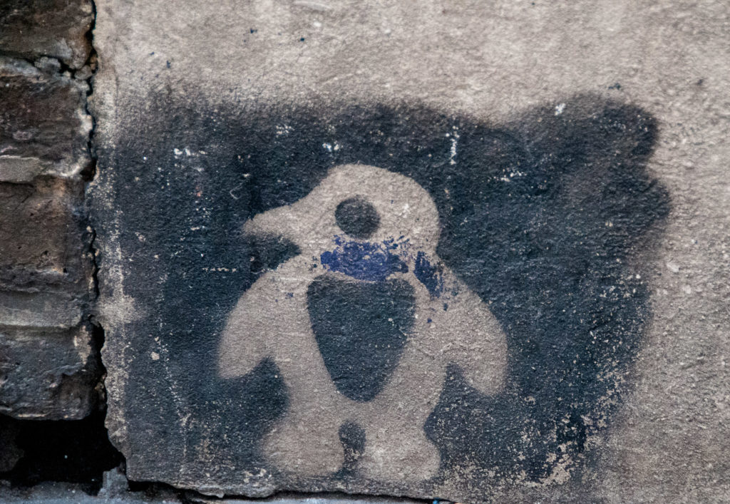
And this spooky little alien character …

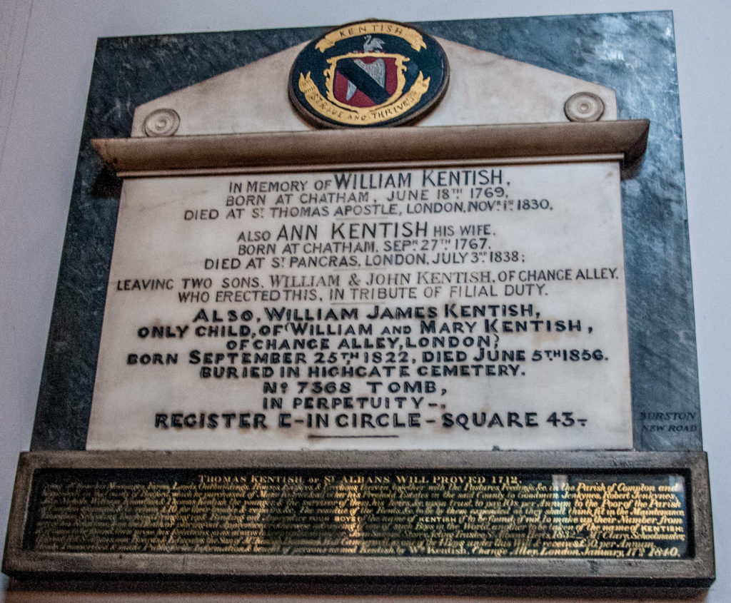
There is one grave left in the graveyard …

The marker for the grave of John Barker (d 179?), his wife (d 1831) and their son Robert (date of death illegible)

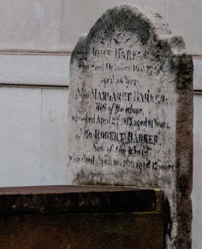
Unfortunately I have not been able to find out more about the family.

As you look towards Fenchurch Street, you can see the date of the post-war building inscribed above the entrance …

The wooden facade of the restaurant makes it look much older

Finally, there is also an edition of Spitalfields Life dealing with City Alleys – you can access it here. This is my favourite picture from it …

‘Hello, hello, hello …’

St Mary Woolnoth – a lucky survivor

The church of St Mary Woolnoth has been lucky twice.

A masterpiece by Wren’s brilliant protégé Nicholas Hawksmoor, it was built between 1716 and 1727 in the English Baroque style. Amazingly, it was scheduled for demolition in 1898 in order to facilitate the construction of Bank Underground Station. A public outcry put a stop to that and a compromise was reached. The crypt was cleared and the extended area under the church became the Underground ticket office – the church authorities collected a whopping £170,000 in compensation.

It was lucky a second time around during the Second World War which it survived unscathed …

Bank Underground Station, January 11th 1941 – a near miss for the church

First recorded in 1191, it has an unusual name. The founder may have been a Saxon noble, Wulfnoth, or alternatively, the name may be connected with the wool trade. Certainly this was true of the nearby church of St Mary Woolchurch Haw, destroyed in the Great Fire of 1666 (its parish then united with that of St Mary Woolnoth).

The most celebrated priest associated with the church was John Newton (1725-1807)…

Born the son of a master mariner in Wapping, he spent the early part of his career as a slave trader. From 1745-1754 he worked on slave ships, serving as captain on three voyages. He was involved in every aspect of the slaver’s trade, and his log books record the torture of rebellious slaves. Following his conversion to devout Christianity in 1748 he eventually became rector here in 1780. In the church is his memorial tablet, which he wrote himself beginning …

John Newton, Clerk, once an infidel and libertine, a servant of slaves in Africa …

In 1785, he became a friend and counsellor to William Wilberforce and was very influential himself in the abolition of slavery. He lived just long enough to see the Abolition Act passed into law. Think of him also when you hear the hymn Amazing Grace, which he co-wrote with the poet William Cowper in 1773.

The outside of the church is very unusual and it has a fine position on the corner of King William Street and Lombard Street, just off the major Bank road junction (EC3V 9AN). The clock is mentioned in a famous poem which I shall refer to later …

The gate to the church bears the coat of arms of the Diocese of London …

These cherubs once used to gaze at me as, when I worked nearby, I went down the steps to the station on my way home …

The small, square, tranquil interior was regarded by Simon Jenkins as the ‘most remarkable in the City, the majesty it conjures from a limited space’ ..

At each corner are a group of three great Corinthian columns …

Monuments other than the one to Newton include this one to William Kentish …

The plaque, in the shape of the end of a chest tomb, incorporates a bright coat of arms with the motto ‘Survive and thrive’. William’s grandson was buried in Highgate Cemetery and the plaque describes where to find his resting place. Beneath is a note of the will of Thomas Kentish of St Albans (died 1712) which arranges for the education etc. of four boys, ideally named Kentish.

This panel was erected in memory of Thomas Lloyd, the man who started the famous coffee house, which eventually led to the Corporation of Lloyd’s …

The miniature coat of arms at the top is held by two tiny lions and, although it was placed here only in 1931, to me it does look appropriately 18th century.

The stunning, bulging pulpit dates from Hawksmoor’s time and Newton delivered his sermons from it. It was made by Thomas Darby and Gervaise Smith …

The inlaid sunburst marquetry by Appleby is sublime …

In the corner sits this clock mechanism surrounded by a cover on which is etched an extract from T.S. Elliott’s poem The Wasteland

Elliott worked nearby and, having watched the commuters trudge over London Bridge, wrote …

A crowd flowed over London Bridge, so many,
I had not thought death had undone so many.
Sighs, short and infrequent, were exhaled,
And each man fixed his eyes before his feet.
Flowed up the hill and down King William Street,
To where Saint Mary Woolnoth kept the hours
With a dead sound on the final stroke of nine.

No doubt if you were not at the office by the ‘final stroke of nine’ you were going to be late.

And finally, have you noticed these figures around the corner from the church in King William Street?

I used to think they were connected to the church but I was mistaken. They were, in fact, created in 1899 to enhance the entrance to the Underground Station. Bank was the terminus of the City and South London Railway – the first deep level ‘tube’ in London and, indeed, the world and the first to use electric locomotives.

Appropriately, the lady on the left represents electricity …

She wears a spiked crown, is surrounded by thunder clouds and shoots lightning bolts from her extended finger.

Mercury reclines on the right …

He represents Speed. He is wearing his winged hat and sandals and holding a caduceus. The architect was Sydney Smith who designed the Tate Gallery at Millbank and the sculptor Oliver Wheatley.

By the way, if you travel to the church by Underground, as you climb the stairs to the street take a moment to admire these fearsome dragons by Gerald Laing …

… and if you think the Tube is claustrophobic now, the original City & South London railway carriages had no windows because ‘there was nothing to see’. Here is a drawing from an 1890 edition of the Illustrated London News …


The City before the Great Fire

Just suppose you could go back in time and were approaching London from the north in Tudor times. If you were coming from modern day Lincoln or York, you would be following the old Roman Road, Ermine Street, which would lead you to Bishopsgate, one of the principal gates into the City. Stow’s 1598 Survey of London describes this area as part of the ‘suburbs without walls,’ and throughout the 16th century wealthy citizens were beginning to build properties for themselves in that vicinity. One of them was Sir Paul Pindar (1565?-1650), and when the Venetian Ambassador, Pietro Contarini, lodged with him in the early 17th century he described Bishopsgate Without as ‘… an airy and fashionable area … a little too much in the country‘.

It’s wonderful to know that you can today, in the 21st century, get some idea of the house’s scale and beauty since its facade is preserved and on display at the Victoria & Albert Museum …

A close-up of one of the brackets

Contarini’s chaplain described it as ‘a very commodious mansion which had heretofore served as the residence of several former ambassadors’.

Having unfortunately lent generously to Charles I, poor Pindar died leaving considerable debts and by 1660 the mansion had already been subdivided into smaller dwellings. It survived the Great Fire of 1666, but was soon given over to the London workhouse, with wards for ‘poor children’ and ‘vagabonds, beggars, pilferers, lewd, idle, and disorderly persons’. The street-level rooms on the front were used as a tavern, known as Sir Paul Pindar’s Head.

The house was demolished in 1890 to make room for the expansion of Liverpool Street Station, but we do have an idea as to what it looked like in 1812. There are more pictures and commentary on the Spitalfields Life blog which you can access here.

What would you see going on elsewhere in this area north of the City walls? We are extremely fortunate to have this map that gives us some idea …

The Copperplate Map circa 1556-1558

This is one of the earliest maps we have of London and you can take an imaginary walk thanks to its fascinating detail. Approaching from Shoredich in the north, the already dissolved hospital of St Mary Spital would be on your left. On your right is the lunatic hospital of Bedlam before its destruction in the 1666 Great Fire. As you approached the Bishop’s Gate itself, the illustration appears to show some spikes exhibiting the gruesome remains of traitors who had been hanged, drawn and quartered. Moor Gate to the left seems to have a similar display and leads directly on to Moor Field, an area drained and ‘laid out in pleasant walks’ in 1527. There is a lot going on there.

Washing is being laid out to dry, goods are being carried to market, a lady carries a pot on her head, archery is being practised, people have stopped to chat and there is a rather elegant Dogge Hous. See if you can find the man with the horse and cart driving what looks like a sow and piglets in front of him.

To the right you can see that the wealthy and the religious orders have enclosed their land within private walls, windmills can be seen on hilly ground.

Now take a look at this map …

The ‘Agas’ woodcut plan from 1633 – a ‘cheap and cheerful’ version of the Copperplate Map

At a quick glance it looks the same but there are differences and this map is nowhere near as detailed. For example, fewer figures are shown in the fields and they are not so well drawn (the Dogge Hous is still there though!). Known as Civitas Londinum, it was first printed from woodblocks in about 1561 and obviously drew on the Copperplate map for much of its information. Widely, but erroneously, attributed to the surveyor Ralph Agas, no early copies survive and the small section above is from a modified version printed in 1633.

One of the things that fascinated me was how many of the streets exist to this day and have the same name. Here is another section of the map …

With some serious concentration I found Old Street, Chiswell Street, Beech Street, Cheapside, Aldersgate, Whitecross Street, Aldermanbury, Milk Street and a few others – all pretty much located exactly where they are today.

If you want to study an enlarged version of the map in more detail, pop into the Guildhall Art Gallery. Here it is displayed in all its glory …

The architect Simon Foxell, in his outstanding book Mapping London – Making Sense of the City, (ISBN 13: 9781906155070) states …

Civitas Londinum is the essential view into the teeming streets of Tudor London. It shows us the interrelationship between churches and streets and houses and how, outside the walls, London rapidly transforms into fields and villages. It shows the windmills that must have dominated the horizon and the regular lime kilns that must have filled the sky with smoke. A recognisable view into a past beyond living memory.

The Great Fire of 1666 devastated the City and, luckily for us, the etcher Wenceslaus Hollar was there to produce this ‘groundplot’ of the damage. His drawing of 1666 is a bird’s eye view of the City and gives us some perspective as to the vast extent of the catastrophe. The non-shaded area shows the extent of the destruction …

What else can we see today that pre-dates the Fire apart from the street names?

St Paul’s Cathedral was lost in the inferno but there was a remarkable survivor …

The effigy of John Donne, 17th century poet and Dean of the Cathedral, survived the Fire but you can still make out the scorch marks on the urn (you have to go into the Cathedral to see it). I have written about Donne in an earlier blog which you can access here.

And finally, there is the oldest house in the City …

41-42 Cloth Fair  EC1A 7JQ    

Built in 1615, it survived the Great Fire due to its being enclosed and protected by the priory walls of St Bartholomew. Incidentally, you’ll notice the building has no window sills. The post-Fire Building Acts required window sills at least four inches deep or more to be installed in homes in order to reduce the risk of fire spreading upwards. I have written about this and other City dwellings in an earlier blog City Living.

I hope you enjoyed this trip back in time. I love old maps, so will probably be exploring the history of the City in a similar way in the future.


Page 106 of 133

Powered by WordPress & Theme by Anders Norén

Symbols & Secrets
Privacy Overview

This website uses cookies so that we can provide you with the best user experience possible. Cookie information is stored in your browser and performs functions such as recognising you when you return to our website and helping our team to understand which sections of the website you find most interesting and useful.